Mount Lewis, New South Wales
Mount Lewis, a suburb of local government area City of Canterbury-Bankstown, is 18 km south-west of the Sydney central business district, in the state of New South Wales, Australia. It is a part of the South-western Sydney region.
| Mount Lewis Sydney, New South Wales | |||||||||||||||
|---|---|---|---|---|---|---|---|---|---|---|---|---|---|---|---|
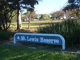 Mount Lewis Reserve | |||||||||||||||
Mount Lewis | |||||||||||||||
| Coordinates | 33°54′54″S 151°3′4″E | ||||||||||||||
| Population | 1,195 (2016 census)[1] | ||||||||||||||
| Postcode(s) | 2190 | ||||||||||||||
| Location | 18 km (11 mi) from CBD | ||||||||||||||
| LGA(s) | City of Canterbury-Bankstown | ||||||||||||||
| State electorate(s) | Lakemba | ||||||||||||||
| Federal Division(s) | Watson | ||||||||||||||
| |||||||||||||||
| 🌍 |
History
Mount Lewis takes its name from the highest point in the district at Mount Lewis Reserve on Wattle Street. The origin of the name is unclear but it reflects the height which provides good views west towards the Bankstown CBD, south towards Canterbury Road and east towards the Sydney CBD skyline.[2] Thomas Collins acquired 50 acres (200,000 m2) of land in 1834/35.[3]
Commercial area
Mount Lewis is a mostly residential suburb with a few shops and commercial developments located on Wattle Street. Mount Lewis Bowling Club is located on Waterloo Road.
Schools
Mount Lewis has an infants school on Noble Avenue.
References
- Australian Bureau of Statistics (27 June 2017). "Mount Lewis (State Suburb)". 2016 Census QuickStats. Retrieved 11 April 2018.

- The Book of Sydney Suburbs, Compiled by Frances Pollen, Angus & Robertson Publishers, 1990, Published in Australia ISBN 0-207-14495-8
- History Suburb Names Archived 8 March 2008 at the Wayback Machine
| Wikimedia Commons has media related to Mount Lewis, New South Wales. |