Myitkyina
Myitkyina (Burmese: မြစ်ကြီးနားမြို့; MLCTS: mrac kri: na: mrui., pronounced [mjɪʔtɕíná]; (Eng; mitchinar) Jinghpaw: Myitkyina, [mjìtkjí̠ná]) is the capital city of Kachin State in Myanmar (Burma), located 1,480 kilometers (920 mi) from Yangon, and 785 kilometers (488 mi) from Mandalay. In Burmese it means "near the big river", and Myitkyina is on the west bank of the Ayeyarwady River, just below 40 kilometers (25 mi) from Myit-son (Burmese for confluence) of its two headstreams (the Mali and N'mai rivers).[2] It is the northernmost river port and railway terminus in Myanmar.[3] The city is served by Myitkyina Airport.
Myitkyina
Myitkyina Muklum | |
|---|---|
City | |
 | |
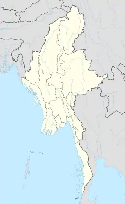 Myitkyina Location in Myanmar (Burma) | |
| Coordinates: 25°23′0″N 97°24′0″E | |
| Country | |
| Division | |
| District | Myitkyina District |
| Township | Myitkyina Township |
| Elevation | 472 ft (144 m) |
| Population (2014) | |
| • Urban | 306,949 |
| • Ethnicities | |
| • Religions | |
| Time zone | UTC+6.30 (MMT) |
| Area code(s) | 74 |
| Climate | Cwa |
| [1] | |
History
Myitkyina has been an important trading town between China and Myanmar since ancient times.
American Baptist missionary George J. Geis and his wife arrived in Myitkyina in the late 1890s and in 1900 they requested permission to build a mansion in the town. The building was named Geis Memorial Church [4] It is one of the Kachin Baptist Convention (KBC)churches in Myitkyina.
Japanese forces captured the town and nearby airbase during World War II in 1942. In August 1944, Myitkyina was recaptured by the Allied forces under General Joseph Stilwell after a prolonged siege and heavy fighting between Nationalist Chinese divisions, the Chindits, and Merrill's Marauders of the Northern Combat Area Command and the besieged elements of the 33rd Imperial Japanese Army under General Masaki Honda. The town was strategically important not only because of its rail and water links to the rest of Burma, but also because it was on the planned route of the Ledo Road.[2][5]
Transportation
Myitkyina Airport is the main airport serving the city. It connects the cities of Putao and Mandalay. And it also connects Lashio Airport every Monday.
It takes almost 24 hours Mandalay to Myitkyina by train. The railway has been used for 100 years. This railway is major transportation for most kinds of good for both farmers and traders. It also connects Laiza, Bhamo, China, and Sumprabum by car.
The Myitkyina-Tanai-India road which is known as the Ledo Road, was constructed by the British rule during the British Colonial period.
In the downtown, the main transportation are three wheel motor cycle also known as tone bain, three wheel bicycle, and motor bike.

Population

As the capital of the state, it has government offices, and a greater population than other cities in the state. The city has a population of approximately 150,000, with a mix of Kachin, Shan, Bamar, Burmese Gorkha and some Chinese and Indians.[6]
The Kachin language is the common language among the Kachin. There are a lot of meaning for Jinghpo word. In Jinghpo language, Jinghpo means People. Some people can speak English and Nepali while the town's people mostly speak in Burmese which is the national language of Myanmar.
Foreigners are now free to visit Myitkyina without prior government permission.
Religion
Major religions are Theravada Buddhism, Christianity (Roman Catholic and Baptist are major denominations), and other religions such as animism, Hinduism and Islam.
Climate
Myitkyina has a humid subtropical climate (Köppen climate classification Cwa) bordering on a tropical savanna climate (Köppen climate classification Aw). Temperatures are very warm throughout the year, although the winter months (December–February) are milder. There is a winter dry season (November–April) and a summer wet season (May–October).
| Climate data for Myitkyina (1981–2010, extremes 1951–present) | |||||||||||||
|---|---|---|---|---|---|---|---|---|---|---|---|---|---|
| Month | Jan | Feb | Mar | Apr | May | Jun | Jul | Aug | Sep | Oct | Nov | Dec | Year |
| Record high °C (°F) | 35.0 (95.0) |
35.0 (95.0) |
38.0 (100.4) |
41.1 (106.0) |
42.0 (107.6) |
40.2 (104.4) |
38.3 (100.9) |
38.5 (101.3) |
37.5 (99.5) |
36.2 (97.2) |
38.5 (101.3) |
35.5 (95.9) |
42.2 (108.0) |
| Average high °C (°F) | 25.3 (77.5) |
27.5 (81.5) |
30.4 (86.7) |
32.6 (90.7) |
33.3 (91.9) |
31.6 (88.9) |
30.5 (86.9) |
32.0 (89.6) |
31.7 (89.1) |
30.9 (87.6) |
28.4 (83.1) |
25.8 (78.4) |
30.0 (86.0) |
| Daily mean °C (°F) | 18.0 (64.4) |
20.3 (68.5) |
23.9 (75.0) |
26.6 (79.9) |
27.6 (81.7) |
27.9 (82.2) |
27.7 (81.9) |
28.3 (82.9) |
28.1 (82.6) |
26.2 (79.2) |
22.5 (72.5) |
18.8 (65.8) |
24.9 (76.8) |
| Average low °C (°F) | 10.4 (50.7) |
12.9 (55.2) |
16.3 (61.3) |
19.7 (67.5) |
22.3 (72.1) |
24.3 (75.7) |
24.5 (76.1) |
24.6 (76.3) |
23.9 (75.0) |
21.5 (70.7) |
16.2 (61.2) |
11.9 (53.4) |
19.0 (66.2) |
| Record low °C (°F) | 3.0 (37.4) |
7.5 (45.5) |
10.0 (50.0) |
10.0 (50.0) |
16.1 (61.0) |
18.1 (64.6) |
18.0 (64.4) |
20.0 (68.0) |
19.8 (67.6) |
15.0 (59.0) |
8.0 (46.4) |
3.0 (37.4) |
3.0 (37.4) |
| Average rainfall mm (inches) | 9.9 (0.39) |
21.0 (0.83) |
24.0 (0.94) |
54.0 (2.13) |
218.5 (8.60) |
549.2 (21.62) |
543.0 (21.38) |
398.3 (15.68) |
294.7 (11.60) |
170.6 (6.72) |
25.1 (0.99) |
11.7 (0.46) |
2,320 (91.34) |
| Average rainy days (≥ 0.3 mm) | 2 | 7 | 5 | 8 | 15 | 25 | 27 | 28 | 19 | 11 | 3 | 2 | 152 |
| Average relative humidity (%) | 77 | 68 | 64 | 64 | 72 | 83 | 89 | 87 | 85 | 83 | 79 | 78 | 77 |
| Source 1: Norwegian Meteorological Institute,[7] Deutscher Wetterdienst (mean temperatures 1991–2010, rainy days 1896–1940, humidity 1963–1988)[8] | |||||||||||||
| Source 2: Meteo Climat (record highs and lows)[9] | |||||||||||||
Air Quality
The city residents dispose of the majority of their waste by burning it in small piles by the roadside. Most waste is disposed in this way, including plastics. Almost every block in the city has one small fire every evening. Burning usually starts late-afternoon, and by 6.00pm the city air is often quite smoky. Burning can start earlier at the weekend. The air quality in Myitkyina in the evenings can be poor, which can make being outside unpleasant. Sometimes, due to atmospheric pressure, the air will still be smoky in the morning. The only time of year that this does not happen is during the monsoon season, when it is reported that the air is fresh.
Education
The city is home to Myitkyina University, a Christian theological seminary, a college for teachers, a training school for nurses, a college for the study of computers and other rare type of colleges affiliated with several seminaries in the United States and Asia, notably Kachin Theological College-Nawng Nang. It is also home to the branch I.L.B.C. (International Language Business Center) a chain of private schools for English learners in the Myanmar. It has also many non-government institutions such as Naushawng development institute, Pinnya Tagar, Ningshawng and Kachinland School of Arts & Sciences,[10] which has a University vision in 2024.

- Technological University, Myitkyina
- Computer University, Myitkyina
- Myitkyina University
- Myitkyina Education College
Economy
Myitkyina is a business center of Kachin State. Resources are jade, gold, amber, teak and forestry products, and agricultural products. Due to short term contract of jade, gold mines, teak, Kachin State was good in business field for Chinese. As per government data, almost US$2 billion in jade were exported yearly in 2010, 2011. Now, due to fighting between Kachin KIA rebels and government army, all business have gone down. Most of Kachin State business trades are done in Myitkyina.
Healthcare
Public Hospitals
- Myitkyina General Hospital
- Myitkyina Narcotic Hospital
Military
- Northern SOC (HQ at Myitkyina)
- Nanpong / Nanpong Air Base headquarters (formerly 503 Air Base)
Notes
- "National Telephone Area Codes". Myanmar Yellow Pages. Archived from the original on 2009-07-19.
- "Myitkyina, Myanmar". Encyclopædia Britannica Online. Retrieved 2009-03-29.
- "Train travel in Myanmar (Burma)". seat61.com. Retrieved 2009-03-29.
- Baptist missionary magazine, Volume 80. American Baptist Foreign Mission Society, American Baptist Missionary Union. 1900. p. 196.
- Gardner, Major John J. "Battle of Myitkyina". Retrieved 2006-10-15.
- "MYITKYINA". my-myitkyina.com. Retrieved 2006-08-24.
- "Myanmar Climate Report" (PDF). Norwegian Meteorological Institute. pp. 26–36. Archived from the original (PDF) on 8 October 2018. Retrieved 8 October 2018.
- "Klimatafel von Myitkyina / Myanmar (Birma)" (PDF). Baseline climate means (1961-1990) from stations all over the world (in German). Deutscher Wetterdienst. Retrieved 6 November 2018.
- "Station Myitkyina" (in French). Meteo Climat. Retrieved 10 October 2018.
- http://www.KachinlandSAS.org
External links
| Wikimedia Commons has media related to Myitkyina. |
- Satellite Map of Myitkyina from Google Map
- Kachin State map Asterism
- http://www.kachinstate.com
- http://www.infoplease.com/ce6/world/A0834638.html
Capital: Myitkyina | ||
| Bhamo District |   | |
| Mohnyin District | ||
| Myitkyina District | ||
| Putao District | ||
| Main cities and towns | ||
