Nangqên County
Nangqên County, or Nangchen (Tibetan: ནང་ཆེན་རྫོང་།, Wylie: nang chen rdzong, ZYPY: Nangqên Zong ) or Nangqian County (simplified Chinese: 囊谦县; traditional Chinese: 囊謙縣; pinyin: Nángqiān Xiàn), is a county of the Yushu Tibetan Autonomous Prefecture and is the southernmost county-level division of Qinghai province, China, bordering the Tibet Autonomous Region to the south. It was one of the five kingdoms of the historical region of Kham.
Nangqên County
囊谦县 · ནང་ཆེན་རྫོང་། | |
|---|---|
 | |
.png.webp) Location of Nangqên County (red) within Yushu Prefecture (yellow) and Qinghai | |
| Coordinates: 32°12′11″N 96°28′52″E | |
| Country | People's Republic of China |
| Province | Qinghai |
| Autonomous prefecture | Yushu |
| Area | |
| • Total | 12,741 km2 (4,919 sq mi) |
| Population (2019) | |
| • Total | 101,126[1] |
| Time zone | UTC+8 (China Standard) |
| Postal code | 815200 |
The county seat is Xangda (shor mda’ / Template:Zh-Latn 香达镇), built in a side valley and on the right bank of the Dza Chu (upper reaches of the Mekong). In 2000, the county's population amounted to 57,387 people, inhabiting a surface of 11,539 km2 (4,455 sq mi).
History
The county's name is derived from the former king (nang chen rgyal po) and kingdom of Nangchen, a tribal confederation that emerged as a unified Buddhist kingdom in the 13th century. In the 18th century, the kingdom recognized the ultimate authority of the Chinese emperors, but remained largely autonomous until 1951, when the last king, Trashi Tsewang Dorjé, accepted the incorporation of the kingdom of Nangchen into China, serving as the (nominal) head of a newly established “Government of the Tibetan People’s Autonomous District of Yushu or Upper Kham.”[2] The present-day's county comprises the core area of the old kingdom of Nangchen.
Memories of the kingdom of Nangchen play a role in local politics, and among Tibetan refugees who came to India from the area. Scholar Maria Turek reported that in 2015 she heard about “a man who went to various Tibetan communities in India, introducing himself as ‘the king of Nangchen’ not without some success, even though he had no credentials to prove his claim.”[3]
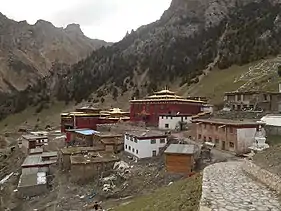
A Yelpa Kagyu monastery, Tana Monastery (Jang Tana), was founded by Yelpa Yeshe Tsek in 1068. It is considered a branch monastery of Tsurpu.[4][5][6][7]
Administrative divisions
Nangqên County (Nangqian County) is divided into one town and nine townships:[8]
- Towns
- Xiangda Town (香达镇)
- Townships
|
|
Transportation
References
- "China : Population - ceicdata.com". ceicdata. Retrieved 2020-12-30.
- Maria Turek, “Return of the Good King: Kingship and Identity among Yushu Tibetans since 1951,” in Frontier Tibet: Patterns of Change in the Sino-Tibetan Borderland, ed. by Stéphane Gros, Amsterdam: Amsterdam University Press, 2019, 453-488.
- Maria Turek, “Return of the Good King: Kingship and Identity among Yushu Tibetans since 1951,” in Frontier Tibet: Patterns of Change in the Sino-Tibetan Borderland, ed. by Stéphane Gros, Amsterdam: Amsterdam University Press, 2019, 453-488 (482).
- "Jang Tana". The Treasury of Lives. Retrieved 2017-08-05.
- "Tana Sengge Nam Dzong" - the Monastery of Ling, in: Andreas Gruschke, The Cultural Monuments of Tibet’s Outer Provinces: Kham vol. 2 - The Qinghai Part of Kham (Yushu Autonomous Prefecture), Bangkok 2004, pp.110-115.
- Tanma Jamyang Tsultrim: "Cultural Relics of the Tana Monastery in Yushu and Gesar", in: Tibet Studies, 1991, No.1, S. 184-190.
- Tana monastery, (towards) Ji'nyinsib, Qinghai, CN. Mapping Buddhist Monasteries, accesssed August 5, 2017.
- "统计用区划代码 www.stats.gov.cn" (in Chinese). XZQH. Retrieved 2020-12-27.