National Cycle Route 72
National Route 72 of the National Cycle Network, in Northern England is also called "Hadrian's Cycleway". It starts at Kendal and makes its way around the Cumbrian coast via Barrow-in-Furness and Whitehaven to Silloth, and then across the country through Carlisle via Newcastle upon Tyne to Tynemouth at the northern shore or to South Shields at the Tynes south shore, where the cycleway ends at Arbeia Roman Fort. Much of its route is very close to Hadrian's Wall.
| National Cycle Route 72 | |
|---|---|
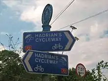
Hadrian's Cycleway route sign | |
| Hadrian's Cycleway | |
| Length | 274 km (170 mi) |
| Trailheads | |
| Elevation | |
| Highest point | near Bardon Mill, 255 m (837 ft) |
| Cycling details | |
| Waymark |  |
| Website | www |
Route Sign NCN 72
Kendal to Barrow in Furness is mapped on the Walney To Wear map. Ravenglass to Tynemouth is open and mapped on the Hadrian's Cycleway map, though some sections between Ravenglass and Silloth are using interim routes.
External links
| Wikimedia Commons has media related to National Cycle Network route 72. |
- Official website

- Hadrian's Cycleway at cycle-routes.org
This article is issued from Wikipedia. The text is licensed under Creative Commons - Attribution - Sharealike. Additional terms may apply for the media files.