National Register of Historic Places listings in Brookhaven (town), New York
This is a list of all National Register of Historic Places listings in the Town of Brookhaven, New York. The locations of National Register properties for which the latitude and longitude coordinates are included below, may be seen in an online map.[1]
Listings
| [2] | Name on the Register | Image | Date listed[3] | Location | City or town | Description |
|---|---|---|---|---|---|---|
| 1 | Bald Hill Schoolhouse | 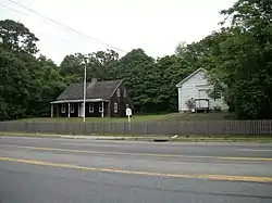 Bald Hill Schoolhouse |
July 21, 1988 (#88001018) |
Horseblock Road 40°50′06″N 73°02′34″W |
Farmingville | |
| 2 | Bayles Shipyard | 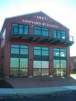 Bayles Shipyard |
June 2, 2000 (#00000580) |
101 East Broadway 40°56′54″N 73°04′05″W |
Port Jefferson | |
| 3 | Mary E. Bell House | 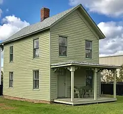 Mary E. Bell House |
November 13, 2020 (#100005831) |
66 Railroad Ave. 40°48′13″N 72°47′24″W |
Center Moriches | |
| 4 | Bellport Academy | 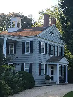 Bellport Academy |
July 4, 1980 (#02001452) |
24 Academy Lane 40°45′14″N 72°56′16″W |
Bellport | |
| 5 | Bellport Village Historic District | 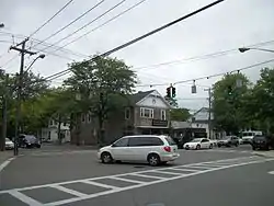 Bellport Village Historic District |
July 4, 1980 (#02001451) |
Roughly bounded by South Country Road, Bellport Lane, Brown's Lane, Brewster Lane, and Bell Street 40°45′30″N 72°56′12″W |
Bellport | |
| 6 | Benner–Foos–Ceparano Estate | 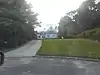 Benner–Foos–Ceparano Estate |
August 22, 2016 (#16000557) |
99 Van Brunt Manor & 6 Osprey Lane 40°57′20″N 73°05′39″W |
Poquott | Shingle Style 1890s estate is only Lamb & Rich design with bowed plan. Transitioned from vacation home to full-time residence over the 20th century; one of the few North Shore estates in its original form. |
| 7 | Bethel Christian Avenue Historic District |  Bethel Christian Avenue Historic District |
November 9, 2017 (#100001808) |
Roughly Christian Ave., Hill & Locust Sts. 40°56′31″N 73°07′21″W |
Setauket | African-American neighborhood built around 19th-century church |
| 8 | Mary Louise Booth Girlhood House | 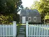 Mary Louise Booth Girlhood House |
January 27, 2015 (#14001219) |
E. Main St. 40°50′12″N 72°54′57″W |
Yaphank | Childhood home of Mary Louise Booth, 19th-century newspaper editor and French translator. See these links, and this one too. |
| 9 | Brewster House | 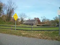 Brewster House |
February 28, 2008 (#08000109) |
Junction of NY 25A & Runs Road 40°56′43″N 73°06′11″W |
East Setauket | |
| 10 | Caroline Church and Cemetery | 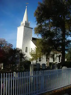 Caroline Church and Cemetery |
September 9, 1991 (#91001148) |
Junction of Dyke and Bates Roads 40°56′49″N 73°06′46″W |
Setauket | |
| 11 | Carrington House | 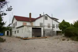 Carrington House |
January 8, 2014 (#13001057) |
Lewis Walk (at eastern terminus of Ocean Walk) 40°39′43″N 73°04′39″W |
Cherry Grove | Early 20th-century beach bungalow was home to theater director Frank Carrington and an early center of gay life on Fire Island; Truman Capote wrote Breakfast at Tiffany's during a stay there. |
| 12 | Cherry Grove Community House and Theatre | 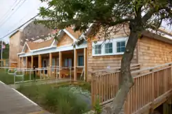 Cherry Grove Community House and Theatre |
June 4, 2013 (#13000373) |
180 Bayview Walk 40°39′36″N 73°05′26″W |
Cherry Grove | |
| 13 | Congregational Church of Patchogue | .jpg.webp) Congregational Church of Patchogue |
April 1, 1993 (#93000279) |
95 East Main Street 40°45′57″N 73°00′47″W |
Patchogue | |
| 14 | Davis Town Meeting House | 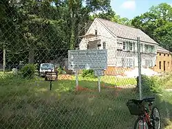 Davis Town Meeting House |
August 15, 2001 (#01000850) |
Junction of Middle Country Road and Coram-Mt. Sinai Road 40°52′54″N 72°59′01″W |
Coram | |
| 15 | ELVIRA (sloop) | May 23, 2012 (#12000288) |
Newey Lane 40°46′17″N 72°53′54″W |
Brookhaven | ||
| 16 | First Congregational Church of New Village | 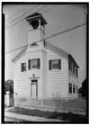 First Congregational Church of New Village |
April 11, 2002 (#02000361) |
North side of Middle Country Road, West of Elliot Avenue 40°51′35″N 73°06′37″W |
Lake Grove | |
| 17 | First National Bank of Port Jefferson | 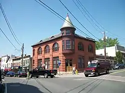 First National Bank of Port Jefferson |
October 5, 2005 (#05001134) |
Main and East Main Streets 40°56′43″N 73°04′06″W |
Port Jefferson | |
| 18 | William Floyd House |  William Floyd House |
October 15, 1980 (#71000066) |
20 Washington Avenue 40°46′09″N 72°49′21″W |
Mastic Beach | |
| 19 | Gamecock Cottage | 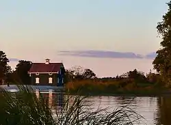 Gamecock Cottage |
August 30, 2007 (#07000886) |
Shipman's Point, South end of West Meadow Beach 40°55′40″N 73°08′50″W |
Stony Brook | |
| 20 | Noah Hallock House | 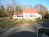 Noah Hallock House |
December 11, 2013 (#13000913) |
172 Hallock Landing Road 40°57′43″N 72°56′19″W |
Rocky Point | Seaside frame cottage of early settler |
| 21 | Hawkins Homestead | 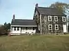 Hawkins Homestead |
June 9, 1988 (#88000727) |
165 Christian Avenue 40°55′45″N 73°08′19″W |
Stony Brook | |
| 22 | Robert Hawkins Homestead | 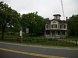 Robert Hawkins Homestead |
April 10, 1986 (#86000702) |
Yaphank Avenue 40°49′04″N 72°55′04″W |
Yaphank | |
| 23 | Homan-Gerard House and Mills | 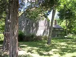 Homan-Gerard House and Mills |
December 16, 1988 (#88002761) |
Junction Main Street and Yaphank Road 40°50′09″N 72°54′57″W |
Yaphank | |
| 24 | Samuel Hopkins House | 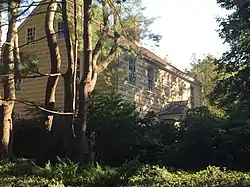 Samuel Hopkins House |
February 26, 2009 (#09000057) |
415 Pipe Stave Hollow Road 40°57′30″N 73°01′16″W |
Miller Place | |
| 25 | Nathaniel Longbotham House |  Nathaniel Longbotham House |
November 16, 1989 (#89002022) |
1541 Stony Brook Road 40°54′27″N 73°08′05″W |
Stony Brook | |
| 26 | Masury Estate Ballroom | 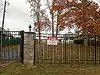 Masury Estate Ballroom |
September 11, 1986 (#86002513) |
Old Neck Road South 40°46′54″N 72°48′26″W |
Center Moriches | |
| 27 | Frank Melville Memorial Park |  Frank Melville Memorial Park |
July 19, 2010 (#10000486) |
Old Field Road between Lake Street and Main Street 40°56′42″N 73°06′57″W |
Setauket | |
| 28 | Middle Island Presbyterian Church | 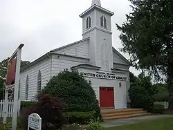 Middle Island Presbyterian Church |
December 7, 2005 (#05001388) |
271 Middle Country Road 40°52′49″N 72°57′48″W |
Middle Island | |
| 29 | Miller Place Historic District |  Miller Place Historic District |
June 17, 1976 (#76001281) |
North Country Road 40°57′30″N 72°59′56″W |
Miller Place | |
| 30 | William Sidney Mount House | 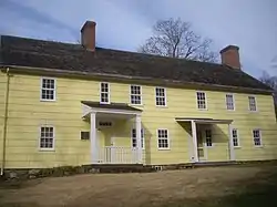 William Sidney Mount House |
October 15, 1966 (#66000575) |
Stony Brook Road and NY 25A 40°54′27″N 73°08′18″W |
Stony Brook | |
| 31 | Old Bethel Cemetery |  Old Bethel Cemetery |
November 9, 2017 (#100001810) |
Christian & Woodfield Avenues 40°55′54″N 73°07′59″W |
Stony Brook | Final resting place of many early residents of the Bethel Christian Avenue Historic District |
| 32 | Old Field Club and Farm |  Old Field Club and Farm |
February 2, 2016 (#15001027) |
86 West Meadow Road 40°56′49″N 73°08′22″W |
East Setauket | Early social center of Setauket when built for a residential community in 1930 |
| 33 | Port Jefferson Village Historic District |  Port Jefferson Village Historic District |
April 6, 2005 (#05000265) |
Roughly along East Main Street, East Broadway, Grant Street, High Street and South Street 40°56′49″N 73°03′58″W |
Port Jefferson | |
| 34 | Setauket Presbyterian Church and Burial Ground |  Setauket Presbyterian Church and Burial Ground |
September 27, 1996 (#96001023) |
5 Caroline Avenue 40°56′45″N 73°06′41″W |
Setauket | |
| 35 | Sherwood-Jayne House | 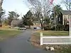 Sherwood-Jayne House |
December 2, 2009 (#09000969) |
55 Old Post Road 40°56′21″N 73°05′20″W |
East Setauket | |
| 36 | Smith Estate | 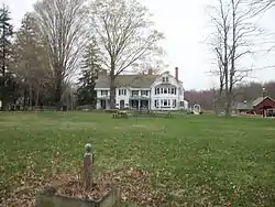 Smith Estate |
December 10, 1981 (#81000414) |
Longwood and Smith Roads 40°52′05″N 72°54′24″W |
Ridge | Also known as Longwood Estate - Smith House[4] |
| 37 | Smith-Rourke House | 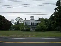 Smith-Rourke House |
November 28, 1989 (#89002021) |
350 South Country Road 40°45′43″N 72°58′44″W |
East Patchogue | |
| 38 | St. Andrew's Episcopal Church | 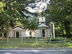 St. Andrew's Episcopal Church |
September 15, 1988 (#88001442) |
Main Street 40°50′12″N 72°54′55″W |
Yaphank | |
| 39 | St. James Chapel | 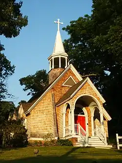 St. James Chapel |
June 16, 2000 (#00000583) |
East side of Main Street, 250 ft. North of Stony Brook Lane 40°54′56″N 73°08′50″W |
Stony Brook | |
| 40 | St. Paul's Episcopal Church Complex | 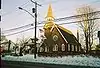 St. Paul's Episcopal Church Complex |
June 22, 1995 (#95000722) |
31 Rider Avenue 40°45′52″N 73°00′33″W |
Patchogue | |
| 41 | Stony Brook Grist Mill | 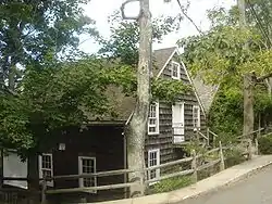 Stony Brook Grist Mill |
August 3, 1990 (#90001140) |
Harbor Road, West of Main Street 40°54′49″N 73°08′47″W |
Stony Brook | |
| 42 | Suffolk County Almshouse Barn | 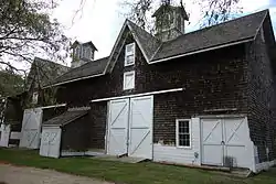 Suffolk County Almshouse Barn |
September 11, 1986 (#86002512) |
West of Yaphank Avenue 40°49′41″N 72°55′18″W |
Yaphank | |
| 43 | Swan River Schoolhouse | 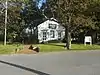 Swan River Schoolhouse |
August 18, 2017 (#100001492) |
31 Roe Avenue 40°45′52″N 72°59′20″W |
East Patchogue | |
| 44 | Terry-Ketcham Inn | 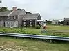 Terry-Ketcham Inn |
June 24, 1993 (#92000555) |
81 Main Street 40°48′08″N 72°46′52″W |
Center Moriches | |
| 45 | Thompson House |  Thompson House |
January 7, 1988 (#87002283) |
North Country Road 40°56′01″N 73°07′04″W |
Setauket | |
| 46 | United Methodist Church | 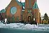 United Methodist Church |
April 19, 1984 (#84003006) |
South Ocean Avenue and Church Street 40°45′52″N 73°00′53″W |
Patchogue | |
| 47 | Union Savings Bank | 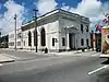 Union Savings Bank |
June 11, 2010 (#10000337) |
62 South Ocean Avenue 40°45′52″N 73°00′54″W |
Patchogue | On the opposite corner from United Methodist Church (Patchogue, New York) |
| 48 | US Post Office-Patchogue | 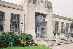 US Post Office-Patchogue |
May 11, 1989 (#88002397) |
170 East Main Street 40°45′55″N 73°00′42″W |
Patchogue | |
| 49 | USS SAN DIEGO (Armored Cruiser) Shipwreck Site | 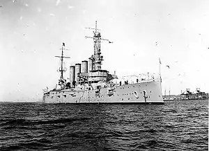 USS SAN DIEGO (Armored Cruiser) Shipwreck Site |
February 17, 1998 (#98000071) |
Address Restricted |
Fire Island | |
| 50 | Wardenclyffe Laboratories | 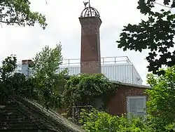 Wardenclyffe Laboratories |
July 27, 2018 (#100002744) |
56 NY 25A 40°56′54″N 72°53′54″W |
Shoreham | Ruins of laboratory designed by Stanford White for Nicola Tesla's early telecommunications research in 1901 |
| 51 | West Meadow Beach Historic District | 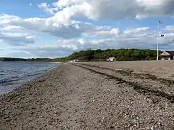 West Meadow Beach Historic District |
October 28, 2004 (#04001195) |
Trustees Road 40°55′59″N 73°08′48″W |
Stony Brook | |
| 52 | Josiah Woodhull House | 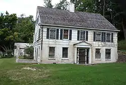 Josiah Woodhull House |
August 24, 2011 (#11000602) |
170 North Country Rd. 40°57′30″N 72°52′12″W |
Shoreham |
Former listings
| [2] | Name on the Register | Image | Date listed | Date removed | Location | City or town | Summary |
|---|---|---|---|---|---|---|---|
| 1 | Radio Central Complex |  Radio Central Complex |
June 27, 1980 (#80002777) | April 25, 1997 | S of Rocky Point on Rocky Point-Yaphank Rd. |
Rocky Point vicinity | Currently owned by the New York State Department of Environmental Conservation. See this link also. |
See also
| Wikimedia Commons has media related to National Register of Historic Places in Suffolk County, New York. |
References
- The latitude and longitude information provided is primarily from the National Register Information System, and has been found to be fairly accurate for about 99% of listings. For 1%, the location info may be way off. We seek to correct the coordinate information wherever it is found to be erroneous. Please leave a note in the Discussion page for this article if you believe any specific location is incorrect.
- Numbers represent an alphabetical ordering by significant words. Various colorings, defined here, differentiate National Historic Landmarks and historic districts from other NRHP buildings, structures, sites or objects.
- The eight-digit number below each date is the number assigned to each location in the National Register Information System database, which can be viewed by clicking the number.
- Longwood's Journey (Longwood Library History Website) Archived 2009-05-01 at the Wayback Machine
| Topics |  | |
|---|---|---|
| Lists by county |
| |
| Lists by city | ||
| Other lists | ||
| ||
This article is issued from Wikipedia. The text is licensed under Creative Commons - Attribution - Sharealike. Additional terms may apply for the media files.