National Register of Historic Places listings in Oyster Bay (town), New York
This is a list of all National Register of Historic Places listings in the Town of Oyster Bay, in Nassau County, New York. The locations of National Register properties for which the latitude and longitude coordinates are included below, may be seen in an online map.[1]
Current listings
| [2] | Name on the Register | Image | Date listed[3] | Location | City or town | Description |
|---|---|---|---|---|---|---|
| 1 | Adam-Derby House | May 17, 1979 (#79001597) |
166 Lexington Avenue 40°52′02″N 73°32′05″W |
Oyster Bay | ||
| 2 | John E. Aldred Estate | 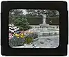 John E. Aldred Estate |
August 3, 1979 (#79001594) |
Lattingtown Road 40°53′40″N 73°36′59″W |
Lattingtown | |
| 3 | James William Beekman House | December 12, 1973 (#73001212) |
West Shore Road 40°52′45″N 73°32′49″W |
Oyster Bay | ||
| 4 | Building at 390 Ocean Avenue | 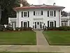 Building at 390 Ocean Avenue |
October 27, 2017 (#100001770) |
390 Ocean Avenue 40°40′26″N 73°28′14″W |
Massapequa | |
| 5 | Central Hall | 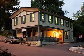 Central Hall |
February 18, 1988 (#88000019) |
93 Central Avenue 40°50′54″N 73°38′54″W |
Sea Cliff | |
| 6 | Christ Building | 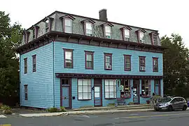 Christ Building |
January 4, 2012 (#11001002) |
357-359 Sea Cliff Ave. 40°50′58″N 73°38′59″W |
Sea Cliff | |
| 7 | Christ Church | 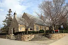 Christ Church |
November 9, 2018 (#100003115) |
61 E Main St. 40°52′20″N 73°31′40″W |
Oyster Bay | Theodore Roosevelt's family church, established in 1705, with buildings dating to 1870s |
| 8 | CHRISTEEN (oyster sloop) |  CHRISTEEN (oyster sloop) |
December 4, 1991 (#91002060) |
40°52′40″N 73°32′23″W |
Oyster Bay | Built in 1883, the oldest surviving oyster sloop in the U.S. |
| 9 | Church of Our Lady of Kazan |  Church of Our Lady of Kazan |
October 4, 2016 (#16000695) |
2 Willow Shore Ave. 40°50′21″N 73°39′05″W |
Sea Cliff | 1942 Orthodox church built by Russian emigrés displaced by early 20th-century upheavals at home. |
| 10 | Cock-Cornelius House |  Cock-Cornelius House |
March 22, 2006 (#06000157) |
34 Birch Hill Road 40°52′27″N 73°35′17″W |
Locust Valley | |
| 11 | Cold Spring Harbor Laboratory Historic District |  Cold Spring Harbor Laboratory Historic District |
March 30, 1994 (#94000198) |
Jct. of NY 25A and Bungtown Road 40°51′43″N 73°28′02″W |
Laurel Hollow | |
| 12 | Crowell House | 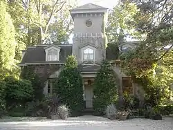 Crowell House |
February 18, 1988 (#88000020) |
375 Littleworth Lane 40°50′20″N 73°38′55″W |
Sea Cliff | |
| 13 | Lillian Sefton Dodge Estate | 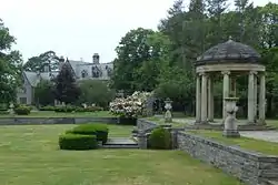 Lillian Sefton Dodge Estate |
July 22, 1979 (#79001595) |
Frost Mill Road 40°52′39″N 73°33′34″W |
Mill Neck | |
| 14 | DuPont-Guest Estate | 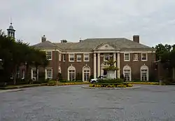 DuPont-Guest Estate |
December 11, 2009 (#09001084) |
S. side of Northern Blvd. between Cotillion Ct. & DuPont Ct. 40°48′32″N 73°36′53″W |
Brookville | |
| 15 | Elmwood | April 3, 1975 (#75001200) |
E side of Cove Road 40°51′59″N 73°29′45″W |
Oyster Bay | ||
| 16 | First Presbyterian Church of Oyster Bay | 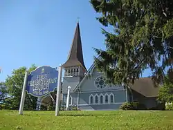 First Presbyterian Church of Oyster Bay |
December 12, 1976 (#76001232) |
E. Main Street 40°52′18″N 73°31′45″W |
Oyster Bay | |
| 17 | Fort Massapeag Archeological Site |  Fort Massapeag Archeological Site |
April 19, 1993 (#93000610) |
Sunset Park 40°39′11″N 73°27′40″W |
Massapequa | Site of only known remaining Native American fort on western Long Island |
| 18 | Glen Cove Post Office | 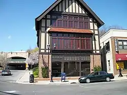 Glen Cove Post Office |
November 29, 2010 (#10000957) |
51 Glen St. 40°51′50″N 73°37′46″W |
Glen Cove | |
| 19 | A. Conger Goodyear House | 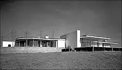 A. Conger Goodyear House |
December 4, 2003 (#03001246) |
14 Orchard Lane 40°48′04″N 73°35′24″W |
Old Westbury | |
| 20 | Grace Church Complex | 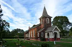 Grace Church Complex |
June 30, 1983 (#83001713) |
Merrick and Dover Roads 40°40′01″N 73°27′33″W |
Massapequa | |
| 21 | Stephen Harding House | 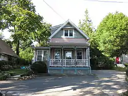 Stephen Harding House |
August 24, 2011 (#11000597) |
182 14th Ave. 40°50′54″N 73°38′58″W |
Sea Cliff | |
| 22 | Heitz Place Courthouse | 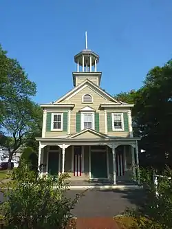 Heitz Place Courthouse |
July 30, 1974 (#74001263) |
Heitz Place 40°46′08″N 73°31′16″W |
Hicksville | |
| 23 | House at 9 Locust Place | 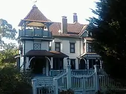 House at 9 Locust Place |
February 18, 1988 (#88000030) |
9 Locust Place 40°50′40″N 73°39′05″W |
Sea Cliff | |
| 24 | House at 18 Seventeenth Avenue | 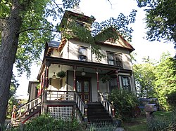 House at 18 Seventeenth Avenue |
February 18, 1988 (#88000011) |
18 Seventeenth Avenue 40°50′49″N 73°38′49″W |
Sea Cliff | |
| 25 | House at 19 Locust Place | 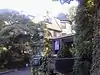 House at 19 Locust Place |
February 18, 1988 (#88000010) |
19 Locust Place 40°50′38″N 73°39′04″W |
Sea Cliff | |
| 26 | House at 52 Eighteenth Avenue | 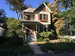 House at 52 Eighteenth Avenue |
March 18, 1988 (#88000032) |
52 Eighteenth Avenue 40°50′48″N 73°39′01″W |
Sea Cliff | |
| 27 | House at 52 Frost Mill Road | August 24, 2011 (#11000598) |
52 Frost Mill Road 40°53′13″N 73°33′39″W |
Mill Neck | ||
| 28 | House at 58 Eighteenth Avenue | 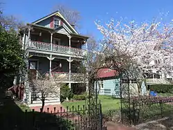 House at 58 Eighteenth Avenue |
February 18, 1988 (#88000002) |
58 Eighteenth Avenue 40°50′48″N 73°39′01″W |
Sea Cliff | |
| 29 | House at 65 Twentieth Avenue | 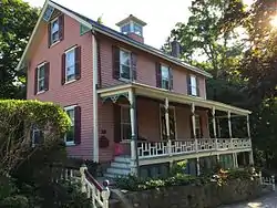 House at 65 Twentieth Avenue |
February 18, 1988 (#88000001) |
65 Twentieth Avenue 40°50′45″N 73°39′09″W |
Sea Cliff | |
| 30 | House at 103 Roslyn Avenue | 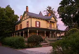 House at 103 Roslyn Avenue |
February 18, 1988 (#88000018) |
103 Roslyn Avenue 40°50′51″N 73°38′43″W |
Sea Cliff | |
| 31 | House at 112 Sea Cliff Avenue | 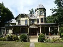 House at 112 Sea Cliff Avenue |
February 18, 1988 (#88000015) |
112 Sea Cliff Avenue 40°50′59″N 73°38′28″W |
Sea Cliff | |
| 32 | House at 115 Central Avenue | 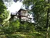 House at 115 Central Avenue |
February 18, 1988 (#88000014) |
115 Central Avenue 40°50′49″N 73°38′53″W |
Sea Cliff | Also named "The Woodshed." |
| 33 | House at 137 Prospect Avenue | 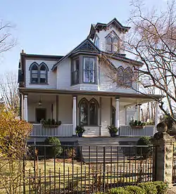 House at 137 Prospect Avenue |
February 18, 1988 (#88000016) |
137 Prospect Avenue 40°50′54″N 73°39′02″W |
Sea Cliff | |
| 34 | House at 173 Sixteenth Avenue | 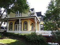 House at 173 Sixteenth Avenue |
February 18, 1988 (#88000013) |
173 Sixteenth Avenue 40°50′51″N 73°39′10″W |
Sea Cliff | |
| 35 | House at 176 Prospect Avenue | 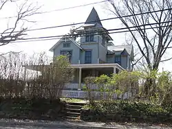 House at 176 Prospect Avenue |
February 18, 1988 (#88000012) |
176 Prospect Avenue 40°50′54″N 73°39′03″W |
Sea Cliff | |
| 36 | House at 195 Prospect Avenue |  House at 195 Prospect Avenue |
February 18, 1988 (#88000009) |
195 Prospect Avenue 40°50′49″N 73°39′04″W |
Sea Cliff | |
| 37 | House at 199 Prospect Avenue |  House at 199 Prospect Avenue |
February 18, 1988 (#88000008) |
199 Prospect Avenue 40°50′49″N 73°39′04″W |
Sea Cliff | |
| 38 | House at 207 Carpenter Avenue | 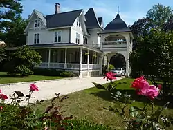 House at 207 Carpenter Avenue |
February 18, 1988 (#88000007) |
207 Carpenter Avenue 40°50′56″N 73°38′31″W |
Sea Cliff | |
| 39 | House at 240 Sea Cliff Avenue | 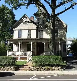 House at 240 Sea Cliff Avenue |
February 18, 1988 (#88000006) |
240 Sea Cliff Avenue 40°50′58″N 73°38′44″W |
Sea Cliff | |
| 40 | House at 285 Sea Cliff Avenue | 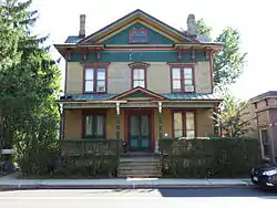 House at 285 Sea Cliff Avenue |
February 18, 1988 (#88000005) |
285 Sea Cliff Avenue 40°50′55″N 73°38′50″W |
Sea Cliff | |
| 41 | House at 332 Franklin Avenue | 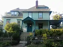 House at 332 Franklin Avenue |
February 18, 1988 (#88000038) |
332 Franklin Avenue 40°50′42″N 73°39′03″W |
Sea Cliff | |
| 42 | House at 362 Sea Cliff Avenue | 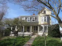 House at 362 Sea Cliff Avenue |
February 18, 1988 (#88000037) |
362 Sea Cliff Avenue 40°50′58″N 73°39′01″W |
Sea Cliff | |
| 43 | House at 378 Glen Avenue | 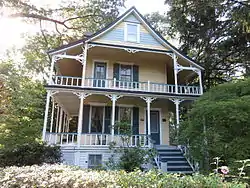 House at 378 Glen Avenue |
February 18, 1988 (#88000033) |
378 Glen Avenue 40°50′44″N 73°39′04″W |
Sea Cliff | |
| 44 | Jericho Friends Meeting House Complex |  Jericho Friends Meeting House Complex |
May 10, 2002 (#02000473) |
6 Old Jericho Turnpike 40°47′40″N 73°32′12″W |
Jericho | |
| 45 | Justice Court Building | 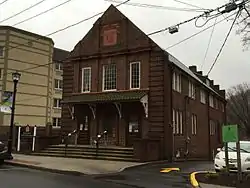 Justice Court Building |
April 26, 1990 (#90000691) |
Jct. of Town Path Extension and Glen Cove Highway 40°51′44″N 73°37′34″W |
Glen Cove | |
| 46 | Long Island Rail Road Station at Farmingdale | 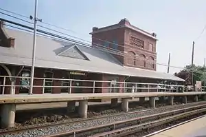 Long Island Rail Road Station at Farmingdale |
November 13, 1991 (#91001677) |
Along LIRR tracks between Farmingdale and Forest Avenues 40°44′08″N 73°26′32″W |
Farmingdale | |
| 47 | Matinecock Friends Meetinghouse | 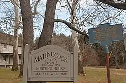 Matinecock Friends Meetinghouse |
July 19, 1976 (#76001231) |
Piping Rock and Duck Pond Roads 40°51′59″N 73°35′41″W |
Locust Valley | |
| 48 | Moore's Building | 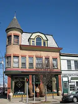 Moore's Building |
September 30, 1996 (#96001043) |
1 East Main Street 40°52′18″N 73°31′37″W |
Oyster Bay | |
| 49 | Benjamin Moore Estate | 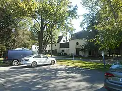 Benjamin Moore Estate |
May 14, 1979 (#79001596) |
N of Muttontown on NY 25A 40°50′19″N 73°32′17″W |
Muttontown | |
| 50 | Oyster Bay Long Island Rail Road Station | 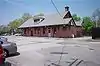 Oyster Bay Long Island Rail Road Station |
July 6, 2005 (#05000666) |
Railroad Avenue 40°53′13″N 73°31′43″W |
Oyster Bay | |
| 51 | Oyster Bay Long Island Rail Road Turntable | 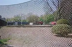 Oyster Bay Long Island Rail Road Turntable |
July 6, 2005 (#05000667) |
Railroad Avenue 40°52′38″N 73°31′43″W |
Oyster Bay | |
| 52 | Pine Hollow Cemetery | 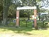 Pine Hollow Cemetery |
July 27, 2018 (#100002740) |
Pine Hollow Road 40°51′37″N 73°32′11″W |
Oyster Bay | Burial ground for members of small local black community since early 19th century |
| 53 | Planting Fields Arboretum | 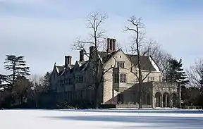 Planting Fields Arboretum |
January 25, 1979 (#79001598) |
Planting Fields Road 40°51′29″N 73°33′29″W |
Upper Brookville | |
| 54 | Raynham Hall | 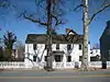 Raynham Hall |
June 5, 1974 (#74001264) |
20 West Main Street 40°52′20″N 73°31′55″W |
Oyster Bay | |
| 55 | James Alfred Roosevelt Estate | May 17, 1979 (#79001592) |
360 Cove Neck Road 40°53′02″N 73°30′29″W |
Cove Neck | ||
| 56 | Sagamore Hill National Historic Site |  Sagamore Hill National Historic Site |
October 15, 1966 (#66000096) |
End of Cove Neck Road 40°53′08″N 73°29′51″W |
Oyster Bay | |
| 57 | St. Luke's Protestant Episcopal Church | 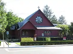 St. Luke's Protestant Episcopal Church |
February 18, 1988 (#88000017) |
253 Glen Street 40°50′49″N 73°38′44″W |
Sea Cliff | |
| 58 | Schenck-Mann House | February 24, 2005 (#05000089) |
222 Convent Road 40°49′19″N 73°29′25″W |
Syosset | ||
| 59 | Schmidlapp-Humes Estate Historic District | August 27, 2020 (#100005469) |
5 Frost Mill Rd., 345 Oyster Bay Rd., and 3 Dogwood Ln. 40°52′17″N 73°34′22″W |
Locust Valley | ||
| 60 | Sea Cliff Firehouse | 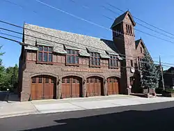 Sea Cliff Firehouse |
May 18, 2003 (#03000408) |
Roslyn Avenue 40°50′54″N 73°38′43″W |
Sea Cliff | |
| 61 | Sea Cliff Railroad Station | 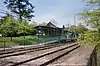 Sea Cliff Railroad Station |
February 18, 1988 (#88000021) |
Sea Cliff Avenue 40°51′07″N 73°37′34″W |
Glen Cove | |
| 62 | Sea Cliff Village Hall, Library and Museum Complex | 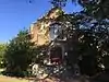 Sea Cliff Village Hall, Library and Museum Complex |
April 22, 2005 (#05000328) |
300 Sea Cliff Avenue 40°50′58″N 73°38′49″W |
Sea Cliff | |
| 63 | Seawanhaka Corinthian Yacht Club | 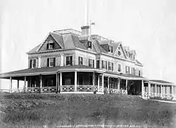 Seawanhaka Corinthian Yacht Club |
January 8, 1974 (#74001265) |
Centre Island Road 40°54′08″N 73°30′49″W |
Oyster Bay | |
| 64 | The Shell House | 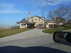 The Shell House |
June 2, 1988 (#88000600) |
26 Westland Drive 40°53′52″N 73°38′03″W |
Glen Cove | |
| 65 | Edward H. Swan House | May 24, 1976 (#76001233) |
Cove Neck Road 40°52′38″N 73°30′12″W |
Oyster Bay | ||
| 66 | George Underhill House | July 5, 2003 (#03000592) |
28 Factory Pond Road 40°53′45″N 73°34′40″W |
Locust Valley | ||
| 67 | US Post Office-Glen Cove | 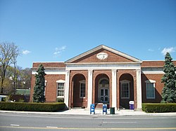 US Post Office-Glen Cove |
May 11, 1989 (#88002525) |
2 Glen Cove Street 40°51′46″N 73°38′01″W |
Glen Cove | |
| 68 | US Post Office-Oyster Bay | 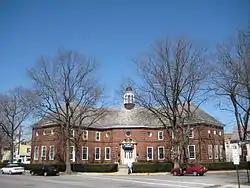 US Post Office-Oyster Bay |
May 11, 1989 (#88002393) |
Shore Avenue 40°52′27″N 73°32′00″W |
Oyster Bay | |
| 69 | Woolworth Estate | 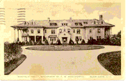 Woolworth Estate |
May 17, 1979 (#79001593) |
77 Crescent Beach Road 40°52′31″N 73°38′38″W |
Glen Cove |
See also
| Wikimedia Commons has media related to National Register of Historic Places in Nassau County, New York. |
References
- The latitude and longitude information provided in this table was derived originally from the National Register Information System, which has been found to be fairly accurate for about 99% of listings. Some locations in this table may have been corrected to current GPS standards.
- Numbers represent an alphabetical ordering by significant words. Various colorings, defined here, differentiate National Historic Landmarks and historic districts from other NRHP buildings, structures, sites or objects.
- The eight-digit number below each date is the number assigned to each location in the National Register Information System database, which can be viewed by clicking the number.
| Topics |  | |
|---|---|---|
| Lists by county |
| |
| Lists by city | ||
| Other lists | ||
| ||
This article is issued from Wikipedia. The text is licensed under Creative Commons - Attribution - Sharealike. Additional terms may apply for the media files.