New Effington, South Dakota
New Effington is a town in Roberts County, South Dakota, United States. The population was 256 at the 2010 census.
New Effington, South Dakota | |
|---|---|
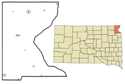 Location in Roberts County and the state of South Dakota | |
| Coordinates: 45°51′22″N 96°55′9″W | |
| Country | United States |
| State | South Dakota |
| County | Roberts |
| Incorporated | 1914[1] |
| Area | |
| • Total | 0.27 sq mi (0.70 km2) |
| • Land | 0.26 sq mi (0.68 km2) |
| • Water | 0.01 sq mi (0.03 km2) |
| Elevation | 1,099 ft (335 m) |
| Population | |
| • Total | 256 |
| • Estimate (2019)[4] | 249 |
| • Density | 954.02/sq mi (368.01/km2) |
| Time zone | UTC-6 (Central (CST)) |
| • Summer (DST) | UTC-5 (CDT) |
| ZIP code | 57255 |
| Area code(s) | 605 |
| FIPS code | 46-44820[5] |
| GNIS feature ID | 1260945[6] |
New Effington was laid out in 1913, after a proposed railroad further away from the original city Effington spurred the need to move the town. Needing a new name they simply added "New", the original being a reference to one of the first women (named Ellie) to get a homestead in the original town.[7]
Geography
New Effington is located at 45°51′22″N 96°55′9″W (45.856135, -96.919074).[8]
According to the United States Census Bureau, the town has a total area of 0.27 square miles (0.70 km2), of which 0.26 square miles (0.67 km2) is land and 0.01 square miles (0.03 km2) is water.[9]
New Effington has been assigned the ZIP code 57255 and the FIPS place code 44860.
Demographics
| Historical population | |||
|---|---|---|---|
| Census | Pop. | %± | |
| 1920 | 305 | — | |
| 1930 | 337 | 10.5% | |
| 1940 | 344 | 2.1% | |
| 1950 | 367 | 6.7% | |
| 1960 | 280 | −23.7% | |
| 1970 | 258 | −7.9% | |
| 1980 | 261 | 1.2% | |
| 1990 | 219 | −16.1% | |
| 2000 | 233 | 6.4% | |
| 2010 | 256 | 9.9% | |
| 2019 (est.) | 249 | [4] | −2.7% |
| U.S. Decennial Census[10] | |||
2010 census
As of the census[3] of 2010, there were 256 people, 107 households, and 65 families residing in the town. The population density was 984.6 inhabitants per square mile (380.2/km2). There were 121 housing units at an average density of 465.4 per square mile (179.7/km2). The racial makeup of the town was 57.8% White, 0.4% African American, 36.3% Native American, 0.8% from other races, and 4.7% from two or more races. Hispanic or Latino of any race were 0.8% of the population.
There were 107 households, of which 29.9% had children under the age of 18 living with them, 42.1% were married couples living together, 14.0% had a female householder with no husband present, 4.7% had a male householder with no wife present, and 39.3% were non-families. 35.5% of all households were made up of individuals, and 18.7% had someone living alone who was 65 years of age or older. The average household size was 2.39 and the average family size was 3.08.
The median age in the town was 39 years. 28.5% of residents were under the age of 18; 10.1% were between the ages of 18 and 24; 19.1% were from 25 to 44; 20.7% were from 45 to 64; and 21.5% were 65 years of age or older. The gender makeup of the town was 46.1% male and 53.9% female.
2000 census
As of the census[5] of 2000, there were 233 people, 105 households, and 59 families residing in the town. The population density was 889.5 people per square mile (346.0/km2). There were 117 housing units at an average density of 446.7 per square mile (173.7/km2). The racial makeup of the town was 72.96% White and 27.04% Native American.
There were 105 households, out of which 23.8% had children under the age of 18 living with them, 46.7% were married couples living together, 7.6% had a female householder with no husband present, and 42.9% were non-families. 41.0% of all households were made up of individuals, and 28.6% had someone living alone who was 65 years of age or older. The average household size was 2.22 and the average family size was 3.08.
In the town, the population was spread out, with 25.8% under the age of 18, 6.0% from 18 to 24, 20.2% from 25 to 44, 18.5% from 45 to 64, and 29.6% who were 65 years of age or older. The median age was 42 years. For every 100 females, there were 87.9 males. For every 100 females age 18 and over, there were 80.2 males.
The median income for a household in the town was $20,909, and the median income for a family was $28,125. Males had a median income of $20,313 versus $18,125 for females. The per capita income for the town was $16,055. About 11.1% of families and 22.1% of the population were below the poverty line, including 28.3% of those under the age of eighteen and 19.7% of those 65 or over.
References
- "SD Towns" (PDF). South Dakota State Historical Society. Retrieved 2010-02-14.
- "2019 U.S. Gazetteer Files". United States Census Bureau. Retrieved July 30, 2020.
- "U.S. Census website". United States Census Bureau. Retrieved 2012-06-21.
- "Population and Housing Unit Estimates". United States Census Bureau. May 24, 2020. Retrieved May 27, 2020.
- "U.S. Census website". United States Census Bureau. Retrieved 2008-01-31.
- "US Board on Geographic Names". United States Geological Survey. 2007-10-25. Retrieved 2008-01-31.
- Federal Writers' Project (1940). South Dakota place-names, v.1-3. University of South Dakota. p. 52.
- "US Gazetteer files: 2010, 2000, and 1990". United States Census Bureau. 2011-02-12. Retrieved 2011-04-23.
- "US Gazetteer files 2010". United States Census Bureau. Archived from the original on 2011-02-20. Retrieved 2012-06-21.
- "Census of Population and Housing". Census.gov. Retrieved June 4, 2015.
Municipalities and communities of Roberts County, South Dakota, United States | ||
|---|---|---|
| Cities | 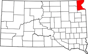 | |
| Towns | ||
| CDPs | ||
| Townships | ||
| Unincorporated community | ||
| Indian reservation | ||
| Footnotes | ‡This populated place also has portions in an adjacent county or counties | |
| ||
