New Hope, Oregon
New Hope is an unincorporated community and census-designated place (CDP) in Josephine County, Oregon, United States.[1] As of the 2010 census it had a population of 1,515.[2]
New Hope, Oregon | |
|---|---|
 New Hope  New Hope | |
| Coordinates: 42.362°N 123.368°W | |
| Country | United States |
| State | Oregon |
| County | Josephine |
| Area | |
| • Total | 3.83 sq mi (9.91 km2) |
| • Land | 3.83 sq mi (9.91 km2) |
| • Water | 0.0 sq mi (0.0 km2) |
| Elevation | 1,040 ft (320 m) |
| Population (2010) | |
| • Total | 1,515 |
| • Density | 396/sq mi (152.8/km2) |
| Time zone | UTC-8 (Pacific (PST)) |
| • Summer (DST) | UTC-7 (PDT) |
| ZIP code | 97527 |
| Area code(s) | 458 and 541 |
| FIPS code | 41-52275 |
| GNIS feature ID | 1146811 |
Geography
New Hope is in eastern Josephine County, 6 miles (10 km) south of Grants Pass, the county seat. The community lies just north of the Applegate River, a northwest-flowing tributary of the Rogue River.
According to the U.S. Census Bureau, the New Hope CDP has an area of 3.8 square miles (9.9 km2), all of it recorded as land.[2]
References
- http://oregon.hometownlocator.com/or/Josephine/New-Hope.cfm
- "Geographic Identifiers: 2010 Census Summary File 1 (G001): New Hope CDP, Oregon". American Factfinder. U.S. Census Bureau. Archived from the original on February 13, 2020. Retrieved November 1, 2018.
Municipalities and communities of Josephine County, Oregon, United States | ||
|---|---|---|
| Cities | 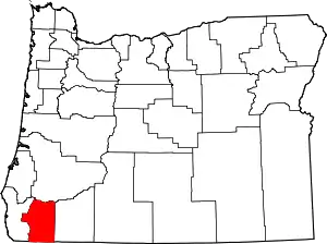 Josephine County map | |
| CDPs | ||
| Other unincorporated communities | ||
| Ghost towns | ||
| ||
This article is issued from Wikipedia. The text is licensed under Creative Commons - Attribution - Sharealike. Additional terms may apply for the media files.