North Salem, New York
North Salem is a town in the northeast part of Westchester County, New York. It is a suburb of New York City approximately 50 miles north of Midtown Manhattan. The population of North Salem was 5,104 at the 2010 census.[4]
North Salem | |
|---|---|
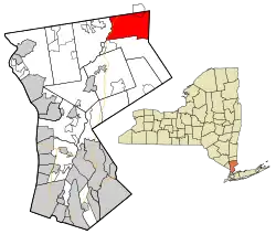 Location of North Salem, New York | |
| Coordinates: 41°19′41″N 73°36′47″W | |
| Country | United States |
| State | New York |
| County | Westchester |
| Government | |
| • Town Supervisor | Warren Lucas (R)[1] |
| Area | |
| • Total | 22.84 sq mi (59.17 km2) |
| • Land | 21.33 sq mi (55.24 km2) |
| • Water | 1.52 sq mi (3.93 km2) |
| Elevation | 338 ft (103 m) |
| Population (2010) | |
| • Total | 5,104 |
| • Estimate (2016)[3] | 5,186 |
| • Density | 243.18/sq mi (93.89/km2) |
| Time zone | UTC-5 (Eastern (EST)) |
| • Summer (DST) | UTC-4 (EDT) |
| ZIP code | 10560 |
| Area code(s) | 914 |
| FIPS code | 36-53517 |
| GNIS feature ID | 0979292 |
| Website | North Salem Website |
According to the demographics data available from the Census Bureau released in July 2016, North Salem had a population of 5,182.[5]
History
The Union Hall was added to the National Register of Historic Places in 1986.[6]
During the American Revolutionary War, John Paulding and Isaac Van Wart left from what was later known as the Yerkes Tavern on Sept. 22, 1780, joined by David Williams (soldier). Their expedition resulted in the capture of the British spy Major John André. The foundation of Yerkes (Yerks) Tavern is all that is left of the historic building, once at the intersection of Yerkes Road and Bogtown Road. An historic plaque posted on the site reads:
On this site stood one of North Salem's early taverns. Its proprietor was John Yerkes, who received a license from the town "to operate a tavern or inn for the accommodation and entertainment of travelers" in 1815.
Early records indicate that this property was owned by the Smith family prior to this date.
Geography
The north town line is the border of Putnam County, New York; and the east town line is the border of Connecticut. According to the United States Census Bureau, the town has a total area of 32.9 square miles (85 km2), of which 31.4 square miles (81 km2) is land and 1.5 square miles (3.9 km2), or 6.38%, is water.
Demographics
| Historical population | |||
|---|---|---|---|
| Census | Pop. | %± | |
| 1790 | 1,058 | — | |
| 1820 | 1,480 | — | |
| 1830 | 1,276 | −13.8% | |
| 1840 | 1,161 | −9.0% | |
| 1850 | 1,335 | 15.0% | |
| 1860 | 1,497 | 12.1% | |
| 1870 | 1,754 | 17.2% | |
| 1880 | 1,693 | −3.5% | |
| 1890 | 1,730 | 2.2% | |
| 1900 | 1,133 | −34.5% | |
| 1910 | 1,258 | 11.0% | |
| 1920 | 934 | −25.8% | |
| 1930 | 1,128 | 20.8% | |
| 1940 | 1,194 | 5.9% | |
| 1950 | 1,622 | 35.8% | |
| 1960 | 2,345 | 44.6% | |
| 1970 | 3,828 | 63.2% | |
| 1980 | 4,569 | 19.4% | |
| 1990 | 4,725 | 3.4% | |
| 2000 | 5,173 | 9.5% | |
| 2010 | 5,104 | −1.3% | |
| 2016 (est.) | 5,186 | [3] | 1.6% |
| U.S. Decennial Census[8] | |||
In 2011, the average income for a household in the town was $157,258, with an average net worth of $1,300,058. The median house value in 2009 was $772,817. The per capita income for the town was $59,403. About 1.5% of families and 2.0% of the population were below the poverty line, including 2.2% of those under age 18 and none of those age 65 or over. As of the census[9] of 2000, there were 5,173 people, 1,764 households, and 1,374 families residing in the town. The population density was 241.5 people per square mile (93.2/km2). There were 1,979 housing units at an average density of 92.4 per square mile (35.7/km2). The racial makeup of the town was 95.44% White, 0.75% African American, 0.08% Native American, 0.97% Asian, 1.12% from other races, and 1.64% from two or more races. Hispanic or Latino of any race were 3.65% of the population.
There were 1,764 households, out of which 39.2% had children under the age of 18 living with them, 68.1% were married couples living together, 7.5% had a female householder with no husband present, and 22.1% were non-families. 17.5% of all households were made up of individuals, and 5.3% had someone living alone who was 65 years of age or older. The average household size was 2.80 and the average family size was 3.17. In the town, the population was spread out, with 26.2% under the age of 18, 4.4% from 18 to 24, 28.5% from 25 to 44, 27.0% from 45 to 64, and 13.9% who were 65 years of age or older. The median age was 40 years. For every 100 females, there were 91.6 males. For every 100 females age 18 and over, there were 87.4 males.
Communities and locations
- Croton Falls – a hamlet in the northwest corner of the town with its own Metro-North station
- Grants Corner – a hamlet southeast of North Salem
- North Salem – a hamlet in the west part of the town. The North Salem Town Hall was added to the National Register of Historic Places in 1980.[6]
- Salem Center – a hamlet at the east end of Titicus Reservoir. The fictitious headquarters of the X-Men Marvel Comics superhero team is located in Salem Center.
- Purdys – a hamlet south of Croton Falls with its own Purdy's station. The Joseph Purdy Homestead was added to the National Register of Historic Places in 1973.[6]
Education
North Salem Middle School/High School is at 230 June Road in North Salem.[10] The North Salem School District's border encompasses the entire town of North Salem, in addition to parts of the Putnam County towns of Southeast, and Carmel. Some residents of nearby Somers also reside within the district line.
In 2004, the high school was distinguished as a Blue Ribbon School for high levels of educational achievement by the United States Department of Education.[11] Pequenakonck Elementary School, located 0.3 miles (0.5 km) away from the middle school/high school, serves grades K-5. The middle school, which shares the same building as the high school, serves grades 6–8. This school is particularly small, with about 90 children on average per grade, making the student to faculty ratio relatively small.
Town government
North Salem's town government consists of a town supervisor and 4 town board members. The supervisor serves a 2 year term, and the board members serve 4 year terms. Elections are staggered such that in any given election year, the supervisor and 2 board members seats will be up.[12]
| Position elected | Name | Year first elected | Political affiliation | Year next up for election |
|---|---|---|---|---|
| Town Supervisor | Warren Lucas | 2009 | R | 2021 |
| Town Council Member | Peter Kamenstein | 2009 | R | 2021 |
| Town Council Member | Vacant | N/A | N/A | 2020 |
| Town Council Member | Lisa Douglas | 2015 | R | 2023 |
| Town Council Member | Martin Aronchick | 2011* | D | 2021 |
*Aronchick first won his seat in 2011, lost it in 2015 to Lisa Douglas, and won a seat back in 2016 in a special election.
Notable people
- Jacob M. Appel, author of Einstein's Beach House[13]
- Emily Bindiger, singer[14]
- Dick Button, figure skater[15]
- Fanny Crosby, writer[16]
- Laurence D. Fink, business executive, owns a farm there[17]
- Chapman Grant, grandson of President Ulysses S. Grant
- Robbie Kondor, musician[14]
- Alan Menken,[18] film composer and songwriter
- David Letterman,[18] talk show host
- David Marks,[18] original member of the Beach Boys
- Steven Rattner, financier, in charge of 2008 General Motors auto bailout, owns a horse farm in North Salem.[19]
- Sam Savitt, equestrian artist and author[20]
- Yannis Pappas, comedian
- Jake Yoel, Student
- Grace Fogle, Sit-down comedian
See also
- South Salem, New York
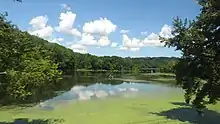
- Baxter Preserve, North Salem's most popular park
- Hammond Museum and Japanese Stroll Garden
References
- Pacchiana, Katherine (24 August 2011). "North Salem: Who is Running For What?". The Daily Voice. Retrieved October 5, 2015.
Republican incumbent Warren Lucas will run unopposed for supervisor
- "2016 U.S. Gazetteer Files". United States Census Bureau. Retrieved Jul 5, 2017.
- "Population and Housing Unit Estimates". Retrieved June 9, 2017.
- "Profile of General Population and Housing Characteristics: 2010 Demographic Profile Data (DP-1): North Salem town, Westchester County, New York". United States Census Bureau. Retrieved November 15, 2011.
- U.S. Census Bureau, Population Estimates Program (PEP), Updated annually. Population and Housing Unit Estimates U.S. Census Bureau, 2010 Census of Population, P94-171 Redistricting Data File. Updated every 10 years. American FactFinder
- "National Register Information System". National Register of Historic Places. National Park Service. March 13, 2009.
- Yerkes Tavern, Map the Past
- "Census of Population and Housing". Census.gov. Retrieved June 4, 2015.
- "U.S. Census website". United States Census Bureau. Retrieved 2008-01-31.
- "northsalemschools". Retrieved July 25, 2011.
- "northsalemschools". Retrieved July 25, 2016.
- "Town Board > Home | The Town of North Salem, NY". www.northsalemny.org. Retrieved 2018-02-17.
- Phoning Home. University of South Carolina Press, 2014
- https://westchesternorth.macaronikid.com/events/5e32d6007ff162630657016f/a-musical-valentine-for-north-salem-a-performance-by-pianist-robbie-kondor-and-vocalist-emily-bindiger
- Cary, Bill (September 6, 2013). "Dick Button's garden glory: Open Days opened over weekend". lohud.com. Gannett. Retrieved 10 September 2013.
- https://www.adventuresaroundputnam.com/2017/10/22/fanny-crosby-birthplace-historical-marker/
- https://www.vanityfair.com/news/2010/04/fink-201004
- "Westchester Magazine". Retrieved July 25, 2011.
- http://northsalem.dailyvoice.com/neighbors/happy-birthday-north-salem-s-steven-lawrence-rattner
- https://www.tapinto.net/towns/north-salem/sections/arts-and-entertainment/articles/north-salem-equine-rescue-tastes-victory
External links
![]() Media related to North Salem, New York at Wikimedia Commons
Media related to North Salem, New York at Wikimedia Commons
- Town of North Salem official website
- Ruth Keeler Memorial Library
- North Salem Central School District
- North Salem Lions
- North Salem Chamber of Commerce
- Balanced Rock of the Hudson Valley - Large perched rock and possible Druid Dolmen located in North Salem, NY
Municipalities and communities of Westchester County, New York, United States | ||
|---|---|---|
| Cities | 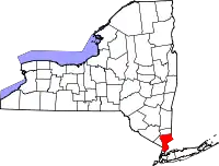 | |
| Towns | ||
| Villages | ||
| CDPs |
| |
| Other hamlets | ||
| Footnotes | ‡This populated place also has portions in an adjacent county or counties | |
| ||
| Authority control |
|---|