Dobbs Ferry, New York
Dobbs Ferry is a village in Westchester County, New York, United States. The population was 10,875 according to the 2010 United States Census.[3] In 2019, its population rose to an estimated 11,027.[4] The village of Dobbs Ferry is located in, and is a part of, the town of Greenburgh. The village ZIP code is 10522. Most of the village falls within the boundaries of the Dobbs Ferry Union Free School District.
Dobbs Ferry, New York | |
|---|---|
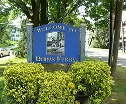 Dobbs Ferry welcome sign | |
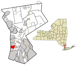 Location of Dobbs Ferry, New York | |
| Coordinates: 41°0′46″N 73°51′58″W | |
| Country | United States |
| State | New York |
| County | Westchester |
| Town | Greenburgh |
| Area | |
| • Total | 3.17 sq mi (8.22 km2) |
| • Land | 2.42 sq mi (6.27 km2) |
| • Water | 0.75 sq mi (1.95 km2) |
| Elevation | 210 ft (64 m) |
| Population (2010) | |
| • Total | 10,875 |
| • Estimate (2019)[2] | 11,027 |
| • Density | 4,550.97/sq mi (1,757.34/km2) |
| Time zone | UTC-5 (Eastern (EST)) |
| • Summer (DST) | UTC-4 (EDT) |
| ZIP code | 10522 |
| Area code(s) | 914 |
| FIPS code | 36-20698 |
| GNIS feature ID | 0970074 |
| Website | www.dobbsferry.com |
Dobbs Ferry was ranked seventh in the list of the top 10 places to live in New York State for 2014 according to the national online real estate brokerage Movoto.[5] Dobbs Ferry is also the first village in New York State certified as a Climate Smart Community and was granted in 2014 the highest level given out in the state.[6][7]
History
Dobbs Ferry was named after Jeremiah Dobbs, a descendant of William Dobbs, of Swedish and Dutch ancestry[8] whose family ran a ferry service[9] that traversed the Hudson River at this location.[10] Dobbs was a fisherman and settled near the southern part of what is now Dobbs Ferry, and he "added to his meager income by ferriage of occasional travelers across the Hudson. He used a style of boat known at that day as a periauger, a canoe hollowed out of a solid log. . . From this primitive ferry the village took its name."[8]
Dobbs Ferry played a vital role in the American Revolutionary War. The position of the village opposite the northernmost end of the Palisades gave it importance during the war. The region was repeatedly raided by camp followers of each army; earthworks and a fort, commanding the Hudson ferry and the ferry to Paramus, New Jersey, were built; the British army made Dobbs Ferry a rendezvous, after the Battle of White Plains in November 1776, and the continental division under General Benjamin Lincoln was here at the end of January 1777.[11]
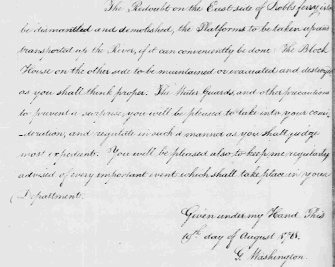
In July and August 1781, during the seventh year of the war, Continental Army troops commanded by General George Washington were encamped in Dobbs Ferry and neighboring localities, alongside allied French forces under the command of the Comte de Rochambeau.[12] A large British army controlled Manhattan at the time, and Washington chose the Dobbs Ferry area for encampment because he hoped to probe for weaknesses in the British defenses, just 12 miles (19 km) to the south. But on August 14, 1781, a communication was received from French Admiral Comte de Grasse in the West Indies, which caused Washington to change his strategy. De Grasse's communication, which advocated a joint land and sea attack against the British in Virginia, convinced Washington to risk a march of more than 400 miles (640 km) to the Chesapeake region of Virginia. Washington's new strategy, adopted and designed in mid-August 1781, at the encampment of the allied armies, would win the war. The allied armies were ordered to break camp on August 19, 1781: on that date the Americans took the first steps of their march to Virginia along present-day Ashford Avenue and Broadway, en route to victory over General Cornwallis at the Siege of Yorktown and to victory in the Revolutionary War.[13]
The village was originally incorporated in 1873 as Greenburgh, but the name was changed to Dobbs Ferry in 1882.
The current local government of Dobbs Ferry is headed by Mayor Vincent Rossillo, a Democrat, who was elected in November 2019.
The Estherwood and Carriage House, Hyatt-Livingston House, South Presbyterian Church, and United States Post Office are listed on the National Register of Historic Places.[14]
Demographics
| Year | Pop. | ±% |
|---|---|---|
| 1880 | 1,915 | — |
| 1890 | 2,083 | +8.8% |
| 1900 | 2,888 | +38.6% |
| 1910 | 3,455 | +19.6% |
| 1920 | 4,401 | +27.4% |
| 1930 | 5,741 | +30.4% |
| 1940 | 5,883 | +2.5% |
| 1950 | 6,268 | +6.5% |
| 1960 | 9,260 | +47.7% |
| 1970 | 10,353 | +11.8% |
| 1980 | 10,053 | −2.9% |
| 1990 | 9,940 | −1.1% |
| 2000 | 10,622 | +6.9% |
| 2010 | 10,875 | +2.4% |
| 2019 | 11,027 | +1.4% |
| Sources: 1880 value is given for Greenburgh Village,[15] 1890,[16] 1900,[17] 1910,[18] 1920,[19] 1930,[19] 1940,[20] 1950,[21] 1960,[22] 1970,[22] 1980,[23] 1990,[23] 2000,[24] 2010[3] Source: | ||
As of the census[26] of 2000, there were 10,622 people, 3,792 households, and 2,570 families residing in the village. The population density was 4,350.0 people per square mile (1,680.8 per km2). There were 3,941 housing units at an average density of 1,614.0 per square mile (623.6 per km2). The racial makeup of the village was 80.70% White, 7.38% African American, 0.08% Native American, 7.56% Asian, 0.09% Pacific Islander, 1.93% from other races, and 2.26% from two or more races. Hispanic or Latino of any race were 7.00% of the population.
There were 3,792 households, out of which 34.5% had children under the age of 18 living with them, 54.8% were married couples living together, 10.0% had a female householder with no husband present, and 32.2% were non-families. Of all households, 27.6% were made up of individuals, and 8.4% had someone living alone who was 65 years of age or older. The average household size was 2.55 and the average family size was 3.13.
In the village, the population was spread out, with 26.0% under the age of 18, 7.3% from 18 to 24, 27.4% from 25 to 44, 24.1% from 45 to 64, and 15.2% who were 65 years of age or older. The median age was 39 years. For every 100 females, there were 95.7 males. For every 100 females age 18 and over, there were 84.5 males.
The median income for a household in the village was $70,333, and the median income for a family was $93,127. Males had a median income of $65,532 versus $50,091 for females. The per capita income for the village was $35,090. About 1.8% of families and 5.8% of the population were below the poverty line, including 4.8% of those under age 18 and 7.2% of those age 65 or over.
Geography
Dobbs Ferry is located at 41°0′46″N 73°51′58″W (41.012729, −73.866026).[27]
According to the United States Census Bureau, the village has a total area of 3.2 square miles (8.3 km2), of which 2.4 square miles (6.2 km2) is land and 0.7 square miles (1.8 km2), or 23.03%, is water.
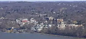
The village is bounded on the west by the Hudson River, and on the east by the Saw Mill River. Wickers Creek (name derived from the indigenous Weckquaesgeek) runs east to west through the center of the village from its main source in the Juhring Nature Preserve, Todd's Pond.
The village consists of a series of neighborhoods as defined in the 2010 Vision Plan, the Master Plan for the village. These neighborhoods are not popularly recognized as of 2014. As the Vision Plan states, "Sometimes the boundaries of these neighborhoods are clearly defined, but other times less so. Where necessary, boundaries have been interpolated." The neighborhoods are: Springhurst Park, Broadway, Wickers Creek, Waterfront, Old Town, Fairmead, Riverview Manor, Villard, Osborne, Belden, Maple, Walgrove, Virginia, Beacon Hill, Campuses and Woods, Parkway, Southfield, Knoll, Northfield, and Juhring. (Homes in Juhring are commonly referred to by real estate brokers as part of the Ardsley Park neighborhood, which encompasses the Juhring neighborhood in Dobbs Ferry and the Ardsley-on-Hudson neighborhood of Irvington, New York).[28]
Climate
| Climate data for Dobbs Ferry, New York | |||||||||||||
|---|---|---|---|---|---|---|---|---|---|---|---|---|---|
| Month | Jan | Feb | Mar | Apr | May | Jun | Jul | Aug | Sep | Oct | Nov | Dec | Year |
| Record high °F (°C) | 73 (23) |
75 (24) |
86 (30) |
96 (36) |
97 (36) |
99 (37) |
104 (40) |
102 (39) |
101 (38) |
89 (32) |
82 (28) |
77 (25) |
104 (40) |
| Average high °F (°C) | 38.1 (3.4) |
41.4 (5.2) |
50.5 (10.3) |
61.9 (16.6) |
72.5 (22.5) |
80.4 (26.9) |
85.4 (29.7) |
83.4 (28.6) |
75.8 (24.3) |
64.7 (18.2) |
53.6 (12.0) |
42.8 (6.0) |
62.5 (17.0) |
| Average low °F (°C) | 23.0 (−5.0) |
24.5 (−4.2) |
31.7 (−0.2) |
40.4 (4.7) |
50.3 (10.2) |
59.3 (15.2) |
64.7 (18.2) |
63.6 (17.6) |
56.3 (13.5) |
45.3 (7.4) |
37.1 (2.8) |
28.1 (−2.2) |
43.7 (6.5) |
| Record low °F (°C) | −10 (−23) |
−5 (−21) |
2 (−17) |
17 (−8) |
29 (−2) |
38 (3) |
49 (9) |
44 (7) |
34 (1) |
27 (−3) |
12 (−11) |
−4 (−20) |
−10 (−23) |
| Average precipitation inches (mm) | 4.39 (112) |
3.35 (85) |
4.54 (115) |
4.50 (114) |
4.87 (124) |
3.88 (99) |
4.57 (116) |
4.38 (111) |
4.77 (121) |
4.11 (104) |
4.52 (115) |
4.27 (108) |
52.15 (1,325) |
| Average snowfall inches (cm) | 10.1 (26) |
8.9 (23) |
5.2 (13) |
.9 (2.3) |
trace | 0 (0) |
0 (0) |
0 (0) |
0 (0) |
.1 (0.25) |
.8 (2.0) |
4.3 (11) |
30.3 (77) |
| Average precipitation days | 11.4 | 9.8 | 11.7 | 12.1 | 12.4 | 11.6 | 10.7 | 10.0 | 9.4 | 8.7 | 10.4 | 11.9 | 130.1 |
| Average snowy days | 5.9 | 4.8 | 3.2 | .4 | 0 | 0 | 0 | 0 | 0 | .1 | .8 | 3.5 | 18.7 |
| Source: NOAA (1971−2000)[29] | |||||||||||||
Education
A majority of the village is within the Dobbs Ferry Union Free School District, which consists of Springhurst Elementary, grades K–5, Dobbs Ferry Middle School, grades 6–8, and the Dobbs Ferry High School, grades 9–12.
Mercy College, a private institution with undergraduate and graduate programs, has its main campus in Dobbs Ferry. Our Lady of Victory Academy, a local parochial school offering grades 9–12 for girls, was located on the campus of Mercy College until its closing in 2011.
The Masters School is a private school located south of the town center that offers grades 5–12 for boys and girls. It is a boarding or day school that was founded in 1877 by Eliza Masters. The school contains a mansion called Estherwood.[30]
An Alcott Montessori School is located in the town.
Public transit
Almost 10% of households do not own a car and rely on public transit, bicycling, and walking.[28]
Several lines of the Bee-Line Bus System run through Dobbs Ferry, facilitating north-south travel along the Broadway/Route 9 corridor and east-west along Ashford Avenue. The village operates a shuttle bus from the train station in the afternoon and evenings.[31]
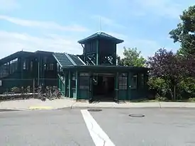
Commuter rail service to Grand Central Terminal is available via the Dobbs Ferry station, served by Metro-North Railroad. The train runs on the Hudson Line, and travel time from Dobbs Ferry to Grand Central Terminal is approximately 37 minutes on an express train and 43 minutes on a local train. Many Metro North riders connect to the New York City Subway's 1 train at Marble Hill to reach destinations on the west side of Manhattan, or at Harlem–125th Street station for the Upper East Side.
Amtrak inter-city rail trains travel on the Hudson Line tracks, but trains do not stop in the village. The closest Amtrak stations are Yonkers and Croton–Harmon stations.
Culture
In 2018 Brooke Lea Foster of The New York Times stated that it was one of several "Rivertowns" in New York State, which she described as among the "least suburban of suburbs, each one celebrated by buyers there for its culture and hip factor, as much as the housing stock and sophisticated post-city life."[32] Of those, Foster stated that Dobbs Ferry had the most ethnic/cultural diversity.[32]
Parks and recreation
The village's Recreation Department runs a variety of programs out of the Embassy Community Center, including art and dance classes, sports leagues, summer camp, and other activities open to the public. Programs for older adults are also well-funded and used. Additional sports leagues for baseball and soccer are run independently but use village facilities.
There are a variety of village public parks, in order of size:
- Juhring Nature Preserve, a 76-acre wooded park with trail entrances from the Ardsley Park (Juhring), Northfield, and Knoll neighborhoods in Dobbs Ferry.
- Waterfront Park on the Hudson River shoreline with playground, soccer field, and open space. It serves as the site of the Dobbs Ferry Union Free School District graduation ceremony, summer concerts, and Independence Day fireworks.
- Gould Park in the center of the Village, with two public swimming pools, playground, basketball court, and multi-sport ballfields.
- Memorial Park[33] has a wading pool, baseball field, basketball court, and bocce court. In 2014, the American Legion Post 148, which leased space in the park, collapsed and was razed.[34][35]
Two linear parks used for active transportation and recreation traverse Dobbs Ferry as well. The Old Croton Aqueduct Trailway, a linear State Park, runs north-south through the village on its western side. The South County Trailway, a linear Westchester County park also runs north-south through the village, but on its eastern side along the bank of the Saw Mill River. There are also segments of trails unconnected to each other, including the Gateway Trail near Estherwood Avenue and Spoiler's Run[36] near Belden Avenue.
Emergency services
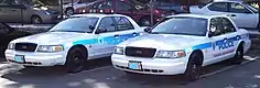
Dobbs Ferry is served by a paid police department, a volunteer fire department (housing three pumpers and one tower ladder in two firehouses) and a volunteer ambulance corps (possessing two ambulances (one equipped with four-wheel-drive) and a fire rehab unit). As a part of the Town of Greenburgh, the village is eligible for additional coverage from the town services. Mutual aid agreements exist with neighboring municipalities for further coverage.
Notable people
- Jane Alexander, actress[37]
- Jacob M. Appel, novelist, essayist[38]
- Rex Beach, novelist, playwright, and Olympic water polo player, whose most famous novel is commemorated by the Spoiler's Run walking/bike trail.[39]
- Mark Blount, NBA basketball player
- Jason Blum, film producer
- Bradley Bolke (1925–2019), voice actor
- William C. Conner (1920–2009), federal judge for the United States District Court for the Southern District of New York[40]
- Augusta Dabney (1918–2008), actress
- Alvin Dark (1922–2014), Major League Baseball player and manager
- Cyrus West Field, inventor of electromagnetic trans-Atlantic telecommunication
- Paul Fix (1901–1983), film and television character actor
- Jean Fritz, author
- Bernice Gottlieb, pioneer in trans-racial adoption movement
- Lewis Hine (1874–1940), sociologist and photographer
- Joel Higgins, actor
- Robert G. Ingersoll (1833–1899), lawyer, politician, orator, advocate of agnosticism
- J. Howard Kitching, Civil War brevet Brigadier General
- Eric Paschall, NBA basketball player
- Sarah Jessica Parker, actress
- Stone Phillips (born 1954), former co-anchor of Dateline NBC
- Dusty Rhodes, baseball player, member of 1954 World Series champion New York Giants
- Charles Sheeler (1883–1965), artist and photographer
- Fanny Garrison Villard (1844-1928), co-founder of the NAACP, and leader of women's suffrage movement
- Henry Villard (1835-1900), journalist, newspaper publisher, financier and railroad baron.
- Mark Zuckerberg, co-founder of Facebook[41]
- Randi Zuckerberg, Marketing Director of Facebook
References
- "2019 U.S. Gazetteer Files". United States Census Bureau. Retrieved July 27, 2020.
- "Population and Housing Unit Estimates". United States Census Bureau. May 24, 2020. Retrieved May 27, 2020.
- "Profile of General Population and Housing Characteristics: 2010 Demographic Profile Data (DP-1): Dobbs Ferry village, Westchester County, New York". United States Census Bureau. Retrieved November 16, 2011.
- "2018 ACS Demographic and Housing Estimates". data.census.gov. Retrieved 2020-02-01.
- "10 Best Places to Live in New York – Movoto". Movoto Blog.
- "Governor Cuomo Announces Climate Smart Communities Certification Program". Governor Andrew M. Cuomo.
- "Energy efficiency projects save communities money, state recognition". lohud.com. 30 April 2014.
- Cutter, William Richard (1 January 1912). Genealogical and Family History of Central New York: A Record of the Achievements of Her People in the Making of a Commonwealth and the Building of a Nation. Lewis Historical Publishing Company. Retrieved 28 June 2016 – via Internet Archive.
- "Rockland Co. NY historical sites and landmarks". Retrieved 28 June 2016.
- Chisholm 1911.
-
 One or more of the preceding sentences incorporates text from a publication now in the public domain: Chisholm, Hugh, ed. (1911). "Dobbs Ferry". Encyclopædia Britannica. 8 (11th ed.). Cambridge University Press. pp. 349–350.
 - "The Washington-Rochambeau Encampment of the American and French Armies at Dobbs Ferry, Ardsley, Hartsdale and Edgemont"
- "March in NY". Archived from the original on 2016-03-08. Retrieved 28 June 2016.
- "National Register Information System". National Register of Historic Places. National Park Service. March 13, 2009.
- U.S. Census Office (1882). "Population of Civil Divisions Less Than Counties: New York". Statistics of the Population of the United States at the Tenth Census (June 1, 1880). 1. Washington, D.C.: U.S. Government Printing Office. p. 271.
- U.S. Census Office (1895). "Minor Civil Divisions: New York". Report on Population of the United States at the Eleventh Census: 1890. Part I. Washington, D.C.: U.S. Government Printing Office. p. 253.
- U.S. Census Office (1901). "Population". Twelfth Census of the United States, Taken in the Year 1900. I. Washington, D.C.: U.S. Government Printing Office. p. 285.
- U.S. Census Bureau (1913). "Population: 1910". Thirteenth Census of the United States Taken in the Year 1910. 3. Washington, D.C.: U.S. Government Printing Office. p. 206.
- U.S. Census Bureau (1931). "Population". Fifteenth Census of the United States: 1930. 1. Washington, D.C.: U.S. Government Printing Office. p. 765.
- U.S. Census Bureau (1942). "Population". Sixteenth Census of the United States: 1940. I. Washington, D.C.: U.S. Government Printing Office.
- U.S. Census Bureau (7 Oct 1951). "Population of New York: April 1, 1950". 1950 Census of Population: Advance Reports. PC-8, No. 31. Washington, D.C.: U.S. Government Printing Office. p. 4.
- U.S. Census Bureau (Mar 1973). "Characteristic of Population". 1970 Census of Population. New York, section 1. Washington, D.C.: U.S. Government Printing Office. p. 34.
- U.S. Census Bureau (1990). "Population and Housing Unit Counts". 1990 Census of Population and Housing. CPH-2-34, New York. Washington, D.C.: U.S. Government Printing Office. p. 37.
- U.S. Census Bureau (Sep 2003). "Population and Housing Unit Counts". 2000 Census of Population and Housing. PHC-3-34, New York. Washington, D.C.: U.S. Government Printing Office. p. 26.
- "Census of Population and Housing". Census.gov. Retrieved June 4, 2016.
- "U.S. Census website". United States Census Bureau. Retrieved 2008-01-31.
- "US Gazetteer files: 2010, 2000, and 1990". United States Census Bureau. 2011-02-12. Retrieved 2011-04-23.
- Super User. "Dobbs Ferry Vision Plan – Village of Dobbs Ferry". dobbsferry.com. Archived from the original on 2014-03-04. Retrieved 2014-03-04.
- "Climatology of the United States No. 20: DOBBS FERRY ARDSLEY, NY 1971–2000" (PDF). National Oceanic and Atmospheric Administration. Archived from the original (PDF) on 2014-08-14. Retrieved 2011-11-11.
- http://www.hudsonshores.com/cgi-bin/hspage.cgi?area=dobb%5B%5D
- "Info. on The Commuter Bus In Dobbs Ferry". Cindy Kief, Realtor in Westchester County.
- Foster, Brooke Lea (2018). "Comparing Suburbs: Montclair in New Jersey vs. Dobbs Ferry in New York". The New York Times.
- "Dobbs Ferry's Memorial Park Pool Opens Saturday". The Rivertowns Daily Voice. 24 May 2013.
- "Condemned And Vacant Dobbs Ferry Legion Hall Collapses". The Rivertowns Daily Voice. 15 February 2014.
- "Westchester County, New York - The Journal News - lohud.com - lohud.com". The Journal News - lohud.com.
- https://www.scribd.com/document/382825933/spoilers-run-agreement
- "Westchester". westchestermagazine.com.
- Phoning Home (revised edition), University of South Carolina Press, 2015
- Google (28 June 2016). "Spoilers Run" (Map). Google Maps. Google. Retrieved 28 June 2016.
- Martin, Douglas. "William Conner, Judge Expert in Patent Law, Dies at 89", The New York Times, July 19, 2009. Accessed July 20, 2009.
- "Mark Zuckerberg Biography".
Further reading
- Borkow, Richard. George Washington's Westchester Gamble: The Encampment on the Hudson and the Trapping of Cornwallis. 2011. ISBN 978-1609490393.
External links
| Wikimedia Commons has media related to Dobbs Ferry, New York. |
 Dobbs Ferry travel guide from Wikivoyage
- Village of Dobbs Ferry official website
- Dobbs Ferry Schools Foundation
- The Rivertowns Enterprise, hometown newspaper
- Dobbs Ferry Conference 1781
Municipalities and communities of Westchester County, New York, United States | ||
|---|---|---|
| Cities | 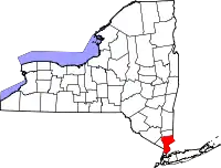 | |
| Towns | ||
| Villages | ||
| CDPs |
| |
| Other hamlets | ||
| Footnotes | ‡This populated place also has portions in an adjacent county or counties | |
| ||
| Authority control |
|---|