North Stormont, Ontario
North Stormont is a lower tier township in eastern Ontario, Canada in the United Counties of Stormont, Dundas and Glengarry.
North Stormont | |
|---|---|
| Township of North Stormont | |
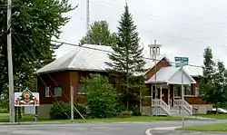 Township office in Berwick | |
| Motto(s): A Good Place to Grow... | |
 North Stormont | |
| Coordinates: 45°13′N 75°00′W | |
| Country | |
| Province | |
| County | Stormont, Dundas and Glengarry |
| Formed | January 1, 1998 |
| Government | |
| • Type | Township |
| • Mayor | Jim Wert |
| • Deputy Mayor | François Landry |
| • Federal riding | Stormont—Dundas—South Glengarry |
| • Prov. riding | Stormont—Dundas—South Glengarry |
| Area | |
| • Total | 515.91 km2 (199.19 sq mi) |
| Population (2016)[1] | |
| • Total | 6,873 |
| • Density | 13.3/km2 (34/sq mi) |
| Time zone | UTC-5 (Eastern (EST)) |
| • Summer (DST) | UTC-4 (Eastern Daylight (EDT)) |
| Postal code FSA | K0C |
| Area code(s) | 613 and 343 |
| Website | northstormont |
Communities
The township of North Stormont comprises a number of villages and hamlets, including the following communities:
- Finch Township: Berwick, Crysler, Finch; Cahore, Goldfield, Glenpayne
- Roxborough Township: Avonmore, Monkland, Moose Creek, Roxborough Gardens, Bloomington, Dyer, Gravel Hill, Lodi, MacDonalds Grove, McMillans Corners (partially), Sandringham, Strathmore, Tayside, Tolmies Corners, Warina, Valley Corners
The township administrative offices are located in Berwick.
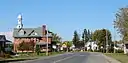 Crysler
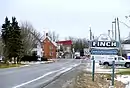 Finch
Finch Monkland
 Moose Creek
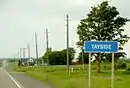 Tayside
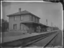 Canadian Pacific Railway Station, Avonmore, Ontario, [between 1895 and 1910]
History
Early settlement in the area began in 1785 Finch Township was originally part of the Royal Township of Osnabruck, and Roxborough Township was originally part of the Royal Township of Cornwall. Stormont County was created in 1792, and both Finch and Roxborough were separated from their southerly parents in 1798.
The hamlet of Berwick was first settled by four Cockburn brothers from Scotland in the early 19th century. Berwick became the administrative home of municipal government in the former Finch Township, incorporated January 1, 1850.
The New York and Ottawa Railway was built in 1897 and sent up to four daily passenger trains, as well as up to five daily freight trains through Berwick. The first church was built in 1883.
The township was established on January 1, 1998, with the amalgamation of the former Townships of Finch and Roxborough, along with the Village of Finch.
Demographics
| Year | Pop. | ±% |
|---|---|---|
| 1986 | 5,748 | — |
| 1991 | 6,159 | +7.2% |
| 1996 | 6,900 | +12.0% |
| 2001 | 6,855 | −0.7% |
| 2006 | 6,769 | −1.3% |
| 2011 | 6,775 | +0.1% |
| 2016 | 6,873 | +1.4% |
| Population amounts prior to 2001 is total of Finch TP, Roxborough TP, and Finch VL. | ||
| Canada census – North Stormont, Ontario community profile | |||
|---|---|---|---|
| 2016 | 2011 | 2006 | |
| Population: | 6,873 (1.4% from 2011) | 6,775 (0.1% from 2006) | 6,769 (-1.3% from 2001) |
| Land area: | 515.91 km2 (199.19 sq mi) | 515.65 km2 (199.09 sq mi) | 515.55 km2 (199.05 sq mi) |
| Population density: | 13.3/km2 (34/sq mi) | 13.1/km2 (34/sq mi) | 13.1/km2 (34/sq mi) |
| Median age: | 41.6 (M: 41.6, F: 41.6) | 40.9 (M: 40.3, F: 41.5) | 38.9 (M: 38.6, F: 39.1) |
| Total private dwellings: | 2,717 | 2,583 | 2,514 |
| Median household income: | $76,544 | $59,486 | |
| References: 2016[2] 2011[3] 2006[4] earlier[5] | |||
Railways
Crysler is represented by a signpost on the Canadian National Railway line between Montreal and Toronto.
References
- "North Stormont census profile". 2016 Census of Population. Statistics Canada. Retrieved 2019-10-24.
- "2016 Community Profiles". 2016 Canadian Census. Statistics Canada. February 21, 2017. Retrieved 2019-10-24.
- "2011 Community Profiles". 2011 Canadian Census. Statistics Canada. July 5, 2013. Retrieved 2012-02-27.
- "2006 Community Profiles". 2006 Canadian Census. Statistics Canada. March 30, 2011. Retrieved 2012-02-27.
- "2001 Community Profiles". 2001 Canadian Census. Statistics Canada. February 17, 2012.
Places adjacent to North Stormont, Ontario | |
|---|---|