Nuh (city)
Nuh is the district headquarters of the Nuh district[1] in the Indian state of Haryana. It lies on the National Highway 248 (NH 48) or Gurgaon-Sohna-Alwar highway about 45 kilometres (28 mi) from Gurgaon.
Nuh
नूँह Mewat | |
|---|---|
Town | |
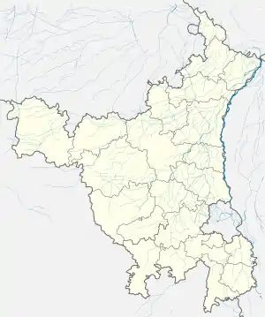 Nuh  Nuh | |
| Coordinates: 28.12°N 77.02°E | |
| Country | |
| State | Haryana |
| District | Nuh |
| Elevation | 199 m (653 ft) |
| Population (2011) | |
| • Total | 10,767 |
| Demonym(s) | Mewati |
| Languages | |
| • Official | Hindi |
| • Spoken | Urdu, Mewati |
| Time zone | UTC+5:30 (IST) |
| ISO 3166 code | IN-HR |
| Vehicle registration | HR-27 |
| Website | haryana |
| http://www.mewat.gov.in | |
History
According to Mahabharata (900 BCE), the area was granted by the eldest Pandava king Yudhishthira to their teacher Dronacharya. Later is passed in the hands of Maurya empire to invaders like Parthian and Kushan, and Yaudheya after they expelled Kushanas from the area between Yamuna and Satluj. Yodheyas was subjugated by king Rudradaman I of Indo-Scythians and later by Gupta Empire and then by Hunas, who were overthrown by Yashodharman of Mandsaur and then by Yashovarman of Kannauj. The area was also ruled by Harsha (590 - 467 CE), Gurjara-Pratihara (mid 7th century CE to 11th century). Tomara dynasty, who founded Dhillika in 736 CE, were earlier tributaries of Partiharas, overthrew Partiharas. In 1156 CE, it was conquered by king Visaladeva Chauhan of Chauhan Dynasty. After the defeat of Prithviraj Chauhan conquered the area of Gurugram, Nuh, Bhiwani and Rewari in 1182 CE. After the defeat of Prithviraj Chauhan in 1192 CE, the area came under Qutb al-Din Aibak (1206 CE) of Delhi Sultanate who defeated and killed Prithviraj's son Hemraj who had invaded Mewat are from Alwar. Meo who were all Hindus during those times, killed Sayyid Wajih-ud-din who was sent to subjugate Meos, but they were later suppressed by nephew of Aibak called Miran Hussain Jang and those Meo who remained Hindus were forced to pay Islamic religious tax Jizya and others were forced to convert to Islam. In 1249 CE, Balban killed 2000 rebellious Meos. Meo rebels took away large number of camels of Balban's army in 1257-58 CE. In 1260 CE, Balban retaliated by overrunning the area and killing 250 Meo prisoners and slaughtered 12,000 women, children and surviving men.
Khanzada Rajput Era
At the time of invasion of Timur in 1398 CE,Bahadur Nahar formerly known as Sonpar Pal, of Hindu Jadu clan was the prominent king of the area, who constructed the fort called Kotla Bahadur Nahar near Kotla lake at Kotla village of Nuh. Sonpar Pal converted to Islam in 1355 and was given a new name of Raja Nahar Khan (not to be confused with Jat king Nahar Singh) by Sultan Firuz Shah Tughlaq. He became founder of Khanzada Rajputs. After the fall of Tughlaq dynasty in 1398, Nahar Khan reconciled with Timur. In 1420, during the era of Nahar Khan's grandson, Khanzada Feroz Khan, Mewat was attacked by Sultan Khizr Khan of Delhi Sayyid dynasty .The Mewati army fortified themselves for one year in Kotla Fort, after which the Delhi army retreated. In 1425, great grandsons of Bahadur Nahar named Khanzada Jalal Khan and Khanzada Abdul Qadir Khan (Jallu and Qaddu) revolted against Dehli Sultanate, they were defeated by Delhi Sultan Mubarak Shah ( 1421– 1434 CE) who overran Mewat and killed Qaddu. Jallu continued the native Mewati rebellion against the Delhi sultanate,in 1427, the Mewati army fortified themselves for one year in the hills of Tijara, after which the Delhi army retreated.In 1527, Hasan Khan Mewati, a descendant of Raja Nahar Khan, sided with Rajput king Rana Sanga and they were defeated by Babur at Battle of Khanwa where Hassan Khan Mewati was killed by Mughals and his son Naher Khan II ruled Mewat as a vassal of Mughals.
Mughal Era
Aurangzeb sent Jai Singh I to crush the revolting Khanzada chief Ikram Khan,Jagirdar of Tijara a descendant of Raja Nahar Khan(through his son Malik Alaudin Khan). After the death of Aurangzeb, Bahadurgarh and Farrukhnagar in the north were under the Baloch nawabs who were granted jagir in 1713 CE by Mughal king Farrukhsiyar, central area of Badshapur was under Hindu Badgurjar king Hathi Singh and south including Nuh were under the great Jat king of Bharatpur State, Maharaja Suraj Mal. During Maratha Empire the area was conquered by their French generals in late 18th century and they granted Farukhnagar to George Thomas and Jharsa (Badshahpur) to Begum Sumro and south area including Nuh stayed under the Bharatpur Jat Kings and their vassal relatives, one of whom was Nahar Singh.[2][3][4]
Geography
Nuh is located at 28.12°N 77.02°E.[5] It has an average elevation of 199 metres (652 feet).
It is 70 km from New Delhi. It is located in the far southwest area of Haryana.
Climate
Climate in City is Extreme. Lowest Temperature: 0-1 degrees Highest Temperature: 44-45 degrees
Demographics
As of 2001 India census,[6] Nuh had a population of 11,038. Males constitute 45% of the population and females 47%. Nuh has an average literacy rate of 54%, lower than the national average of 59.5%: male literacy is 63%, and female literacy is 44%. In Nuh, 20% of the population is under 6 years of age.
Visitor attractions and monuments
The town assumed importance at the time of Bahadur Singh of Ghasera because of the trade in salt manufactured in neighbouring villages. To the west of the town is a masonry tank of red sandstone tank featuring a chhatri adorned with floral designs. The tomb of Sheikh Musa combines Muslim and Rajput forms of architecture and is about 2.5 kilometres (1.6 mi) from the town.
In 2018, 5 monuments were notified as the state protected monuments, including Ghasera fort, Chuhi Mal Ka Taalab, Old tehsil building in Nuh, Kotla mosque, and group of monuments at Meoli.[7] Various ancient monuments of historical importance are scattered in this region, including:
Ghasera Fort
The ruined Ghasera Fort, a state protected monument,[8] lies at Ghasera village 14 kilometres (8.7 mi) from Nuh city on Nun-Sohna road.[9] that was ruled by Bahadur Singh Bargujar, a Rajput chief of 11 villages, he was killed in 1753 by the famous Jat king Surajmal of Bharatpur State after Jats besieged and ran over the Ghasera fort, after which Jats turned to Delhi by defeating Mughal king Ahmad Shah Bahadur and occupied the Red Fort there in 1754 CE.[10][11]
Chuhi Mal Ka Taalab
Chuhi Mal Ka Talaab (literally "Chuhi Mal's water tank"), is a rectangular ancient water tank built by a rich salt trader and Nagarseth (city chief) "Seth Chuhi Mal" in the 18th-19th century, comprises a covered and arcaded gateway, four ghats on all four flanks with steps leading to the waterbody, 8 single-story octagonal-shaped chhatris of red sandstone built on burjis (pylon or bastion), and two historic temples on its bank. The tank is fed by a channel from Agra Canal flowing nearby.[12][13] near Nalhar road behind Yasin degree college on the outskirts of Nuh city. The pond has an ancient cenotaph (chhatri) of red stone and having beautiful carvings.[14]
Temple houses the idols of Shiva, Hanuman and Durga. The larger double-storied cenotap made of Bharatpur stone with inscriptions of floral and animal motifs and arches in mixed style of Mughal and Rajput architecture was built by his son "Hukum Chand" in his memory after his death, which has been painted with the rare pictures.[15][12]
The complex is maintained by the descendants of Chui Mal who still live in Nuh.[12]
Meoli monuments
There are 3 monuments at Meoli village is in Nuh tehsil, two chhatris and a water well which have been notified by the Haryana government as the protected state monuments. This village, established by the Mewa Singh who was the head of 52 khorei (settlements) in Kala Pahad (Aravalli hill range in Nuh), is the traditional seat of Deharwal Meos.[7]
Nalhshwar Mahadev temple and Pandava Reservoir
Nalhar Pandava Reservoir and Nalhshwar Mahadev temple Temple (Nalhar Shiv temple) are located 2 kilometres (1.2 mi) from Nuh city within the U-shaped Nalhar valley surrounded by several picturesque peaks near Nalhar village in the foothills of Nalhar hills of Aravalli range. It can be reached by the Nalhar road from Nuh city through a large ceremonial Hindu religious gate short distance from the temple. There is also a natural reservoir at base of Kadamb tree higher up in the Nalhar hill, which can be reached by climbing 250 paved and iron stairsteps behind the Nalhar Shiva Temple. According to the popular oral tradition, Pandavas stayed here, prayed to the lord Shiva and drank water from this reservoir during a visit in their 14 years long exile. Shaheed Hasan Khan Mewati Government Medical College is located nearby.[16][17] View from the top of Nalhar hill is the best.
Swami Gyan Giri found the temple in ruins. He restored it with the help of the local villagers and installed a natural lingam here which has the images of Aum, Shiva, Ganesha, Ganges, Janau and Naga. The temple is now managed by the "Shri Shiv Rudra Jan Kalyan Sanstha" headquartered in Mojowal near Nangal Dam. A large fair and bhandara (langar) is held on Maha Shivaratri.[16]
Nuh colonial tehsil building
The old tehsil building, on the city's main road, was notified as a state protected monument in June 2018. In 1861, Nuh was made one of the 5 tehsils of then Gurgaon district during the british raj. In 1872-73, the single-storey tehsil building with 30 rooms was built with bricks on 14 Kanal 8 Marla land within the revenue estate of Nuh.[8][7]
Temple of Hathor
The ruins of Temple of Hathor (not to be confused with Hathor temple in the Dendera Temple complex in Egypt) along with the Tomb of Sheikh Musa are located on a small hillock next to the Mewat Engineering College 6.5 kilometres (4.0 mi) from Nuh city on Nuh-Taoru road (state highway 132).[18]
Tomb of Sheikh Musa
The Tomb of Sheikh Musa is a 14th-century structure also has as the Shaking Minarets of Sheikh Musa and the adjacent Temple of Hathor are located on a small hillock next to the Mewat Engineering College 6.5 kilometres (4.0 mi) from Nuh city.
The Tomb and mosque were built in Hijri era 1142 (14th century CE) in Tughlaq style architecture.[18] Sheikh Musa was the grandson of Mohammed Farid, and he came to Nuh looking for solitude and salvation. The tomb was built in his memory and the complex grew over time, with his dargah (tomb), mosque, madarsa, surrounding defensive wall with 12 arched gateways, one of the gateways around the dargah has shaking minarets that vibrate synchronously.[18]
The shaking arches and gateways were built in late Mughal-Rajput architectural style in 18th to early 19th century.[18] These minarets are one of its kind in India, as these can vibrate/shake. If a person shakes the pillars of one minar, the person standing inside the adjacent minar will automatically feel vibrations.[19] The condition of these minars are not good due to lack of maintenance by concerned authorities and immediate action required otherwise within next 2–3 years we may lose this example of ancient engineering.[18]
Kotla Fort, Kotla mosque and tomb of Bahadur Khan Nahar
The Kotla Fort and Tomb of Raja Nahar Khan in the Kotla Mosque are 6.5 kilometres (4.0 mi) from Nuh city in the Kotla village. Square-shaped Kotla mosque (dating back to 1392-1400 CE) on a plinth, with grey quartzite tomb and red carved sandstone jalis has inscription on the ruined gateway, was notified as a state protected monument in June 2018.[8][20]
Nuh System of Lakes
Nuh System of Lakes, a collection of several lakes lying in each other's vicinity, includes the permanent swamp of Khalilpur lake 1,500 acres (610 ha) in size which gets flooded during rains lies north-west of Nuh around Khalilpur and Indari villages on Delhi Western Peripheral Expressway, permanent swamp with standing water of Chandaini lake 1,500 acres (610 ha) in size which lies 10 kilometres (6.2 mi) west of Khalilpur village, Sangil-Ujina lake is not a clearly defined basin of lake as it carried only the overflow water in the rainy season from Khalilpur lake and other lakes, and Kotla Dahar lake at the foothills of Aravalli Range is the largest lake which is 5 kilometres (3.1 mi) broad and 4 kilometres (2.5 mi) long and lies across Nuh and Ferozpur Jhirka tehsils. Through a system of bunds and artificial drains the lakes of Khalilpur, Chandaini and Kotla Dahar are drained by November to make the land available for cultivation.[2]
In 2018, Haryana govt release INR82 crore (820 million) to rejuvenate Kotla Lake and other lakes in NUh system of lakes, which will recharge the ground water and irrigate 27,000 acre farm land.[21]
Transport
It lies on the National Highway 248 (NH 248) or Gurgaon-Sohna-Alwar highway about 45 kilometres (28 mi) from Gurgaon.
Nuh is well connected to Gurgaon, Delhi, Rajasthan and Uttar Pradesh by high frequency bus service. Night bus services are also provided by Rajasthan and Haryana Roadways. It has a depot and workshop of Haryana Roadways. Frequent bus service provided by Haryana and Rajasthan Roadways from Delhi to Alwar serves Nuh city.
The nearest railway stations are Palwal (32 km) and Gurgaon (45 km). A new railway line is being laid from Alwar to Pirthala and Asaoti near Palwal as a part of Western Dedicated Freight Corridor. A small portion of the track will pass slightly east of Nuh town and a Nuh railway station may be created. Western Periphery Expressway for Manesar or Palwal is about 14 km from Nuh on NH 248A.
The nearest airport is Palam airport at New Delhi.
Education
Schools
- A.M.U. PUBLIC SR.SEC.SCHOOL BICHHORE (PUNHANA)
- Sardar Gurumukh Singh Memorial School
- Hindu High School
- Meo High School
- Utopian Sr.Sec.School (Punahana)
- Maria Manzil School
- Green Field Public School
- Girl High School
- Kasturba Gandhi Balika Vidhliya
- Aravali Public School
A.M.U.EDUCATIONAL COLLEGE BICHHORE (NUH)
Higher Education
Mewat Engineering college Palla NUH(WAKF)
Nearby cities and towns
- Sohna (20 km) north
- Taoru (11 km) west
- Palwal (35 km) east
- Pinangwan (28 km) south east
- Punahana (41 km) south east
- Gurgaon (45 km) north
- Ferozepur Jhirka (37 km) south
- Faridabad (57 km) north east
- Delhi (75 km) north east
- Hodal (40 km) south east
- Narnaul (106 km) west
- Rewari (52 km) west
- Tijara (45 km) south west
- Hathin ( 25 km) east
- Tapukara ( 26 km) west
References
- "Gurgaon is now 'Gurugram', Mewat renamed Nuh: Haryana government". The Indian Express. 12 April 2016. Retrieved 12 April 2016.
- Gazeteer of Gurgaon 1983 Archived 19 March 2015 at the Wayback Machine, Haryana Revenue Department, Chapter II, pp.35-45.
- Gazeteer of Gurgaon 1910" Archived 9 October 2016 at the Wayback Machine, Haryana Revenue Department, Section B, pp.19-24.
- Gazeteer of Gurgaon 1883-84" Archived 28 April 2015 at the Wayback Machine, Haryana Revenue Department, Chapter II, pp.19-25.
- "Falling Rain Genomics, Inc - Nuh". Archived from the original on 1 May 2013. Retrieved 3 July 2006.
- "Census of India 2001: Data from the 2001 Census, including cities, villages and towns (Provisional)". Census Commission of India. Archived from the original on 16 June 2004. Retrieved 1 November 2008.
- 5 Nuh monuments get state protection, The Tribune, 23 June 2018.
- Haryana to take 5 monuments in Nuh under State protection, Daily Pioneer, 23 June 2018.
- Nuh to Ghasera route map and distance
- "Jat Kingdom of Bharatput". Archived from the original on 6 May 2020. Retrieved 18 April 2016.
- "Haryana Revenue Gazeteer of Gurgaon 1910, Section B - History" (PDF). Archived from the original (PDF) on 9 October 2016. Retrieved 18 April 2016.
- Chuhimal ka talab and Chatri complex, Nuh, Times of India, 21 Aug 2003.
- Magnificent masonry tanks of yore
- Photo trip of Chui Mal ka talaab
- Heritage of Mewat, Amar Ujala.
- Centre f reverence amidst aravali, The Trbune 13 April 2009.
- Climber Explorer - A natural reservoir in Nalhar Nuh
- Tomb of Sheikh Musa
- Photo trip of Shaking Minarets of Tomb of Sheikh Musa
- Haryana Govt - Nuh District
- Kirishi Samvad Archived 30 November 2018 at the Wayback Machine, Oct 2018.
