Oadby and Wigston
Oadby and Wigston is a local government district and borough in the English county of Leicestershire. It was formed in 1974, under the Local Government Act 1972, from the merger of the Oadby and Wigston urban districts. The population of the district at the 2011 census was 56,170.[1] The district forms part of the Harborough constituency.
Borough of Oadby and Wigston | |
|---|---|
Borough | |
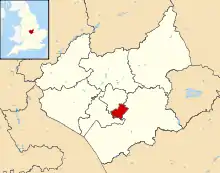 Shown within Leicestershire | |
| Sovereign state | United Kingdom |
| Constituent country | England |
| Region | East Midlands |
| Administrative county | Leicestershire |
| Admin. HQ | Wigston Magna |
| Government | |
| • Type | Oadby and Wigston Borough Council |
| • Leadership: | Alternative - Sec.31 |
| • Executive: | Liberal Democrat |
| • MPs: | Neil O'Brien |
| Area | |
| • Total | 9.08 sq mi (23.53 km2) |
| Area rank | 307th |
| Population (mid-2019 est.) | |
| • Total | 57,015 |
| • Rank | Ranked 306th |
| • Density | 6,300/sq mi (2,400/km2) |
| Time zone | UTC+0 (Greenwich Mean Time) |
| • Summer (DST) | UTC+1 (British Summer Time) |
| ISO 3166-2 | GB-LEC |
| ONS code | 31UJ (ONS) E07000135 (GSS) |
| NUTS 3 | UKF22 |
| Ethnicity | 82.8% White 13.5% S.Asian 1.3% Black British |
| Website | Oadby-Wigston.gov.uk |
Geography
It is composed of the areas of Oadby, Wigston Magna and South Wigston. It is predominantly urban, and runs directly into Leicester, to the north-west. There are no civil parishes in the district.
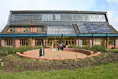
The most northerly corner is near the junction of the A6030 and B582, and near the Bupa hospital it meets Harborough. It runs along the B582 then along the former Roman road (which runs to Corby), passing the playing fields of the University of Leicester. It passes along the north edge of Oadby Lodge, a farm owned by the Co-op. Towards the deserted village of Stretton Magna (outside the district), the boundary passes southwestwards. This area was proposed to be the site of the eco-town Pennbury. It crosses the A6 at Glen Gorse Golf Club. It crosses Newton Lane and the Midland Main Line. It crosses the Grand Union Canal, and towards Kilby it meets the district of Blaby at the River Sence. It follows the River Sence, crossing the A5199 (Welford Road). At Rose Farm it follows Countesthorpe Road towards South Wigston, to the Grand Union Canal, crossing the former Midland Counties Railway, which it follows westwards. It passes northwards across St Thomas Road (B582) and the Birmingham to Peterborough Line. It passes northwards on the east side of the Glen Parva prison (in Blaby district). It meets Leicester UA south of Eyres Monsell, a large housing estate.
.svg.png.webp)
Following the Leicester boundary, it crosses Saffron Road (B5366), then follows Dorset Avenue, follows the Midland Main Line northwards, crossing Aylestone Lane (B5418), then crosses the Midland Main Line. It crosses the Welford Road (A5199) at the point where the road becomes a dual-carriageway south of the Best Western Leicester Stage Hotel (in Leicester UA). It passes on the south edge of Knighton Park, and the western edge of Oadby Golf Club, west of Leicester Racecourse (in the district). Near the racecourse entrance it crosses the A563 southern ring road, then London Road (A6), passing northwards along the western edge of the University of Leicester's Oadby Student Village, west of the University of Leicester Botanic Garden (in the district).
Twinning
Demographics
Although perceived as an affluent area, and much more affluent than neighbouring Leicester, it has the second lowest house prices in Leicestershire, only above Hinckley and Bosworth. Paradoxically it neighbours Harborough, which has the highest house prices in Leicestershire. House prices in Leicestershire are higher in rural areas as demand for these areas is higher; demand often exceeds supply.
Overall, social deprivation is fairly low in the district, and in the lowest half for social deprivation in Leicestershire. The district shows definite features common to areas in the economic south of England. 60% of the district lies in the 20% least-deprived English areas. There are pockets of relative deprivation in Super Output Areas (by highest deprivation) South Wigston Blaby Road & Saffron Road (E01025987), Chartwell Drive Industrial Estate (E01025994), South Wigston Countesthorpe Road (E01025989), Guthlaxton College & Wigston Police (E01025992), Oadby Industrial Estate (E01025976), and Wigston Rolleston Road (E01025997). Social deprivation in the district is highest in the Wigston area, specifically along the B582, in the Wigston Fields, South Wigston and Wigston All Saints wards.
The least deprived Super Output Area is Oadby Woodland Grange Primary School (E01025982), followed by Oadby Glen Road (E01025984).[2][3][4] The least deprived areas are in the far east of the district (Oadby), east of the A6 in the Oadby Woodlands ward near to Great Glen, the closest major village in Harborough district to Oadby and Wigston where the Leicester Urban Area, as presently defined, gives way to the county.
| Population growth in Oadby and Wigston | ||||||||||||
|---|---|---|---|---|---|---|---|---|---|---|---|---|
| Year | 1951 | 1961 | 1971 | 1981 | 1991 | 2001 | 2011 | 2016 | 2021 | 2031 | ||
| Population | 23,943 | 34,206 | 50,253 | 50,014 | 51,542 | 55,773 | 56,170 | 55,800 | 56,500 | 59,700 | ||
| Census [5] | ONS [6] | ONS Projections [7] | ||||||||||
The stabilisation of population levels over recent decades indicates that the borough has a reducing area available for green field development. To meet targets in housing provision, including affordable options, there may be a requirement for new higher density quality developments around the two town centres, for example, and/or on redundant industrial land.
Political control
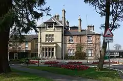
The current composition of the council is as follows:
| Party | Seats [8] | |
|---|---|---|
| Liberal Democrats | 24 | |
| Conservative | 2 | |
The Conservatives held a majority of seats on the council from its creation in 1973 until 1991. The Liberal Democrats first won a majority in 1991 and have retained control since then. The current leader and deputy leader of the council are John Boyce and Michael Charlesworth.
Education
Both Beauchamp College, in the south of Oadby, and Wigston College, on the B582 in Wigston, are former grammar schools. Both are upper schools, as the three tier system operates in the district's schools. Also near the council offices on the B582 is South Leicestershire College, an FE college. Next to the Beauchamp College is the Gartree High School, a middle school. Another school is Manor High School, Oadby, the largest middle school in the country.
References
- "Local Government district population 2011". Neighbourhood Statistics. Office for National Statistics. Retrieved 11 June 2016.
- "Leicestershire County Council - Serving the people of Leicestershire" (PDF). www.leics.gov.uk. Retrieved 22 April 2018.
- "Reports" (PDF). www.lsr-online.org. Retrieved 22 April 2018.
- "Reports" (PDF). www.lsr-online.org. Retrieved 22 April 2018.
- Vision of Britain through time
- mid year estimate
- ONS population projections 2014 base
- https://www.bbc.co.uk/news/topics/c7z584nenw1t/oadby-and-wigston-borough-council
External links
| Wikimedia Commons has media related to Oadby and Wigston. |
