South Derbyshire
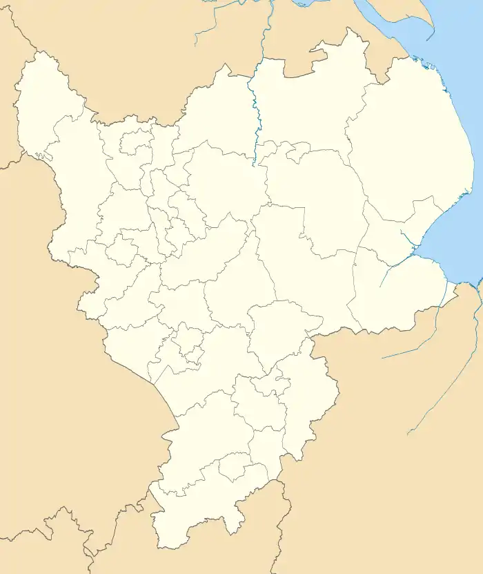
South Derbyshire is a local government district in Derbyshire, England. The population of the local authority at the 2011 Census was 94,611.[2] It contains a third of the National Forest, and the council offices are in Swadlincote.[3]
South Derbyshire District | |
|---|---|
District | |
 Shown within Derbyshire | |
| Sovereign state | United Kingdom |
| Constituent country | England |
| Region | East Midlands |
| Administrative county | Derbyshire |
| Admin. HQ | Swadlincote |
| Government | |
| • Type | South Derbyshire District Council |
| • Leadership: | Alternative - Sec.31 |
| • Executive: | Conservative |
| • MP: | Heather Wheeler |
| Area | |
| • Total | 130.5 sq mi (338.1 km2) |
| Area rank | 122nd |
| Population (mid-2019 est.) | |
| • Total | 107,261 |
| • Rank | Ranked 222nd |
| • Density | 820/sq mi (320/km2) |
| Time zone | UTC+0 (Greenwich Mean Time) |
| • Summer (DST) | UTC+1 (British Summer Time) |
| ONS code | 17UK (ONS) E07000039 (GSS) |
| Ethnicity | 95.6% White 2.3% S.Asian[1] |
| Website | south-derbys.gov.uk |
The district was formed on 1 April 1974 as a merger of the Swadlincote urban district along with Repton Rural District and part of South East Derbyshire Rural District.
Settlements
Settlements in the district include:
- Aston-on-Trent
- Barrow upon Trent, Boulton Moor, Bretby
- Calke, Castle Gresley, Cauldwell, Church Gresley, Church Broughton, Coton in the Elms
- Egginton, Elvaston, Etwall
- Hartshorne, Hatton, Hilton, Hollington
- Ingleby
- Kings Newton
- Linton, Lullington
- Melbourne, Milton
- Netherseal, Newton Solney
- Overseal
- Repton, Rosliston
- Shardlow, Smisby, Stanton by Bridge, Stenson Fields, Swadlincote, Swarkestone
- Ticknall
- Walton-on-Trent, Weston-on-Trent, Willington
Energy policy
In May 2006, a report commissioned by British Gas[4] showed that housing in South Derbyshire produced the 19th highest average carbon emissions in the country at 6,929 kg of carbon dioxide per dwelling. As a way of helping to reduce these emissions, the local councils have since given out leaflets and flyers telling people information about climate change.
Population
Relative to Derbyshire, the East Midlands and England as a whole the population of South Derbyshire is expected to rise by 23% in forecasts from a 2005 population of 88,000 to a 2025 population of 108,600. Swadlincote is anticipated to absorb most of this expansion. No other district in Derbyshire is expected to grow at even half this rate. The figures for the East Midlands as whole over this time range is 10.5% with both Derbyshire and England as a whole being similar but less. Derby is forecast to grow by only 6%.[5]
References
- Check Browser Settings
- "Local Authority populalation 2011". Neighbourhood Statistics. Office for National Statistics. Retrieved 23 March 2016.
- South Derbyshire government site accessed 28 December 2007
- Gas report Archived 26 June 2008 at the Wayback Machine
- Population, Derbyshire County Council, 14 October 2008
External links
| Wikisource has the text of the 1911 Encyclopædia Britannica article Swadlincote. |
| Wikimedia Commons has media related to South Derbyshire. |
- South Derbyshire District Council Official site
- South Derbyshire Citizens Advice Bureau Official site
- South Derbyshire Badgers Official set
Derbyshire Portal | |
| Unitary authorities | |
| Boroughs or districts | |
| Major settlements |
|
| Rivers | |
| Topics | |