Ogema, Minnesota
Ogema is a city in Becker County, Minnesota, United States. The population was 184 at the 2010 census.[6]
Ogema | |
|---|---|
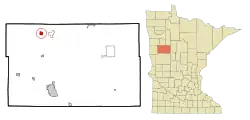 Location of Ogema, Minnesota | |
| Coordinates: 47°6′14″N 95°55′36″W | |
| Country | United States |
| State | Minnesota |
| County | Becker |
| Area | |
| • Total | 1.29 sq mi (3.33 km2) |
| • Land | 1.23 sq mi (3.19 km2) |
| • Water | 0.06 sq mi (0.14 km2) |
| Elevation | 1,270 ft (387 m) |
| Population | |
| • Total | 184 |
| • Estimate (2019)[3] | 185 |
| • Density | 150.41/sq mi (58.05/km2) |
| Time zone | UTC-6 (Central (CST)) |
| • Summer (DST) | UTC-5 (CDT) |
| ZIP code | 56569 |
| Area code(s) | 218 |
| FIPS code | 27-48130[4] |
| GNIS feature ID | 0648899[5] |
Geography
According to the United States Census Bureau, the city has a total area of 1.29 square miles (3.34 km2), of which 1.23 square miles (3.19 km2) is land and 0.06 square miles (0.16 km2) is water.[7]
Demographics
| Historical population | |||
|---|---|---|---|
| Census | Pop. | %± | |
| 1910 | 171 | — | |
| 1920 | 238 | 39.2% | |
| 1930 | 253 | 6.3% | |
| 1940 | 328 | 29.6% | |
| 1950 | 249 | −24.1% | |
| 1960 | 224 | −10.0% | |
| 1970 | 236 | 5.4% | |
| 1980 | 215 | −8.9% | |
| 1990 | 164 | −23.7% | |
| 2000 | 143 | −12.8% | |
| 2010 | 184 | 28.7% | |
| 2019 (est.) | 185 | [3] | 0.5% |
| U.S. Decennial Census[8] | |||
2010 census
As of the census[2] of 2010, there were 184 people, 73 households, and 49 families living in the city. The population density was 149.6 inhabitants per square mile (57.8/km2). There were 84 housing units at an average density of 68.3 per square mile (26.4/km2). The racial makeup of the city was 38.6% White, 46.2% Native American, and 15.2% from two or more races. Hispanic or Latino of any race were 3.3% of the population.
There were 73 households, of which 41.1% had children under the age of 18 living with them, 31.5% were married couples living together, 27.4% had a female householder with no husband present, 8.2% had a male householder with no wife present, and 32.9% were non-families. 28.8% of all households were made up of individuals, and 9.6% had someone living alone who was 65 years of age or older. The average household size was 2.52 and the average family size was 3.04.
The median age in the city was 27.5 years. 37.5% of residents were under the age of 18; 8.2% were between the ages of 18 and 24; 20.6% were from 25 to 44; 22.3% were from 45 to 64; and 11.4% were 65 years of age or older. The gender makeup of the city was 49.5% male and 50.5% female.
2000 census
As of the census[4] of 2000, there were 143 people, 62 households, and 32 families living in the city. The population density was 117.5 people per square mile (45.3/km2). There were 73 housing units at an average density of 60.0 per square mile (23.1/km2). The racial makeup of the city was 60.14% White, 37.06% Native American, 1.40% from other races, and 1.40% from two or more races. Hispanic or Latino of any race were 1.40% of the population.
There were 62 households, out of which 19.4% had children under the age of 18 living with them, 37.1% were married couples living together, 11.3% had a female householder with no husband present, and 46.8% were non-families. 40.3% of all households were made up of individuals, and 25.8% had someone living alone who was 65 years of age or older. The average household size was 2.31 and the average family size was 3.12.
In the city the population was spread out, with 24.5% under the age of 18, 12.6% from 18 to 24, 19.6% from 25 to 44, 22.4% from 45 to 64, and 21.0% who were 65 years of age or older. The median age was 40 years. For every 100 females there were 85.7 males. For every 100 females age 18 and over, there were 80.0 males.
The median income for a household in the city was $27,083, and the median income for a family was $35,208. Males had a median income of $22,813 versus $19,583 for females. The per capita income for the city was $14,622. There were 8.9% of families and 7.8% of the population living below the poverty line, including 10.0% of under eighteens and none of those over 64.
References
- "2019 U.S. Gazetteer Files". United States Census Bureau. Retrieved July 26, 2020.
- "U.S. Census website". United States Census Bureau. Retrieved 2012-11-13.
- "Population and Housing Unit Estimates". United States Census Bureau. May 24, 2020. Retrieved May 27, 2020.
- "U.S. Census website". United States Census Bureau. Retrieved 2008-01-31.
- "US Board on Geographic Names". United States Geological Survey. 2007-10-25. Retrieved 2008-01-31.
- "2010 Census Redistricting Data (Public Law 94-171) Summary File". American FactFinder. U.S. Census Bureau, 2010 Census. Retrieved 23 April 2011.
- "US Gazetteer files 2010". United States Census Bureau. Archived from the original on January 12, 2012. Retrieved 2012-11-13.
- "Census of Population and Housing". Census.gov. Retrieved June 4, 2015.
Municipalities and communities of Becker County, Minnesota, United States | ||
|---|---|---|
| Cities | 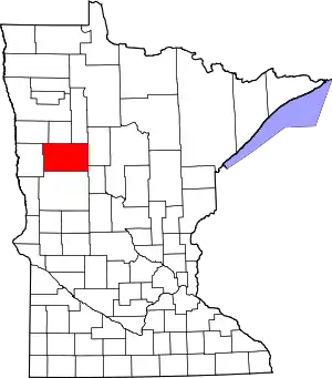 Map of Minnesota highlighting Becker County | |
| Townships |
| |
| CDPs | ||
| Unincorporated communities | ||
| Indian reservations | ||
| Footnotes | ‡This populated place also has portions in an adjacent county or counties | |
| ||