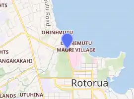
Ohinemutu
Ohinemutu or Ōhinemutu is a suburb in Rotorua, New Zealand. It includes a living Māori village and the original settlement of Rotorua
Ohinemutu | |
|---|---|
Suburb | |
.JPG.webp) St Faiths Anglican Church | |
| |
| Country | New Zealand |
| Local authority | Rotorua |
| Population (2018) | |
| • Total | 1,065 |
| Koutu | Lake Rotorua | (Lake Rotorua) |
| Mangakakahi |
|
Lake Rotorua |
| Utuhina | Victoria | Rotorua Central |
Demographics
| Year | Pop. | ±% p.a. |
|---|---|---|
| 2006 | 927 | — |
| 2013 | 921 | −0.09% |
| 2018 | 1,065 | +2.95% |
| Source: [1] | ||
The statistical area of Kuirau, which corresponds to Ohinemutu, had a population of 1,065 at the 2018 New Zealand census, an increase of 144 people (15.6%) since the 2013 census, and an increase of 138 people (14.9%) since the 2006 census. There were 378 households. There were 552 males and 516 females, giving a sex ratio of 1.07 males per female. The median age was 33.9 years (compared with 37.4 years nationally), with 210 people (19.7%) aged under 15 years, 261 (24.5%) aged 15 to 29, 462 (43.4%) aged 30 to 64, and 135 (12.7%) aged 65 or older.
Ethnicities were 35.8% European/Pākehā, 62.8% Māori, 6.5% Pacific peoples, 15.5% Asian, and 2.3% other ethnicities (totals add to more than 100% since people could identify with multiple ethnicities).
The proportion of people born overseas was 19.4%, compared with 27.1% nationally.
Although some people objected to giving their religion, 39.4% had no religion, 38.6% were Christian, 3.1% were Hindu, 0.6% were Muslim, 0.8% were Buddhist and 11.0% had other religions.
Of those at least 15 years old, 174 (20.4%) people had a bachelor or higher degree, and 141 (16.5%) people had no formal qualifications. The median income was $20,800, compared with $31,800 nationally. The employment status of those at least 15 was that 357 (41.8%) people were employed full-time, 126 (14.7%) were part-time, and 87 (10.2%) were unemployed.[1]
Marae

The area has four marae:
- Te Kuirau or Utuhina Marae and Te Roro o Te Rangi meeting house is a meeting place of the Ngāti Whakaue hapū of Ngāti te Roro o te Rangi.
- Te Papaiouru Marae and Tamatekapua meeting house is a meeting place of the Ngāti Whakaue hapū of Ngāti Hurunga Te Rangi, Ngāti Pūkaki, Ngāti Taeotu, Ngāti Te Rangiwaho, Ngāti te Roro o te Rangi and Ngāti Tūnohopū.
- Para te Hoata or Tūnohopū Marae and Tūnohopū meeting house is a meeting place of the Ngāti Whakaue hapū of Ngāti Tūnohopū and Ngāti Whakaue.
- Waikite Marae and Tiki meeting house is a meeting place of the Ngāti Whakaue hapū of Ngāti Whakaue.[2][3]
Notable people
References
- "Statistical area 1 dataset for 2018 Census". Statistics New Zealand. March 2020. Kuirau (199800). 2018 Census place summary: Kuirau
- "Te Kāhui Māngai directory". tkm.govt.nz. Te Puni Kōkiri.
- "Māori Maps". maorimaps.com. Te Potiki National Trust.
