Victoria, Bay of Plenty
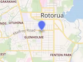
Victoria is a suburb of Rotorua in the Bay of Plenty Region of New Zealand's North Island.
Victoria | |
|---|---|
Suburb | |
| |
| Country | New Zealand |
| Local authority | Rotorua Lakes |
| Electoral ward | East |
| Population (2018)[1] | |
| • Total | 2,094 |
| Ohinemutu | Rotorua Central | |
| Utuhina |
|
Ngāpuna |
| Hillcrest | Glenholme | Fenton Park |
Demographics
| Year | Pop. | ±% p.a. |
|---|---|---|
| 2006 | 1,638 | — |
| 2013 | 1,752 | +0.97% |
| 2018 | 2,094 | +3.63% |
| Source: [1] | ||
Victoria had a population of 2,094 at the 2018 New Zealand census, an increase of 342 people (19.5%) since the 2013 census, and an increase of 456 people (27.8%) since the 2006 census. There were 894 households. There were 1,032 males and 1,062 females, giving a sex ratio of 0.97 males per female. The median age was 32.9 years (compared with 37.4 years nationally), with 312 people (14.9%) aged under 15 years, 573 (27.4%) aged 15 to 29, 936 (44.7%) aged 30 to 64, and 273 (13.0%) aged 65 or older.
Ethnicities were 37.4% European/Pākehā, 26.6% Māori, 5.4% Pacific peoples, 41.1% Asian, and 1.7% other ethnicities (totals add to more than 100% since people could identify with multiple ethnicities).
The proportion of people born overseas was 45.1%, compared with 27.1% nationally.
Although some people objected to giving their religion, 30.1% had no religion, 38.7% were Christian, 10.6% were Hindu, 1.9% were Muslim, 2.3% were Buddhist and 11.9% had other religions.
Of those at least 15 years old, 465 (26.1%) people had a bachelor or higher degree, and 279 (15.7%) people had no formal qualifications. The median income was $22,800, compared with $31,800 nationally. The employment status of those at least 15 was that 843 (47.3%) people were employed full-time, 285 (16.0%) were part-time, and 123 (6.9%) were unemployed.[1]
Education
Rotorua Intermediate is a co-educational state intermediate school,[2][3] with a roll of 697 as of March 2020.[4]
Notable locations
References
- "Statistical area 1 dataset for 2018 Census". Statistics New Zealand. March 2020. Victoria (200300). 2018 Census place summary: Victoria
- "Official School Website". rotorua-intermediate.org.nz.
- "Ministry of Education School Profile". educationcounts.govt.nz. Ministry of Education.
- "Education Review Office Report". ero.govt.nz. Education Review Office.
- "Robertson House". Register of Historic Places. Heritage New Zealand. Retrieved 24 December 2020.
- "The History of Robertson House". Robertson House B&B. Retrieved 24 December 2020.
