Okanagan Falls
Okanagan Falls (also known as OK Falls) is a community located on the south end of Skaha Lake in British Columbia.[1][2]
Okanagan Falls | |
|---|---|
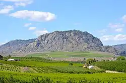 Rolling hills of Okanagan Falls with Peach Cliff in the distance | |
| Nickname(s): OK Falls | |
 Okanagan Falls Location of Okanagan Falls in British Columbia | |
| Coordinates: 49°21′00″N 119°34′00″W | |
| Country | |
| Province | |
| Area code(s) | 250, 778 |
History
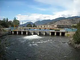
The community was founded in 1893 as Dogtown, which was derived from the name Dog Lake ("skaha" means "dog" in the Okanagan language). The current name derives from a small set of the falls that used to lie on the Okanagan River at the outlet of Skaha Lake. The falls have since been submerged beneath the lake due to the construction of a dam on the river.[3][4]
In 2012, Okanagan Falls expressed interest in incorporating as a municipality.[5]
Geological features
Nestled at the head of a giant spillway formed as the discharge of Glacial Lake Penticton was constrained between Mount McLellan to the west and Peach Cliff to the east. Okanagan Falls has a diverse assemblage of geological attractions.[6]
Peach Cliff
Peach Cliff is a dominant landmark to the east of Okanagan Falls. It consists of trachyte of Eocene age. Peach Cliff is home to herds of mule deer and a sizeable herd of California bighorn sheep. Perched high on a spur of Peach Cliff is Balancing Rock, a large glacial erratic supported by a couple of granitic cobbles.[7]
Indian Head
Southwest of Okanagan Falls, are the ragged cliffs of Indian Head, one of the most unusual rock formations in the Okanagan. Consisting of dark volcanic rocks overlying a lighter conglomerate. This formation contains spectacular megabreccia, volcanic and plutonic rocks up to 70 m (230 ft) across and metamorphic rocks of up to 500 m (1,600 ft) across.[8]
Mahoney Lake
South of Okanagan Falls lies meromictic Mahoney Lake, home to spectacular blooms of purple sulphur bacteria. This purple is contrasted by nearby Green Lake, which is coloured by the precipitation of calcium carbonates in the water column.[9]
Tourism
The Dominion Radio Astrophysical Observatory is a research facility founded in 1960 and located southwest of Okanagan Falls and Penticton.
The site houses three instruments – an interferometric radio telescope, a 26 m (85 ft) single-dish antenna, and a solar flux monitor – and supports engineering laboratories. The DRAO is operated by the Herzberg Institute of Astrophysics of the National Research Council of the Canadian government.
The observatory was named an IEEE Milestone for first radio astronomical observations using VLBI. There is a self-guided tour available at the facility during daylight hours.
Parks
Christie Memorial Provincial Park is located on the south shoreline of Skaha Lake. Okanagan Falls Provincial Park is also nearby.
References
- "Okanagan Falls". BC Geographical Names.
- "Dogtown". BC Geographical Names.
- "Okanagan Falls (falls)". BC Geographical Names.
- "Okanagan Falls Park". BC Geographical Names.
- Fries, Joe (September 11, 2012). "Ok Falls still looking at incorporation". Penticton Western News. Retrieved May 5, 2013.
- Okanagan Geology South. Okanagan Geology Committee. 2011. p. 92. ISBN 978-0-9699795-3-1.
- Okanagan Geology South. Okanagan Geology Committee. 2011. p. 96. ISBN 978-0-9699795-3-1.
- Okanagan Geology South. Okanagan Geology Committee. 2011. pp. 90–91. ISBN 978-0-9699795-3-1.
- Okanagan Geology South. Okanagan Geology Committee. 2011. p. 105. ISBN 978-0-9699795-3-1.
| Wikivoyage has a travel guide for Okanagan Falls. |
| Subdivisions | 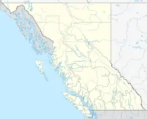 | |
|---|---|---|
| Communities | ||
| Metro areas and agglomerations | ||
| ||
Municipalities and communities of Okanagan, British Columbia, Canada | ||
|---|---|---|
| Cities |  | |
| Towns | ||
| Districts | ||
| Villages | ||
| Designated places |
| |
| Unincorporated communities | ||
| Indian reserves | ||
| Ghost towns | ||
| Footnotes | ‡This populated place also has portions in an adjacent region | |