Onemana
Onemana is a 1970s beach village on the eastern side of the Coromandel Peninsula of New Zealand, with a beach, a surf club,[1] fire station[2] and dairy.[3] It lies 3 km (1.9 mi) to the east of State Highway 25,[4] south of Pauanui and north of Whangamata. The Wharekawa River and Opoutere are just to the north and west.[5]
Onemana | |
|---|---|
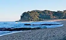
 Onemana village from the beach in 2021 | |
 Onemana | |
| Coordinates: 37.15177°S 175.87754°E | |
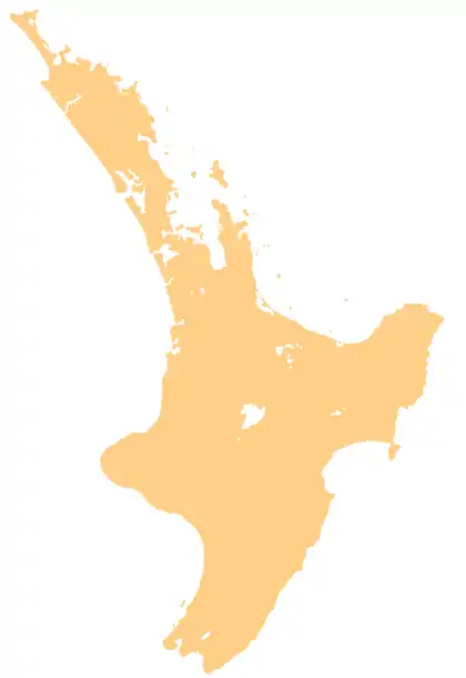
| Country | New Zealand |
| Region | Waikato |
| District | Thames-Coromandel District |
History
The area was originally named Whitipirorua by Māori.[6] The first known settlers of the area were the Ngāti Hei. They were supplanted by Ngāti Hako in the mid 17th century, but Ngā Puhi raids during the Musket Wars of the early 19th century left the area without a permanent population.[7] By a variety of means the land was acquired by the government and sold to settlers.[8] Archaeological evidence suggests that the area was first settled in the 1300s, with a pā located at the south of Onemana Beach.[9] The area was important for the production of stone tools made of matā (chert) and matā tūhua (obsidian).[9]
The 364 section subdivision was created in the 1970s on the Bambury family's Shang-ri-la farm.[10] Much of the archaeological site was destroyed to make way for the subdivision.[9] The name Onemana was adopted for the subdivision, however the name has no traditional relationship with the area.[6]
Demographics
Onemana is in meshblocks 1060413 to 1060419.[11] The permanent population of 116[12] often exceeds 3,000 during the summer peak.[13]
Infrastructure
A 110 m (360 ft) deep groundwater bore into rhyolite provides water for the village,[14] which used 5,370,000 litres (1,180,000 imp gal; 1,420,000 US gal) in the peak 2 weeks of 2014/2015.[15] The sewage plant handles up to 196 m3 (43,000 imp gal) a day, which is disposed of to landfill.[16] Heavy overnight rain from Cyclone Wilma in March 2017 damaged 2 houses with slips and caused wastewater overflows.[17] Onemana sewage plant resource consent renewal was scheduled for 2019/2020.[18] Two accessible toilets, a shelter and community notice board were funded by the Tourism Infrastructure Fund in 2019.[19]
Surfing
Onemana has several surfing peaks along the beach with both right and left handed breaks. The seabed is a mix of sand and rocky reef; and a stream discharges centrally to the bay. A right hand break is sometimes off the southern point through to the beach.[20]
See also
Neighbouring areas | |
|---|---|
Notes
- "Onemana Surf Lifesaving Club - Building Project". www.onemanaslsc.org.nz. Retrieved 2021-01-03.
- "ONEMANA RURAL FIRE FORCE - STATION 79". www.111emergency.co.nz. Retrieved 2021-01-03.
- "Onemana Dairy". Google maps. Retrieved 2021-01-03.
- "Onemana New Zealand". Retrieved 2021-01-02.
- "Onemana, Waikato". NZ Topo Map. Retrieved 2021-01-02.
- Furey, Louise (1990). "THE ARTEFACT COLLECTION FROM WHITIPIRORUA (T12/16), COROMANDEL PENINSULA". Records of the Auckland Institute and Museum. 27: 19–60. ISSN 0067-0464.
|access-date=requires|url=(help) - King, p. 128.
- "The Hauraki report" (PDF). Waitangi Tribunal. 2006.
- Furey, Louise (1991). "EXCAVATIONS AT WHITIPIRORUA, T12/16, COROMANDEL PENINSULA". Records of the Auckland Institute and Museum. 28: 1–32. ISSN 0067-0464.
|access-date=requires|url=(help) - "Our History – Onemana New Zealand". Retrieved 2021-01-02.
- "ArcGIS Web Application". statsnz.maps.arcgis.com. Retrieved 2021-01-03.
- "Zones for a Supply". www.drinkingwater.org.nz. Retrieved 2021-01-03.
- "2016/17 Peak Population Report" (PDF). Thames-Coromandel District Council.
- John Hadfield & Debbie Nicole (29 Aug 2000). "Community Groundwater Supply Source Protection" (PDF). Waikato Regional Council.
- "Thames-Coromandel District Council - Water figures show a busier Coromandel east coast". www.tcdc.govt.nz. Retrieved 2021-01-02.
- "New Zealand Wastewater Treatment Plant". 2018.
- "Thames-Coromandel District Council - Storm causes wastewater overflows". www.tcdc.govt.nz. Retrieved 2021-01-02.
- "Thames-Coromandel District Council - Whangamata Ward Highlights". www.tcdc.govt.nz. Retrieved 2021-01-02.
- "Thames-Coromandel District Council - Works around the wards update". www.tcdc.govt.nz. Retrieved 2021-01-02.
- Ed Atkin and Shaw Mead (Jun 2016). "Surf breaks of regional significance in the Waikato region" (PDF).
