Orakei
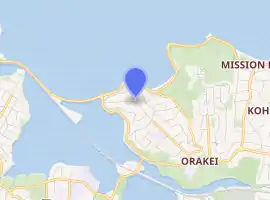
Orakei (Māori: Ōrākei) is a suburb of Auckland city, in the North Island of New Zealand. It is located on a peninsula five kilometres to the east of the city centre, on the shore of the Waitematā Harbour, which lies to the north, and Hobson Bay and Orakei Basin, two arms of the Waitematā, which lie to the west and south. To the east is the suburb of Mission Bay. The mouth of the Waitematā is to the immediate north of Orakei, lying between Bastion Point, in Orakei, and North Head, in Devonport on the North Shore.
Orakei | |
|---|---|
Suburb | |
 View of Hobson Bay looking northwards with Orakei visible in the far right distance, under Rangitoto Island | |
| |
| Country | New Zealand |
| Local authority | Auckland Council |
| Electoral ward | Ōrākei |
| Local board | Ōrākei |
| Population (2018) | |
| • Total | 5,625 |
| Train station(s) | Orakei Train Station |
| (Waitematā Harbour) | (Hauraki Gulf) | Mission Bay |
| Parnell |
|
Mission Bay |
| Remuera | Remuera | Kohimarama, Meadowbank |
The New Zealand Ministry for Culture and Heritage gives a translation of "place of adornment" for Ōrākei.[1]
The suburb achieved national attention in 1977 when Māori protestors occupied vacant land at Bastion Point. Land which had formerly belonged to the Ngāti Whātua iwi had been acquired cheaply for public works many decades before, and members of the tribe occupied the land demanding its return. The site was largely returned to the iwi after a long and not entirely bloodless occupation.
Orakei is home to some of Auckland's most expensive real estate. Paritai Drive in Orakei is generally regarded as the most expensive street in Auckland, and most probably New Zealand. House prices on this street start at $3m and range to $12m. The local secondary school is Selwyn College.
Bastion Point is the location of the Savage Memorial, the tomb and memorial garden for Michael Joseph Savage, the first Labour Party prime minister of New Zealand and one of the country's most popular prime ministers, who died in office in 1940. This magnificent Art Deco ensemble by Tibor Donner and Anthony Bartlett was officially opened in March 1943 and affords remarkable views of the Waitemata Harbour.
Demographics
| Year | Pop. | ±% p.a. |
|---|---|---|
| 2006 | 5,352 | — |
| 2013 | 5,475 | +0.33% |
| 2018 | 5,625 | +0.54% |
| Source: [2] | ||
Orakei, comprising the statistical areas of Orakei West and Orakei East, had a population of 5,625 at the 2018 New Zealand census, an increase of 150 people (2.7%) since the 2013 census, and an increase of 273 people (5.1%) since the 2006 census. There were 2,073 households. There were 2,676 males and 2,946 females, giving a sex ratio of 0.91 males per female, with 909 people (16.2%) aged under 15 years, 1,089 (19.4%) aged 15 to 29, 2,673 (47.5%) aged 30 to 64, and 954 (17.0%) aged 65 or older.
Ethnicities were 70.3% European/Pākehā, 18.8% Māori, 6.9% Pacific peoples, 13.9% Asian, and 3.6% other ethnicities (totals add to more than 100% since people could identify with multiple ethnicities).
The proportion of people born overseas was 30.4%, compared with 27.1% nationally.
Although some people objected to giving their religion, 45.9% had no religion, 37.8% were Christian, and 10.4% had other religions.
Of those at least 15 years old, 1,890 (40.1%) people had a bachelor or higher degree, and 450 (9.5%) people had no formal qualifications. The employment status of those at least 15 was that 2,394 (50.8%) people were employed full-time, 663 (14.1%) were part-time, and 189 (4.0%) were unemployed.[2]
Education
Orakei School is a full primary school (years 1–8) with a roll of 384.[3]
St Joseph's School is a state-integrated Catholic full primary school (years 1–8) with a roll of 77.[4]
Both schools are coeducational. Rolls are as of March 2020.[5]
Marae
Ōrākei Marae and its Tumutumuwhenua meeting house is a traditional tribal meeting ground for the iwi of Ngāti Whātua and Ngāti Whātua o Ōrākei, and their hapū of Ngā Oho, Te Taoū and Te Uri.[6][7]
See also
References
- "1000 Māori place names". New Zealand Ministry for Culture and Heritage. 6 August 2019.
- "Statistical area 1 dataset for 2018 Census". Statistics New Zealand. March 2020. Orakei West (139200) and Orakei East (140100). 2018 Census place summary: Orakei West 2018 Census place summary: Orakei East
- Education Counts: Orakei School
- Education Counts: St Joseph's School
- "New Zealand Schools Directory". New Zealand Ministry of Education. Retrieved 26 April 2020.
- "Te Kāhui Māngai directory". tkm.govt.nz. Te Puni Kōkiri.
- "Māori Maps". maorimaps.com. Te Potiki National Trust.
- Colonial Architecture in New Zealand. John Stacpoole. A.H & A.W Reed 1976
- Decently And in Order, The Centennial History of the Auckland City Council. G.W.A Bush. Collins 1971.
External links
- Photographs of Orakei held in Auckland Libraries' heritage collections.