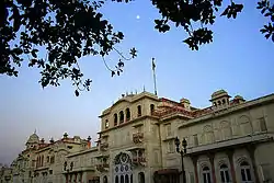
Patiala State
Patiala State was a self-governing princely state of the British Empire in India, and one of the Phulkian States, that acceded to the Union of India upon Indian independence and partition.
| 1763–1947 | |||||||||||
 Coat of arms
| |||||||||||
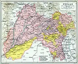 Patiala and other princely states in the Punjab (shown in yellow) in Imperial Gazetteer of India (1909).[1] | |||||||||||
| Capital | Patiala | ||||||||||
| Common languages | Punjabi (official) Gurmukhi (common) | ||||||||||
| Religion | Sikh | ||||||||||
| Government | Absolute monarchy (1763 - 1947) | ||||||||||
| Maharaja | |||||||||||
• 1707 - 1765 | Ala Singh | ||||||||||
• 1938 - 1947 | Yadavindra Singh | ||||||||||
| History | |||||||||||
• Established | 1763 | ||||||||||
• Disestablished | 1947 | ||||||||||
| Area | |||||||||||
| 1881[2] | 15,247 km2 (5,887 sq mi) | ||||||||||
| Population | |||||||||||
• 1881[2] | 1,467,433 | ||||||||||
• 1891[2] | 1,583,521 | ||||||||||
• 1901[2] | 1,596,692 | ||||||||||
| Currency | Rupee And Paisa | ||||||||||
| |||||||||||
| Today part of | India Pakistan | ||||||||||

Etymology
The state's name came from the name of its principal city and capital, Patiala, which itself comes from the roots pati and ala. The former is Urdu for a "strip of land" and 'ala' comes from the name of the founder of the city and Patiala state, Ala Singh, thus meaning ‘the land of Ala Singh’.[3]
Geography
In British India, Patiala State's territory was interspersed with small tracts or even single villages belonging to Nabha State, Jind State, and Malerkotla State, and to the British-ruled districts of Ludhiana, Ferozepore (Firozpur), and Karnal. It included several detached villages that lay within the natural borders of those states and districts.[4] It had the largest population of the princely states in Punjab Province, and was the second-largest in terms of area.[4]
According to the 1901 Indian census report, Patiala State had an area of 5,412 square miles (14,017 km2), but the total of the district areas given in revenue returns was 5,887 square miles (15,247 km2).[2] The state was divided into five nizamats (administrative districts).[2] As of 1901, there were fourteen towns which at the time were called: Patiala, Narnaul, Basi, Givindgarh (or Bhatinda), Samana, Sunam, Mohindargarh (or Kanaud), Sanaur, Bhadaur, Barnala, Banur, Pail, Sirhind, and Hadiaya.[2]
At the time of the 1881 Indian census, the population of Patiala State was: 1,467,433 (males 806,984, females 660,449).[5] The sex ratio was therefore 818 females per 1,000 males. The census showed that there were 328,668 families (i.e. 4.5 people per family),[5] and 282,063 houses.[5]
| Nizamat (district)[2] |
Area | Towns | Villages | Population in 1901 | Number of people able to read and write | |
|---|---|---|---|---|---|---|
| sq mile | sq km | |||||
| Karmgarh | 1,834 | 4,750 | 4 | 665 | 500,635 | 15,370 |
| Pinjaur | 784 | 2,031 | 1 | 1,588 | 212,866 | 3,695 |
| Amargarh | 858 | 2,222 | 3 | 605 | 365,448 | 7,596 |
| Anahadgarh | 1,836 | 4,755 | 4 | 454 | 377,367 | 8,899 |
| Mohindargarh | 575 | 1,489 | 2 | 268 | 140,376 | 2,537 |
| Total | 5,887 | 15,247 | 14 | 3,580 | 1,596,692 | 38,097 |
| Nizamat (district) |
Area in 1903-04[2] | |||
|---|---|---|---|---|
| Total | Cultivated | Irrigated | Cultivable waste | |
| Karmgarh | 1,834 sq mi (4,750 km2) |
1,338 sq mi (3,465 km2) |
368 sq mi (953 km2) |
386 sq mi (1,000 km2) |
| Pinjaur | 784 sq mi (2,031 km2) |
467 sq mi (1,210 km2) |
143 sq mi (370 km2) |
217 sq mi (562 km2) |
| Amargarh | 858 sq mi (2,222 km2) |
672 sq mi (1,740 km2) |
243 sq mi (629 km2) |
128 sq mi (332 km2) |
| Anahadgarh | 1,836 sq mi (4,755 km2) |
1,661 sq mi (4,302 km2) |
465 sq mi (1,204 km2) |
96 sq mi (249 km2) |
| Mohindargarh | 575 sq mi (1,489 km2) |
445 sq mi (1,153 km2) |
38 sq mi (98 km2) |
49 sq mi (127 km2) |
| Total | 5,887 sq mi (15,247 km2) |
4,583 sq mi (11,870 km2) |
1,257 sq mi (3,256 km2) |
876 sq mi (2,269 km2) |
| The column marked "Cultivated" includes both irrigated and non-irrigated land. "Cultivable waste" is land that could be cultivated, that has not been cultivated in the last five years | ||||
"Of the total area under cultivation in 1903–4, 1,257 square miles, or 27 per cent, were classed as irrigated. Of this are, 342 square miles, or 27 per cent, were irrigated from wells, and the rest from canals."[6]
Brief history
Part of a series on the |
|---|
| History of India |
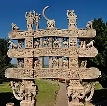 Satavahana gateway at Sanchi, 1st century CE |
Early history
The history of Patiala state starts off with the ancestor of the Sikh Patiala Royal House, Mohan Singh being harassed by neighbouring Bhullar and Dhaliwal farmers . They would not allow Mohan to settle there. He was a follower of Guru Hargobind Sahib and the Guru appealed on behalf of Mohan but to no avail. The result was an armed struggle and the Bhullars and Dhaliwals were defeated by the Guru's men, which allowed Mohan to establish the Village of Meharaj in 1627.[7] Mohan Singh fought against the Mughals at the Battle of Mehraj 1631 on the side of Guru Hargobind Sahib. Mohan Singh and his eldest son Rup Chand were later killed in a fight against the Bhatti's (a tribe who also claim to be the descendants of Rawal Jaisal of Jaisalmer, but also an enemy of the Phulkians). Kala, Mohan's younger son succeeded the "chaudriyat", and was guardian to Rup Chand's sons Phul and Sandali. When Kala Sidhu died, Phul formed his own village (Phul), five miles from Meharaj (under the blessings of Sikh Guru's) in 1663. Nabha and Jind trace their ancestry to the devout Sikh Phul. It was one of the first Sikh Kingdoms of Punjab to be formed. Apparently the appellation of dynasty "Phulkian" is derived from their common founder. One of his sons, Chota Ram, was baptised and blessed by Guru Gobind Singh. His son Ala Singh assumed the leadership in 1714 when Banda Bahadur was engaged in the fierce battle against the Mughals. A man with vision and courage, Ala Singh's general, Gurbaksh Singh Kaleka, carved out an independent principality from a Zamindari of 30 villages. Under his successors, it expanded into a large state, touching the Shivaliks in north, Rajasthan in the south and upper courses of the Yamuna and Sutlej rivers while confronting the most trying and challenging circumstances.
Ala Singh
In the middle of the eighteenth century, Ala Singh, unlike many of his contemporaries, displayed tremendous shrewdness in dealing with the Marathas and Afghans, and successfully established a state which he had started building up from its nucleus Barnala. He became traitor to the Sikhs, who made him a Sardar from a peasant and fought on the side of Ahmad Shah Durrani against the Sikhs. After the Third Battle of Panipat in 1761 in which the Marathas were defeated, the writ of the Afghans prevailed throughout Punjab. Ahmad Shah Durrani gave Ala Singh the title of maharaja.[8]
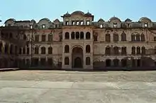
In 1763, the Sikh confederation captured the fortress of Sirhind from Ahmad Shah Durrani's governor. As a result, the former-Mughal province of Sirhind was partitioned and in Ala Singh took possession of Sirhind itself and the surrounding country. This was later regarded as the beginning of Patiala State.[8] In 1763, Ala Singh laid the foundation of the Patiala fort known as Qila Mubarak, around which the present city of Patiala developed. Ala Singh died in 1765, and was succeeded by his grandson Amar Singh.[8]
Treaty with the British
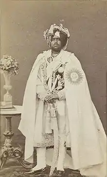
After forty years of ceaseless struggle with the Marathas and Afghans, the borders of the Patiala state witnessed the blazing trails of Ranjit Singh in the north and of the British in the east. Bestowed with the grit and instinct of survival, making self-preservation a priority the Raja of Patiala entered into a treaty with the British against Ranjit Singh in 1808, thus becoming collaborators in the empire building process of the British in the sub-continent of India. The subsequent rulers of Patiala, such as Karam Singh, Narinder Singh, Mahendra Singh, Rajinder Singh, Bhupinder Singh, and Yadvindra Singh were parties to a subsidiary alliance and were heavily influenced by the British, but retained the internal government of their state.
Maharaja Bhupinder Singh
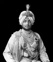
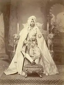
Maharaja Bhupinder Singh, who reigned from 1900 to 1938, gave Patiala a prominent place on the political map of India and also in the field of international sports. In the game of Polo, Patiala had the World's best Polo Back, General Chanda Singh, who later went on to play for England and Spain on the requests of King Edward VII and King Alfonso of Spain, winning both Kings a prestigious Polo Cup. The Maharaja was also fond of dogs, and he and the Maharaja Ranbir Singh of Jind were equally interested in a range of dog breeds. His son Maharaja Yadavindra Singh was the first Indian prince to sign the Instrument of Accession to the new Union of India, thus facilitating the process of national integration after the Partition of India and the departure of the British in August 1947. In recognition of his services, he was appointed as Rajpramukh of the newly established Patiala and East Punjab States Union (PEPSU), from its founding in 1948 until its merger with the Punjab Province in 1956. The downtown area of Patiala is called Adalat Bazaar, which means 'the court corridor', because this was used as the administrative building by one of the caretaker rulers, before Maharaja Bhupinder Singh had reached the age of majority. Rajmata Mohinder Kaur was the oldest member of the family till 2017, and the present head is Amarinder Singh, current chief minister of Punjab.
Rulers
The rulers of Patiala bore the title 'Maharaja-e Rajgan' from 1810 onward.[9]
Maharajas
- 29 Mar 1761 – 22 August 1765: Ala Singh (b. 1691 – d. 1765)
- 22 Aug 1765 – 1767: Amar Singh (b. 1748 – d. 1781)
Raja-e Rajgan
- 1767 – 5 February 1781: Amar Singh (s.a.)
- Feb 1781 – 1810: Sahib Singh (b. 1774 – d. 1813)
Maharaja-e Rajgan
- 1810 – 26 March 1813: Sahib Singh (s. a.)
- 26 Mar 1813 – 23 December 1845: Karam Singh (b. 1797 – d. 1845)
- 26 Mar 1813 – 1823: Maharani Aus Kaur (f) – Regent (b. 1772 – d. af.1823)
- 23 Dec 1845 – 13 November 1862: Narendra Singh (b. 1823 – d. 1862) (from 25 June 1861 Sir Narendra Singh)
- 13 Nov 1862 – 14 April 1876: Mahendra Singh (b. 1852 – d. 1876) (from 28 May 1870 Sir Mahendra Singh)
- 13 Nov 1862 – 26 February 1870: Jagdish Singh (Regent, chairman of regency council)
- 14 Apr 1876 – 9 November 1900: Rajinder Singh (b. 1872 – d. 1900) (from 21 May 1898 Sir Rajendra Singh)
- 14 April 1876 – Oct 1890: Sir Deva Singh (Regent) (b. 1834 – d. 1890) (chairman of regency council)
- 9 November 1900 – 23 March 1938: Bhupinder Singh (b. 1891 – d. 1938) (from 12 December 1911 Sir Bhupindra Singh)
- 9 November 1900 – 3 November 1910: Sardar Gurmukh Singh – (Regent, chairman of regency council)
- 23 Mar 1938 – 15 August 1947: Yadavindra Singh (b. 1913 – d. 1974) (from 1 January 1942 Sir Yadavindra Singh)
References
- Imperial gazetteer of India. XXVI Atlas. 1909. p. plate 32.
- Imperial gazetteer of India. XX Pardi to Pusad. 1908. pp. 40, 42.
- "The History of Patiala | Patiala". www.totalpunjab.com. Retrieved 24 March 2020.
- Imperial gazetteer of India. XX Pardi to Pusad. Oxford, Clarendon Press. 1908. p. 31.
- Hunter, William Wilson (1886). The Imperial Gazetteer of India. XI Pali to Ratia. p. 87.
- Imperial gazetteer of India. XX Pardi to Pusad. Oxford, Clarendon Press. 1908. p. 43.
- A History of Sikh Misals, Dr Bhagat Singh
- Imperial gazetteer of India. XX Pardi to Pusad. 1908. p. 34.
- Princely states of India
Sources
- Hunter, William Wilson (1886). The Imperial Gazetteer of India. XI Pali to Ratia. Tübner. pp. 87–90.
- Imperial gazetteer of India. XX Pardi to Pusad. Oxford, Clarendon Press. 1908. pp. 31–50.
- Chavan, Akshay (15 February 2019), "Hitler's Gift to The Maharaja of Patiala", Live History India
- "The Princely State of Patiala", Sikh Heritage
- Dhavan, Purnima (2011). When Sparrows Became Hawks: The Making of the Sikh Warrior Tradition, 1699-1799. Oxford University Press (US). ISBN 978-0199756551.
- Priscoli, Jerome Delli; Wolf, Aaron T. (2010). Managing and Transforming Water Conflicts. Cambridge University Press. ISBN 978-0521632164.