Peerie Bard
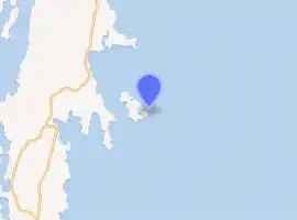
Perie Bard is one of the Shetland Islands. It is a small islet off the east coast of the island of Mousa.[2]
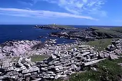
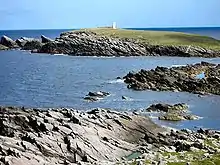
The east coast of Mousa towards the Peerie Bard.
 Eastern tip of Mousa | |
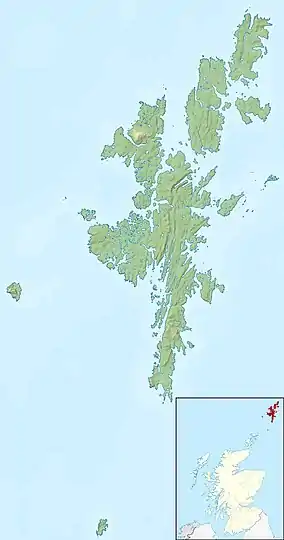 Shetland | |
| |
| Location | Peerie Bard Mousa Shetland Scotland United Kingdom |
|---|---|
| Coordinates | 59.997108°N 1.157808°W |
| Year first constructed | 1951 (first) |
| Year first lit | 2000 (current) |
| Automated | 2000 |
| Deactivated | 2000 (first) |
| Foundation | concrete base |
| Construction | metal skeletal tower |
| Tower shape | quadrangular tower covered by aluminium panels with light on the top |
| Markings / pattern | white tower |
| Tower height | 6 metres (20 ft) |
| Focal height | 20 metres (66 ft) |
| Light source | solar power |
| Characteristic | Fl W 3s. |
| Admiralty number | A3772 |
| NGA number | 3324 |
| ARLHS number | SCO-138 |
| Managing agent | Mousa Nature Reserve[1] |
Although named 'Perie Bard' on OS Maps, the name used in Shetland is "Peerie Bard".
The name is derived from the Shetland dialect words 'Peerie', meaning small, and 'Bard', meaning steep headland. The Muckle Bard, or large steep headland, is located on neighbouring Mousa.
The Mousa Lighthouse is located on the Peerie Bard. The lighthouse was first lit in 1951 and replaced one which had previously been located on the nearby headland of Noness
References
- Mousa The Lighthouse Directory. University of North Carolina at Chapel Hill. Retrieved 31 May 2016
- Haswell-Smith, Hamish (2004). The Scottish Islands. Edinburgh: Canongate. ISBN 978-1-84195-454-7.
This article is issued from Wikipedia. The text is licensed under Creative Commons - Attribution - Sharealike. Additional terms may apply for the media files.