Fidra
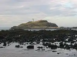
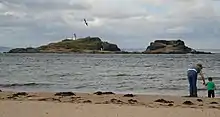
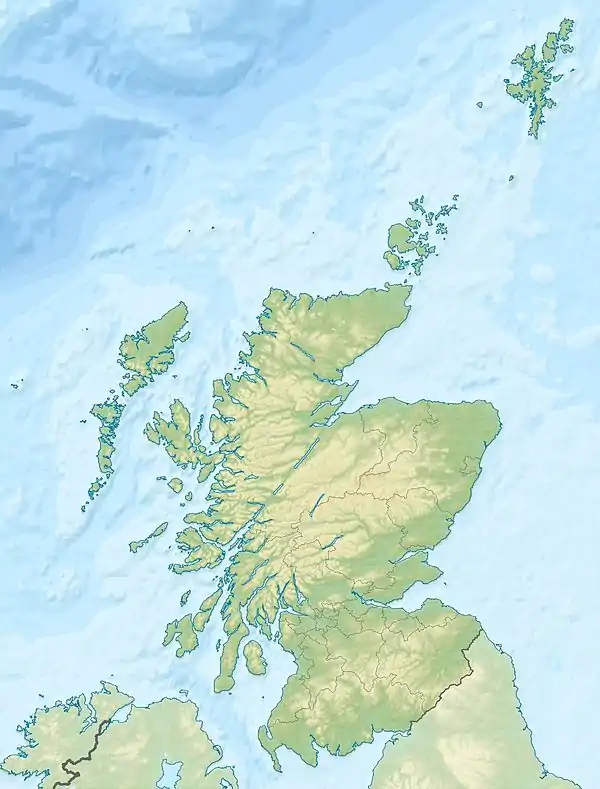
Fidra (archaically Fidrey[5] or Fetheray[6]) is an uninhabited island in the Firth of Forth, 4 km (2.5 mi) north-west of North Berwick, on the east coast of Scotland. The island is an RSPB Scotland nature reserve.
| Scottish Gaelic name | Fiodra |
|---|---|
| Old Norse name | Fiðrey |
| Meaning of name | Norse for "feather island"[1] |
 Fidra | |
| Location | |
 Fidra Fidra shown within Scotland | |
| OS grid reference | NT5186 |
| Coordinates | 56.07°N 2.78°W |
| Physical geography | |
| Island group | Islands of the Forth |
| Area | c. 10 ha (25 acres) |
| Highest elevation | c. 20 m (66 ft) |
| Administration | |
| Sovereign state | United Kingdom |
| Country | Scotland |
| Council area | East Lothian |
| Demographics | |
| Population | 0 |
| References | [2][3][4] |
Geography

Like the other islands near North Berwick, Fidra is the result of volcanic activity around 335 million years ago. Fidra consists of three sections; a hill at one end with the lighthouse on it; a low-lying section in the middle, effectively an isthmus; and a rocky stack at the other end.[7]
History
The island's name is believed to be Old Norse in origin, referring to the large number of bird feathers found there. Like the nearby Bass Rock, it has a substantial seabird population, and is now an RSPB reserve. The village of Gullane lies to the south-west, and the nature reserve of Yellowcraig and village of Dirleton, to which parish Fidra belongs,[8] are to the south. Remotely operated cameras on the island send live pictures to the watching visitors at the Scottish Seabird Centre in North Berwick.[9]
Upon the island are ruins of an old chapel, or lazaretto for the sick, which was dedicated in 1165 to St Nicholas.[8] In the 12th-century, the island formed part of the barony of Dirleton, which was granted to the Anglo-Norman John de Vaux by King David I. The de Vaux family built a stronghold, known as Castle Tarbet, on the island, but in 1220, William de Vaux gifted Fidra to the monks of Dryburgh Abbey, in the Borders. His successor built Dirleton Castle, on the mainland, as a replacement dwelling.[10]
Nature and ecology
The number of breeding puffins on the island has increased recently due to the removal of an introduced plant, tree mallow (Lavatera arborea). It is likely that it was planted by lighthouse keepers for use as toilet paper, and for its medicinal qualities. The shrub was blocking the entrances to the breeding burrows, and in 1996 the number of occupied burrows had fallen to approximately 400. Following clearance by RSPB Scotland staff and volunteers over 1,000 burrows are occupied in 2016.[11]
Cultural references
Robert Louis Stevenson often visited the beaches at the area known today as Yellowcraig and it is said that he based his map of Treasure Island on the shape of Fidra. (This claim is also made about the island of Unst in Shetland.) He also mentioned Fidra in his novel Catriona.[7] Fidra Books is a publishing house, named after the island, and which uses Fidra's outline as part of its logo.[12] The progressive rock band Marillion also briefly mention Fidra in the song, Warm Wet Circles, which contains the line "She nervously undressed in the dancing beams of the Fidra Lighthouse",[13] the coast nearby apparently being a well-known courting spot.[13]
Lighthouse
 Fidra Lighthouse | |
 Scotland | |

| |
| Location | Fidra North Berwick Scotland United Kingdom |
|---|---|
| Coordinates | 56.073219°N 2.785130°W |
| Year first constructed | 1885 |
| Automated | 1970 |
| Construction | brick tower |
| Tower shape | cylindrical tower with balcony and lantern |
| Markings / pattern | white tower, black lantern, ochre trim |
| Tower height | 17 metres (56 ft) |
| Focal height | 34 metres (112 ft) |
| Light source | mains power |
| Range | 24 nautical miles (44 km; 28 mi) |
| Characteristic | Fl (4) W 30s. |
| Admiralty number | A2868 |
| NGA number | 2352 |
| ARLHS number | SCO-080 |
| Managing agent | Forth Ports[14] [15] |
The lighthouse, which was built in 1885 and automated in 1970, is accessible via a jetty on the east coast of the island.[3] The light flashes 4 times every 30 seconds.[16]
See also
- List of islands in Scotland
- List of lighthouses in Scotland
- List of Northern Lighthouse Board lighthouses
- Trinity House of Leith
References
- Ryder, N.L. "Displacement of bone waste by seagulls" (pdf) Circaea: The Bulletin of the Association for Environmental Archaeology. 6 No. 2 (1990) University of York. p. 85. Retrieved 19 September 2010.
- General Register Office for Scotland (28 Nov 2003) Occasional Paper No 10: Statistics for Inhabited Islands Archived May 25, 2007, at the Wayback Machine Retrieved 9 July 2007.
- Haswell-Smith, Hamish (2004). The Scottish Islands. Edinburgh: Canongate. ISBN 978-1-84195-454-7.
- Ordnance Survey
- Lewis, Samuel (1846). "Faifley - Fifeshire". A Topographical. Retrieved 2008-06-18.
- Skene, W. F. (November 1862) "Of the early Frisian Settlements in Scotland". Antiquaries of Scotland. 4 Part 1.
- "Fidra". Gazetteer for Scotland. Retrieved 2008-06-18.
- Martine, John (1890) Fourteen Parishes of the County of Haddington, Edinburgh, p.50-51
- Fidra Web Cam Archived 2007-08-13 at the Wayback Machine Scottish Seabird Centre. Retrieved on 18 June 2008.
- Tabraham, Chris (2007) Dirleton Castle 2nd edition. Historic Scotland. ISBN 978-1-904966-41-8 pp.21-22
- "RSPB Puffins thriving after herbal toilet paper removal". Birdguides. Retrieved 7 June 2016.
- "Fidra Books". Retrieved 2008-06-18.
- Schipper, Jeroen (ed.) (1992–1997). "What is the Fidra Lighthouse?". Marillion Frequently Asked Questions. Retrieved 2008-06-18.CS1 maint: extra text: authors list (link)
- Fidra The Lighthouse Directory. University of North Carolina at Chapel Hill. Retrieved 10 May 2016
- Fidra Northern Lighthouse Board. Retrieved 10 May 2016
- Reeds Small Craft Almanac, London, Adlard Coles Nautical, 2007
