Pont-de-l'Isère
Pont-de-l'Isère is a French commune, located in the department of Drôme and the Auvergne-Rhône-Alpes region. This town really emerged in 1866 when it was separated from La Roche-de-Glun. Its name comes from the bridge which crosses the Isère to the south of the town, built in 1822 after the old wooden bridge burned down in 1814.
Pont-de-l'Isère | |
|---|---|
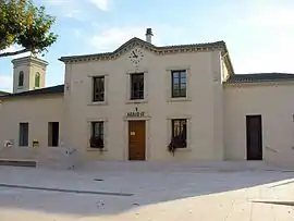 Town hall | |
.svg.png.webp) Coat of arms | |
Location of Pont-de-l'Isère 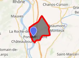
| |
 Pont-de-l'Isère  Pont-de-l'Isère | |
| Coordinates: 45°00′20″N 4°52′03″E | |
| Country | France |
| Region | Auvergne-Rhône-Alpes |
| Department | Drôme |
| Arrondissement | Valence |
| Canton | Tain-l'Hermitage |
| Government | |
| • Mayor (2014–2020) | Marie-Claude Lambert |
| Area 1 | 10.09 km2 (3.90 sq mi) |
| Population (2017-01-01)[1] | 3,503 |
| • Density | 350/km2 (900/sq mi) |
| Time zone | UTC+01:00 (CET) |
| • Summer (DST) | UTC+02:00 (CEST) |
| INSEE/Postal code | 26250 /26600 |
| Elevation | 110–146 m (361–479 ft) (avg. 119 m or 390 ft) |
| 1 French Land Register data, which excludes lakes, ponds, glaciers > 1 km2 (0.386 sq mi or 247 acres) and river estuaries. | |
Geography
Pont-de-l'Isère is best known for the fact that it is located on the 45th parallel north. The municipality is located 9 km south of Tain-l'Hermitage (chief town of canton) and 9 km north of Valence. Municipalities that are the closest are La Roche-de-Glun and Beaumont-Monteux.
Population
| Year | Pop. | ±% |
|---|---|---|
| 1911 | 568 | — |
| 1962 | 653 | +15.0% |
| 1968 | 1,135 | +73.8% |
| 1975 | 1,304 | +14.9% |
| 1982 | 2,477 | +90.0% |
| 1990 | 2,770 | +11.8% |
| 1999 | 2,688 | −3.0% |
| 2008 | 2,713 | +0.9% |
See also
References
- "Populations légales 2017". INSEE. Retrieved 6 January 2020.
| Wikimedia Commons has media related to Pont-de-l'Isère. |
| Authority control |
|
|---|
This article is issued from Wikipedia. The text is licensed under Creative Commons - Attribution - Sharealike. Additional terms may apply for the media files.