Estarreja
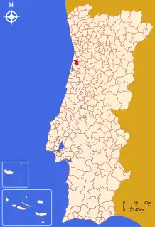
Estarreja (Portuguese pronunciation: [(ɨ)ʃtɐˈʁɐjʒɐ] (![]() listen) or [(ɨ)ʃtɐˈʁɛʒɐ]) is a municipality in Portugal. The population in 2011 was 26,997,[1] in an area of 108.17 km².[2] It had 22,746 eligible voters in 2006. The only city in the municipality is Estarreja, which is in the urban parish of Beduido. The city itself has a population of approximately 7,000. It is built along the banks of the Antuã River, near the Ria de Aveiro. Estarreja is an important chemical industry centre, being the place where several industrial facilities of CUF are located.
listen) or [(ɨ)ʃtɐˈʁɛʒɐ]) is a municipality in Portugal. The population in 2011 was 26,997,[1] in an area of 108.17 km².[2] It had 22,746 eligible voters in 2006. The only city in the municipality is Estarreja, which is in the urban parish of Beduido. The city itself has a population of approximately 7,000. It is built along the banks of the Antuã River, near the Ria de Aveiro. Estarreja is an important chemical industry centre, being the place where several industrial facilities of CUF are located.
Estarreja | |
|---|---|
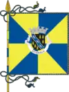
 Flag  Coat of arms | |
 | |
| Coordinates: 40°45′N 8°34′W | |
| Country | |
| Region | Centro |
| Intermunic. comm. | Região de Aveiro |
| District | Aveiro |
| Parishes | 5 |
| Government | |
| • President | Diamantino Sabina (PSD-CDS) |
| Area | |
| • Total | 108.17 km2 (41.76 sq mi) |
| Population (2011) | |
| • Total | 26,997 |
| • Density | 250/km2 (650/sq mi) |
| Time zone | UTC±00:00 (WET) |
| • Summer (DST) | UTC+01:00 (WEST) |
| Local holiday | Saint Anthony 13 June |
| Website | http://www.cm-estarreja.pt |
The municipality is part of the Aveiro District, in the Baixo Vouga subregion, in the Centro Region, Portugal.
Main train stations are Estarreja and Avanca.
The present Mayor is Diamantino Sabina, elected by a coalition between the Social Democratic Party and the People's Party. The municipal holiday is 13 June, the feast of Saint Anthony of Padua. António Egas Moniz the famous Portuguese doctour was born in Avanca, Estarreja.
Demographics
| Population of Estarreja Municipality (1801 – 2011) | ||||||||||
|---|---|---|---|---|---|---|---|---|---|---|
| 1801 | 1849 | 1900 | 1930 | 1960 | 1981 | 1991 | 2001 | 2004 | 2006 | 2011 |
| 17075 | 26147 | 34041 | 23397 | 25213 | 26261 | 26742 | 28182 | 28279 | 28332 | 26997 |
In 1926 a portion of territory with about 13 000 inhabitants was taken away from Estarreja municipality to become the municipality of Murtosa. Hence the population drop from 1900 to 1930.
Parishes
Administratively, the municipality is divided into 5 civil parishes (freguesias):[3]
- Avanca
- Beduído e Veiros
- Canelas e Fermelã
- Pardilhó (town)
- Salreu (town)
Cities and towns
- Estarreja (city)
- Avanca (town)
- Pardilhó (town)
- Salreu (town)
References
- Instituto Nacional de Estatística
- "Áreas das freguesias, concelhos, distritos e país". Archived from the original on 2018-11-05. Retrieved 2018-11-05.
- Diário da República. "Law nr. 11-A/2013, page 552 45" (pdf) (in Portuguese). Retrieved 22 July 2014.
