Puttalam District
Puttalam is a district situated near to the west coast of Sri Lanka. It has an area of 3,072 km2 (1,186 sq mi).[1] Along with the Kurunegala District, it formulates the North Western Province of Sri Lanka. The district capital is Puttalam, which borders the Kala Oya and Modaragam Aru in the north, Anuradhapura District and Kurunegala District in the east, Ma Oya in the south, and the Indian Ocean in the west. Puttalam is well known for its picturesque lagoons, popular for shallow sea fishing and prawn farming activities. The town of Kalpitiya, and the Kalpitiya Peninsula, is located in this district.
Puttalam District
පුත්තලම දිස්ත්රික්කය புத்தளம் மாவட்டம் | |
|---|---|
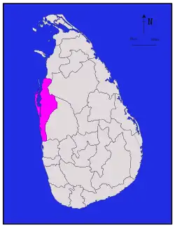 Map of Sri Lanka with Puttalam District highlighted | |
| Coordinates: 08°0′N 80°0′E | |
| Country | Sri Lanka |
| Province | North Western Province |
| Largest town | Puttalam |
| Government | |
| • District Secretary | L. J. M. G. Chandrasiri Bandara |
| Area | |
| • Total | 3,072 km2 (1,186 sq mi) |
| • Land | 2,882 km2 (1,113 sq mi) |
| • Water | 190 km2 (70 sq mi) |
| Population (2012)[2] | |
| • Total | 760,778 |
| • Density | 250/km2 (640/sq mi) |
| Time zone | UTC+05:30 (Sri Lanka) |
| ISO 3166 code | LK-62 |
| Website | www.puttalam.dist.gov.lk |
History
- On 1845, North Western Province was created.
- On 1958, then Puttalam district was merged with Chilaw district.[3]
Geography
Puttalam district is situated in the upper part of the western coastal belt.
Administrative Structure
There are 548 GN division in the area. These areas are governed by the 16 Divisional Secretory areas.
List of Divisional Secretory area in Puttlam district
- Anamaduwa Divisional Secretariat
- Arachchikattuwa Divisional Secretariat
- Chilaw Divisional Secretariat
- Dankotuwa Divisional Secretariat
- Kalpitiya Divisional Secretariat
- Karuwalagaswewa Divisional Secretariat
- Madampe Divisional Secretariat
- Mahakumbukkadawala Divisional Secretariat
- Mahawewa Divisional Secretariat
- Mundalama Divisional Secretariat
- Nattandiya Divisional Secretariat
- Nawagattegama Divisional Secretariat
- Pallama Divisional Secretariat
- Puttalam Divisional Secretariat
- Vanathavilluwa Divisional Secretariat
- Wennappuwa Divisional Secretariat
Religion
Religious statics in Puttalam District (2011)[4]
Puttalam district is a multi-religious area. Buddhism is the major religion in the district. It has established since the early part of the Anuradhapura kingdom. The second commonest religion is the Roman Catholics. In addition to two of the above major religions Hindusium, Christianity and Islam are well established in the area. Munneswaram Hindu Temple, St. Anne's Church Thalawila are some of the historical religious places in the area.
Other towns
- Anamaduwa
- Battuluoya
- Dankotuwa
- Eluvankulam
- Kalpitiya
- Madampe
- Mahawewa
- Marawila
- Mundel
- Nattandiya
- Nuraicholai
- Palavi
- Thillayadi
- Wennappuwa
See also
References
- "Area of Sri Lanka by province and district" (PDF). Department of Census and Statistics. 2010. Archived from the original (PDF) on 2013-09-03. Retrieved 2013-02-07.
- "POPULATION OF SRI LANKA BY DISTRICT" (PDF). Census of Population and Housing 2011. Department of Census and Statistics. 2012-04-20. Retrieved 2013-02-07.
- Administrative Subdivisions of Countries: A Comprehensive World Reference, 1900 through 1998,Gwillim Law, p.334
- Department of Census and Statistics,Census of Population and Housing of Sri Lanka,2012