Qaffin
Qaffin (Arabic: قفّين) is a Palestinian town located 22 kilometers (14 mi) northeast of Tulkarm in the Tulkarm Governorate in the northwestern West Bank. The town is an agricultural town. According to the Palestinian Central Bureau of Statistics, its population consisted over 8,387 inhabitants in 2007.[2] The built-up area of the town is 1,000 dunams.[3]
Qaffin | |
|---|---|
| Arabic transcription(s) | |
| • Arabic | قفّين |
| • Latin | Qaffein (official) |
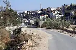 Qaffin, 2011 | |
 Qaffin Location of Qaffin within Palestine | |
| Coordinates: 32°26′00″N 35°05′01″E | |
| Palestine grid | 158/204 |
| State | State of Palestine |
| Governorate | Tulkarm |
| Government | |
| • Type | Municipality |
| • Head of Municipality | Tayseer Harsha |
| Population (2007) | |
| • Total | 8,387 |
| Name meaning | Kuffin: a rugged hill[1] |
History
Ceramics from the Byzantine era have been found here.[4]
In 1265, Qaffin was one of the estates given by Sultan Baibars to his followers after his victory over the Crusaders.[5] Half of Qaffin was given to emir Rukn al-Din Baibars al-Mu'izzi.[6]
Ottoman era
In the 1596 Ottoman tax-records a village named Qaffin appeared part of the nahiya (subdistrict) of Jenin under the liwa' (district) of Lajjun, with a population of 27 Muslim households. They paid taxes on a number of products, including wheat, barley, summer crops, olives, goats and beehives, in addition to occasional revenues and a press for olive oil or grape syrup; a total of 9,000 akçe.[7]
In 1882, the PEF's Survey of Western Palestine described the village, then named Kuffin as: "A good sized village on the low hills east of the Plain of Sharon, with a well on the south side. It has rock cut tombs, and a palm grows near the village."[8]
British Mandate era
In the 1922 census of Palestine conducted by the British Mandate authorities, Kaffin had a population of 721 Muslims,[9] increasing in the 1931 census to 1,085 Muslims, living in 255 houses.[10]
In the 1945 statistics the population of Qaffin, (including Kh. el Aqqaba and Kh. esh Sheik Meisar) was 1,570 Muslims,[11] and the land area was 23,755 dunams of land according to an official land and population survey.[12] Of this, 5,863 dunams were plantations and irrigable land, 8,371 were used for cereals,[13] while 40 dunams were built-up (urban) land.[14]
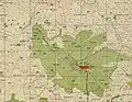 Qaffin 1942 1:20,000
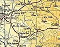 Qaffin 1945 1:250,000
Jordanian era
In the wake of the 1948 Arab–Israeli War, and after the 1949 Armistice Agreements, Qaffin came under Jordanian rule.
In 1961, the population of Qaffin was 2,457.[15]
Post 1967
Since the Six-Day War in 1967, Qaffin has been under Israeli occupation.
References
- Palmer, 1881, p. 150
- 2007 PCBS census. Palestinian Central Bureau of Statistics (PCBS). p. 107.
- Israeli Settlers set fire into 200 dunums of Qaffin Village Lands Archived May 19, 2011, at the Wayback Machine The Applied Research Institute - Jerusalem. 2007-06-17.
- Dauphin, 1998, p. 753
- Zertal, 2016, pp. 316-317
- Ibn al-Furat, 1971, pp. 81, 210, 249 (map)
- Hütteroth and Abdulfattah, 1977, p. 161. They also state that this Qaffin does not coincide with the borders of nahiya Jinin, but Zertal, 2016, p. 316 have included it in this place.
- Conder and Kitchener, 1882, SWP II, p. 47
- Barron, 1923, Sub-district of Jenin, p. 30.
- Mills, 1932, p. 70
- Government of Palestine, Department of Statistics, 1945, p. 21
- Government of Palestine, Department of Statistics. Village Statistics, April, 1945. Quoted in Hadawi, 1970, p. 76
- Government of Palestine, Department of Statistics. Village Statistics, April, 1945. Quoted in Hadawi, 1970, p. 127
- Government of Palestine, Department of Statistics. Village Statistics, April, 1945. Quoted in Hadawi, 1970, p. 177
- Government of Jordan, Department of Statistics, 1964, p. 14
Bibliography
- Barron, J.B., ed. (1923). Palestine: Report and General Abstracts of the Census of 1922. Government of Palestine.
- Conder, C.R.; Kitchener, H.H. (1882). The Survey of Western Palestine: Memoirs of the Topography, Orography, Hydrography, and Archaeology. 2. London: Committee of the Palestine Exploration Fund.
- Dauphin, Claudine (1998). La Palestine byzantine, Peuplement et Populations. BAR International Series 726 (in French). III : Catalogue. Oxford: Archeopress. ISBN 0-860549-05-4.
- Government of Jordan, Department of Statistics (1964). First Census of Population and Housing. Volume I: Final Tables; General Characteristics of the Population (PDF).
- Government of Palestine, Department of Statistics (1945). Village Statistics, April, 1945.
- Hadawi, S. (1970). Village Statistics of 1945: A Classification of Land and Area ownership in Palestine. Palestine Liberation Organization Research Center.
- Hütteroth, Wolf-Dieter; Abdulfattah, Kamal (1977). Historical Geography of Palestine, Transjordan and Southern Syria in the Late 16th Century. Erlanger Geographische Arbeiten, Sonderband 5. Erlangen, Germany: Vorstand der Fränkischen Geographischen Gesellschaft. ISBN 3-920405-41-2.
- Ibn al-Furat (1971). J. Riley-Smith (ed.). Ayyubids, Mamluks and Crusaders: Selections from the "Tarikh Al-duwal Wal-muluk" of Ibn Al-Furat : the Text, the Translation. 2. Translation by Malcolm Cameron Lyons, Ursula Lyons. Cambridge: W. Heffer.
- Mills, E., ed. (1932). Census of Palestine 1931. Population of Villages, Towns and Administrative Areas. Jerusalem: Government of Palestine.
- Palmer, E.H. (1881). The Survey of Western Palestine: Arabic and English Name Lists Collected During the Survey by Lieutenants Conder and Kitchener, R. E. Transliterated and Explained by E.H. Palmer. Committee of the Palestine Exploration Fund.
- Zertal, A. (2016). The Manasseh Hill Country Survey. 3. Boston: BRILL. ISBN 9004312307.
External links
- Welcome To Qaffein
- Survey of Western Palestine, Map 8: IAA, Wikimedia commons

