Raigachhi
Raigachi is a census town in Rajarhat CD Block in Barasat Sadar subdivision[1] in North 24 Parganas district in the Indian state of West Bengal. It is close to Kolkata and also a part of Kolkata Urban Agglomeration.
Raigachi | |
|---|---|
Census Town | |
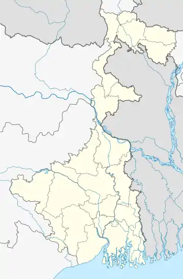
 Raigachi Location in West Bengal, India  Raigachi Raigachi (India) | |
| Coordinates: 22.63722°N 88.473232°E | |
| Country | |
| State | West Bengal |
| District | North 24 Parganas |
| Metro Station | Rabindra Tirtha(under construction) |
| Population (2011) | |
| • Total | 8,245 |
| Languages | |
| • Official | Bengali, English |
| Time zone | UTC+5:30 (IST) |
| PIN | 700135 |
| Telephone code | +91 33 |
| ISO 3166 code | IN-WB |
| Vehicle registration | WB |
| Lok Sabha constituency | Barasat |
| Vidhan Sabha constituency | Rajarhat New Town |
| Website | north24parganas |
Demographics
Population
As per 2011 Census of India Raigachi had a total population of 8,245, of which 4,196 (51%) were males and 4,049 (49%) were females. Population below 6 years was 1,045. The total number of literates in Raigachi was 5,604 (77.83% of the population over 6 years).[3]
As of 2001 India census,[4] Raigachi had a population of 6728. Males constitute 51% of the population and females 49%. Raigachi has an average literacy rate of 55%, lower than the national average of 59.5%: male literacy is 58% and female literacy is 52%. In Raigachhi, 16% of the population is under 6 years of age.
Kolkata Urban Agglomeration
The following Municipalities and Census Town in Barasat Sadar subdivision were part of Kolkata Urban Agglomeration, according to the 2011 census: Barasat (M), Madhyamgram (M), Rajarhat-Gopalpur (M) (made part of Bidhannagar Municipal Corporation in 2015) and Raigachi (CT).[5]
Infrastructure
As per District Census Handbook 2011, Raigachi covered an area of 1.57 km2. It had 6 primary schools, 3 middle schools and 3 secondary schools. The nearest degree college was 3 km away at Krishnapur. The nearest hospital with 20 beds was 1 km away.[6]
Transport
SRCM Road and Rajarhat Main Road (part of State Highway 3) pass along the north and south boundaries of Raigachhi.[2]
Private Bus
- 91 Shyambazar - Bhangar Kanthalia (via SRCM Road)
- 91A Shyambazar - Haroa (via SRCM Road)
- 91C Shyambazar - Lauhati (via SRCM Road)
- 211 Ahiritola - Kharibari/Patharghata (via Rajarhat Main Road)
- 211A Ahiritola - Langalpota (via Rajarhat Main Road)
Bus Routes Without Numbers
- Nabanna - Rajarhat Chowmatha (via Rajarhat Main Road)
- Shyambazar - Polerhat (via Rajarhat Main Road)
Healthcare
North 24 Parganas district has been identified as one of the areas where ground water is affected by arsenic contamination.[7]
See also
Map Rajarhat CD Block on Page 605 of District Census Handbook.[8]
References
- District-wise list of statutory towns Archived 2007-08-09 at the Wayback Machine
- Google maps
- "C.D. Block Wise Primary Census Abstract Data(PCA)". 2011 census: West Bengal – District-wise CD Blocks. Registrar General and Census Commissioner, India. Retrieved 23 March 2016.
- "Census of India 2001: Data from the 2001 Census, including cities, villages and towns (Provisional)". Census Commission of India. Archived from the original on 16 June 2004. Retrieved 1 November 2008.
- "Provisional Population Totals, Census of India 2011" (PDF). Constituents of Urban Agglomeration Having Population Above 1 Lakh. Census of India 2011. Retrieved 30 May 2018.
- "District Census Handbook North Twenty Four Parganas, Census of India 2011, Series 20, Part XII A" (PDF). Section II Town Directory, Pages 781-783 Statement I: Growth History, Pages 799-803: Statement IV: Medical Facilities 2009, Pages 803-805 Section: Educational, Recreational and Cultural Facilities. Directorate of Census Operations V, West Bengal. Retrieved 31 May 2018.
- "Groundwater Arsenic contamination in West Bengal-India (19 years study)". Groundwater arsenic contamination status of North 24-Parganas district, one of the nine arsenic affected districts of West Bengal-India. SOES. Retrieved 24 August 2007.
- "District Census Handbook North Twenty Four Parganas, Census of India 2011, Series 20, Part XII A" (PDF). Page 605 - Map of Rajarhat CD Block. Directorate of Census Operations, West Bengal. Retrieved 1 June 2018.
