Ramgarh Coalfield
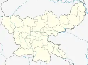
Ramgarh Coalfield are located in Ramgarh district in the Indian state of Jharkhand.
| Location | |
|---|---|
 Ramgarh Coalfield Location in Jharkhand | |
| State | Jharkhand |
| Country | India |
| Coordinates | 23°35′53″N 85°40′34″E |
| Owner | |
| Company | Central Coalfields Limited |
| Website | http://ccl.gov.in/ |
| Year of acquisition | 1975 |
Overview
In 1917, L.S.S.O’Malley described the coalfields in the upper reaches of the Damodar as follows: “Near the western boundary of Jharia field is that of Bokaro, covering 220 square miles (570 km2), with an estimated content of 1,500 million tons; close by… is the Ramgarh field (40 square miles), in which, however, coal is believed to be of inferior quality. A still larger field in the same district is that called Karanpura, which extends over 544 square miles (1,410 km2) and has an estimated capacity of 9,000 million tons.”[1]
The Coalfield
| Collieries in the CCL Ramgarh Coalfield U: Undergroud colliery, O: Open Cast colliery, M: Mixed colliery, W: Washery, S: Facility, A: Administrative headquarters, CT: census town, H: historical, religious, tourist centre Owing to space constraints in the small map, the actual locations in a larger map may vary slightly |
Ramgarh Coalfield covers an area of 98 square kilometres (38 sq mi) and has total coal reserves of 1,059.20 million tonnes.[2]
Projects
| CCL Operational Area | Projects |
|---|---|
| Rajrappa Area | Rajrappa OCP and Rajrappa Washery. The area office is at Rajrappa 829101.[3] |
| Kuju Area | Karma opencast.The area office is at Hesagarha, Kuju 825316.[4] |
Transport
In 1927, Bengal Nagpur Railway opened the 72-mile (116 km) Barkakana-Muri-Chandil line to traffic. In the same year the Central India Coalfields Railway opened the Gomoh-Barkakana line. It was extended to Daltonganj in 1929. Later, these lines were amalgamated with East Indian Railway.[5]
References
- L.S.S. O’Malley, Bengal, Bihar and Orissa, Sikkim, p.87, Cambridge University Press, 1917 (paper back 2011) ISBN 978-1-107-60064-5
- Prasoon Kumar Singh, Gurdeep Singh and Brajendra Kumar Tiwary. "Critical Evaluation of Geo-Environmental Scenario of Damodar River Basin, Inia" (PDF). Retrieved 2008-08-26.
- "Central Coalfields Limited". Areas - Rajrappa. CCL. Retrieved 27 December 2020.
- "Central Coalfields Limited". Areas - Kuju. CCL. Retrieved 25 December 2020.
- "Indian Railway History Timeline". Archived from the original on 2012-02-29. Retrieved 2008-08-26.