Bokaro district
Bokaro district is one of the most industrialized zones in India. It is one of the twenty-four districts of the Jharkhand state, India. It was established in 1991 by carving out one subdivision consisting of two blocks from Dhanbad District and six blocks from Giridih District.
Bokaro district | |
|---|---|
District of Jharkhand | |
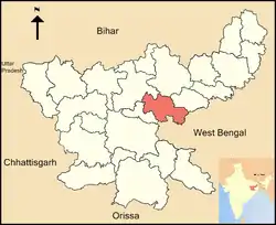 Location of Bokaro district in Jharkhand | |
| Country | India |
| State | Jharkhand |
| Headquarters | Bokaro Steel City |
| Tehsils | 8 |
| Government | |
| • Lok Sabha constituencies | 1. Dhanbad (shared with Dhanbad district), 2. Giridih (shared with Giridih district) |
| Area | |
| • Total | 2,883 km2 (1,113 sq mi) |
| Population | |
| • Total | 2,062,330 |
| • Density | 720/km2 (1,900/sq mi) |
| Demographics | |
| • Literacy | 73.48% |
| Time zone | UTC+05:30 (IST) |
| Website | http://bokaro.nic.in/ |
Economy
In 2006, the Indian government named Bokaro one of the country's 250 most backward districts (out of a total of 640).[1] It is one of the 21 districts in Jharkhand currently receiving funds from the Backward Regions Grant Fund Programme (BRGF).[1]
Demographics
According to the 2011 census, Bokaro district has a population of 2,062,330,[2] This gives it a ranking of 222nd in India (out of a total of 640).[2] The district has a population density of 716 inhabitants per square kilometre (1,850/sq mi).[2] Its population growth rate over the decade 2001–2011 was 15.99%.[2] Bokaro has a sex ratio of 916 females for every 1000 males,[2] and a literacy rate of 73.48%.[2] Schedule Caste (SC) constitutes 14.5% while Schedule Tribe (ST) were 12.4% of total population.
Languages
At the time of the 2011 Census of India, 46.23% of the population in the district spoke Khortha , 11.39% Santali, 10.67% Bengali, 5.72% Bhojpuri, 4.09% Urdu and 1.14% Maithili as their first language.[4]
| Year | Pop. | ±% p.a. |
|---|---|---|
| 1901 | 243,649 | — |
| 1911 | 283,125 | +1.51% |
| 1921 | 293,454 | +0.36% |
| 1931 | 345,504 | +1.65% |
| 1941 | 396,143 | +1.38% |
| 1951 | 454,060 | +1.37% |
| 1961 | 554,613 | +2.02% |
| 1971 | 762,675 | +3.24% |
| 1981 | 1,097,130 | +3.70% |
| 1991 | 1,454,416 | +2.86% |
| 2001 | 1,777,662 | +2.03% |
| 2011 | 2,062,330 | +1.50% |
| source:[5] | ||
Geography
Situation of Bokaro district | ||||||||||
|---|---|---|---|---|---|---|---|---|---|---|
| ||||||||||
References
- Ministry of Panchayati Raj (8 September 2009). "A Note on the Backward Regions Grant Fund Programme" (PDF). National Institute of Rural Development. Archived from the original (PDF) on 5 April 2012. Retrieved 27 September 2011.
- "District Census 2011". Census2011.co.in. 2011. Retrieved 30 September 2011.
- "Archived copy". Archived from the original on 15 August 2018. Retrieved 26 April 2019.CS1 maint: archived copy as title (link)
- 2011 Census of India, Population By Mother Tongue
- Decadal Variation In Population Since 1901
External links
| Wikimedia Commons has media related to Bokaro district. |
Places adjacent to Bokaro district | |
|---|---|