Rennesøy
Rennesøy is a former municipality in Rogaland county, Norway. It was merged into Stavanger municipality on 1 January 2020. It was located in the traditional district of Ryfylke. The administrative centre of the municipality is the village of Vikevåg. Other villages in Rennesøy included Askje and Sørbø. The municipality encompassed a number of islands on the south side of the Boknafjorden, north of the city of Stavanger.
Rennesøy kommune | |
|---|---|
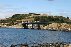 View of the Askjesund Bridge in Rennesøy | |
 Rogaland within Norway | |
 Rennesøy within Rogaland | |
| Coordinates: 59°06′04″N 05°43′55″E | |
| Country | Norway |
| County | Rogaland |
| District | Ryfylke |
| Established | 1 Jan 1838 |
| Disestablished | 1 Jan 2020 |
| Administrative centre | Vikevåg |
| Government | |
| • Mayor (2011) | Dagny Sunnanå Hausken (Sp) |
| Area | |
| • Total | 65.51 km2 (25.29 sq mi) |
| • Land | 64.90 km2 (25.06 sq mi) |
| • Water | 0.61 km2 (0.24 sq mi) 0.9% |
| Area rank | 404 in Norway |
| *Area at municipal dissolution. | |
| Population (2017) | |
| • Total | 4,892 |
| • Rank | 207 in Norway |
| • Density | 75.4/km2 (195/sq mi) |
| • Change (10 years) | 38.7% |
| Demonym(s) | Rennesøybu[1] |
| Time zone | UTC+01:00 (CET) |
| • Summer (DST) | UTC+02:00 (CEST) |
| ISO 3166 code | NO-1142 |
| Official language form | Neutral[2] |
| Created as | Formannskapsdistrikt in 1838 |
| Succeeded by | Stavanger in 2020 |
| Website | rennesoy |

At the time of its dissolution, the 66-square-kilometre (25 sq mi) municipality was the 404th largest by area out of the 422 municipalities in Norway. Rennesøy was the 207th most populous municipality in Norway with a population of 4,892. The municipality's population density is 75.4 inhabitants per square kilometre (195/sq mi) and its population has increased by 38.7% over the last decade.[3]
General information

The parish of Rennesø was established as a municipality on 1 January 1838 (see formannskapsdistrikt law). On 1 July 1884, the municipality was split in two with the islands of Mosterøy, Klosterøy, Fjøløy, Kvitsøy, and the western part of Åmøy forming the new municipality of Mosterøy, and the islands of Rennesøy and Brimse remained as Rennesøy municipality. This split left Rennesøy with 1,092 residents, less than half of its previous population. The island of Kvitsøy later became an independent municipality of its own.
On 1 July 1918, the Hanasand area of the neighboring municipality of Finnøy (population: 72) that was located on the island of Rennesøy was transferred to Rennesøy municipality.
During the 1960s, there were many municipal mergers across Norway due to the work of the Schei Committee. On 1 January 1965, the municipality of Mosterøy was merged back into Rennesøy. Prior to the merger, Rennesøy had 1,370 residents.[4]
On 1 January 2020, the municipalities of Finnøy, Rennesøy, and Stavanger were merge into one, large municipality called Stavanger.[5]
Name
The municipality was named after the main island of the municipality, Rennesøy. The Old Norse form of the name was Rennisøy. The meaning of the first element is unknown and the last element is øy which means "island". Before 1918, the name was written "Rennesø".[6][7]
Coat of arms
The coat of arms was granted on 20 February 1981. The arms show two silver/white crosiers on a blue background. The blue represents the ocean, an important feature for this island municipality. The crosiers represent the importance of Norway's oldest and best preserved monasteries, Utstein Abbey, located in the municipality.[8]
Churches
The Church of Norway had two parishes (sokn) within the municipality of Rennesøy. It was part of the Tungenes prosti (deanery) in the Diocese of Stavanger.
| Parish (sokn) | Church name | Location of the church | Year built |
|---|---|---|---|
| Mosterøy | Askje Church | Askje, Mosterøy island | 1846 |
| Utstein Church | Klosterøy island | 1280 | |
| Vestre Åmøy Chapel | Åmøy island (western side) | 1953 | |
| Rennesøy | Hausken Church | Vikevåg, Rennesøy island | 1857 |
| Sørbø Church | Sørbø, Rennesøy island | 1130 |
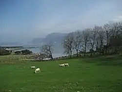
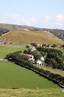
Geography
The island municipality sat on the south side of the large Boknafjorden. It consists of about 80 islands, most of which are uninhabited. The main islands are Rennesøy, Mosterøy, Klosterøy, Fjøløy, Sokn, Bru, Brimse, and the western part of Åmøy (the eastern part is part of Stavanger municipality). All of the main islands are connected together and to the mainland by a series of bridges and tunnels (except for Brimse which has a ferry connection). The Fjøløy Lighthouse is located in the northwestern part of the municipality, lighting a main shipping channel to Stavanger.[7]
| Year | Pop. | ±% |
|---|---|---|
| 1951 | 1,483 | — |
| 1961 | 1,418 | −4.4% |
| 1971 | 2,045 | +44.2% |
| 1981 | 2,363 | +15.6% |
| 1991 | 2,578 | +9.1% |
| 2001 | 3,168 | +22.9% |
| 2011 | 4,202 | +32.6% |
| 2015 | 4,794 | +14.1% |
| Source: Statistics Norway.[9][10] | ||
Government
All municipalities in Norway, including Rennesøy, are responsible for primary education (through 10th grade), outpatient health services, senior citizen services, unemployment and other social services, zoning, economic development, and municipal roads. The municipality is governed by a municipal council of elected representatives, which in turn elect a mayor.[11] The municipality fell under the Stavanger District Court and the Gulating Court of Appeal.
Municipal council
The municipal council (Kommunestyre) of Rennesøy was made up of 21 representatives that were elected to four year terms. The party breakdown of the final municipal council was as follows:
| Party Name (in Norwegian) | Number of representatives | |
|---|---|---|
| Labour Party (Arbeiderpartiet) | 3 | |
| Progress Party (Fremskrittspartiet) | 4 | |
| Conservative Party (Høyre) | 6 | |
| Christian Democratic Party (Kristelig Folkeparti) | 3 | |
| Centre Party (Senterpartiet) | 5 | |
| Total number of members: | 21 | |
| Party Name (in Norwegian) | Number of representatives | |
|---|---|---|
| Labour Party (Arbeiderpartiet) | 3 | |
| Progress Party (Fremskrittspartiet) | 3 | |
| Conservative Party (Høyre) | 7 | |
| Christian Democratic Party (Kristelig Folkeparti) | 3 | |
| Centre Party (Senterpartiet) | 4 | |
| Socialist Left Party (Sosialistisk Venstreparti) | 1 | |
| Total number of members: | 21 | |
| Party Name (in Norwegian) | Number of representatives | |
|---|---|---|
| Labour Party (Arbeiderpartiet) | 3 | |
| Progress Party (Fremskrittspartiet) | 5 | |
| Conservative Party (Høyre) | 5 | |
| Christian Democratic Party (Kristelig Folkeparti) | 3 | |
| Centre Party (Senterpartiet) | 3 | |
| Common list (Samlingsliste) | 2 | |
| Total number of members: | 21 | |
| Party Name (in Norwegian) | Number of representatives | |
|---|---|---|
| Labour Party (Arbeiderpartiet) | 3 | |
| Progress Party (Fremskrittspartiet) | 3 | |
| Conservative Party (Høyre) | 2 | |
| Christian Democratic Party (Kristelig Folkeparti) | 5 | |
| Centre Party (Senterpartiet) | 2 | |
| Common list (Samlingsliste) | 4 | |
| Cross-party list (Tverrpolitisk liste) | 2 | |
| Total number of members: | 21 | |
| Party Name (in Norwegian) | Number of representatives | |
|---|---|---|
| Labour Party (Arbeiderpartiet) | 4 | |
| Conservative Party (Høyre) | 5 | |
| Christian Democratic Party (Kristelig Folkeparti) | 4 | |
| Centre Party (Senterpartiet) | 4 | |
| Cross-party list (Tverrpolitisk liste) | 4 | |
| Total number of members: | 21 | |
| Party Name (in Norwegian) | Number of representatives | |
|---|---|---|
| Labour Party (Arbeiderpartiet) | 3 | |
| Conservative Party (Høyre) | 4 | |
| Christian Democratic Party (Kristelig Folkeparti) | 4 | |
| Centre Party (Senterpartiet) | 8 | |
| Non-party list (Upolitisk liste) | 2 | |
| Total number of members: | 21 | |
| Party Name (in Norwegian) | Number of representatives | |
|---|---|---|
| Labour Party (Arbeiderpartiet) | 3 | |
| Conservative Party (Høyre) | 6 | |
| Christian Democratic Party (Kristelig Folkeparti) | 5 | |
| Centre Party (Senterpartiet) | 6 | |
| Liberal Party (Venstre) | 1 | |
| Total number of members: | 21 | |
| Party Name (in Norwegian) | Number of representatives | |
|---|---|---|
| Labour Party (Arbeiderpartiet) | 4 | |
| Conservative Party (Høyre) | 6 | |
| Christian Democratic Party (Kristelig Folkeparti) | 5 | |
| Centre Party (Senterpartiet) | 6 | |
| Total number of members: | 21 | |
| Party Name (in Norwegian) | Number of representatives | |
|---|---|---|
| Labour Party (Arbeiderpartiet) | 1 | |
| Conservative Party (Høyre) | 7 | |
| Christian Democratic Party (Kristelig Folkeparti) | 5 | |
| Liberal People's Party (Liberale Folkepartiet) | 1 | |
| Centre Party (Senterpartiet) | 7 | |
| Total number of members: | 21 | |
| Party Name (in Norwegian) | Number of representatives | |
|---|---|---|
| Labour Party (Arbeiderpartiet) | 1 | |
| Conservative Party (Høyre) | 3 | |
| Christian Democratic Party (Kristelig Folkeparti) | 7 | |
| New People's Party (Nye Folkepartiet) | 1 | |
| Centre Party (Senterpartiet) | 9 | |
| Total number of members: | 21 | |
| Party Name (in Norwegian) | Number of representatives | |
|---|---|---|
| Labour Party (Arbeiderpartiet) | 1 | |
| Conservative Party (Høyre) | 2 | |
| Christian Democratic Party (Kristelig Folkeparti) | 6 | |
| Centre Party (Senterpartiet) | 9 | |
| Liberal Party (Venstre) | 3 | |
| Total number of members: | 21 | |
| Party Name (in Norwegian) | Number of representatives | |
|---|---|---|
| Labour Party (Arbeiderpartiet) | 1 | |
| Conservative Party (Høyre) | 3 | |
| Christian Democratic Party (Kristelig Folkeparti) | 5 | |
| Centre Party (Senterpartiet) | 8 | |
| Liberal Party (Venstre) | 3 | |
| Local List(s) (Lokale lister) | 1 | |
| Total number of members: | 21 | |
| Party Name (in Norwegian) | Number of representatives | |
|---|---|---|
| Christian Democratic Party (Kristelig Folkeparti) | 5 | |
| Centre Party (Senterpartiet) | 4 | |
| Joint List(s) of Non-Socialist Parties (Borgerlige Felleslister) | 3 | |
| Local List(s) (Lokale lister) | 1 | |
| Total number of members: | 13 | |
| Party Name (in Norwegian) | Number of representatives | |
|---|---|---|
| Local List(s) (Lokale lister) | 13 | |
| Total number of members: | 13 | |
| Party Name (in Norwegian) | Number of representatives | |
|---|---|---|
| Local List(s) (Lokale lister) | 13 | |
| Total number of members: | 13 | |
| Party Name (in Norwegian) | Number of representatives | |
|---|---|---|
| Local List(s) (Lokale lister) | 13 | |
| Total number of members: | 13 | |
| Party Name (in Norwegian) | Number of representatives | |
|---|---|---|
| Local List(s) (Lokale lister) | 12 | |
| Total number of members: | 12 | |
| Party Name (in Norwegian) | Number of representatives | |
|---|---|---|
| Local List(s) (Lokale lister) | 12 | |
| Total number of members: | 12 | |
| Party Name (in Norwegian) | Number of representatives | |
|---|---|---|
| Local List(s) (Lokale lister) | 12 | |
| Total number of members: | 12 | |
Transportation

Since 1992, Rennesøy municipality has been connected to the mainland by a series of bridges and undersea tunnels. The Byfjord Tunnel connects the mainland to the island of Sokn, and it is part of the European route E39 highway. The island of Sokn is connected to the three islands of Åmøy, Bru, and Mosterøy by bridges. Mosterøy is connected to Fjøløy and Klosterøy by short bridges and to Rennesøy by the undersea Mastrafjord Tunnel. Rennesøy island is also connected to the island of Vestre Bokn (across the Boknafjorden) by ferry. Furthermore, the island of Rennesøy is connected to the two islands of Finnøy and Talgje in the neighboring municipality of Finnøy to the northeast by the Finnøy Tunnel.[7]
References
- "Navn på steder og personer: Innbyggjarnamn" (in Norwegian). Språkrådet.
- "Forskrift om målvedtak i kommunar og fylkeskommunar" (in Norwegian). Lovdata.no.
- Statistisk sentralbyrå (2017). "Table: 06913: Population 1 January and population changes during the calendar year (M)" (in Norwegian). Retrieved 4 November 2017.
- Jukvam, Dag (1999). "Historisk oversikt over endringer i kommune- og fylkesinndelingen" (PDF) (in Norwegian). Statistisk sentralbyrå.
- "Om nye Stavanger" (in Norwegian). Retrieved 4 November 2017.
- Rygh, Oluf (1915). Norske gaardnavne: Stavanger amt (in Norwegian) (10 ed.). Kristiania, Norge: W. C. Fabritius & sønners bogtrikkeri. p. 257.
- Store norske leksikon. "Rennesøy – kommune" (in Norwegian). Retrieved 30 December 2015.
- "Civic heraldry of Norway - Norske Kommunevåpen". Heraldry of the World. Retrieved 30 December 2015.
- Projected population – Statistics Norway
- Per 1 January 1965, 1142 Rennesøy and 1143 Mosterøy were merged to one municipality, 1142 Rennesøy.
- Hansen, Tore, ed. (12 May 2016). "kommunestyre". Store norske leksikon (in Norwegian). Kunnskapsforlaget. Retrieved 28 June 2020.
- "Table: 04813: Members of the local councils, by party/electoral list at the Municipal Council election (M)" (in Norwegian). Statistics Norway.
- "Tall for Norge: Kommunestyrevalg 2011 - Rogaland". Valg Direktoratet. Retrieved 5 August 2020.
- "Kommunestyrevalget 1995" (PDF) (in Norwegian). Oslo-Kongsvinger: Statistisk sentralbyrå. 1996. Retrieved 5 August 2020.
- "Kommunestyrevalget 1991" (PDF) (in Norwegian). Oslo-Kongsvinger: Statistisk sentralbyrå. 1993. Retrieved 5 August 2020.
- "Kommunestyrevalget 1987" (PDF) (in Norwegian). Oslo-Kongsvinger: Statistisk sentralbyrå. 1988. Retrieved 5 August 2020.
- "Kommunestyrevalget 1983" (PDF) (in Norwegian). Oslo-Kongsvinger: Statistisk sentralbyrå. 1984. Retrieved 5 August 2020.
- "Kommunestyrevalget 1979" (PDF) (in Norwegian). Oslo: Statistisk sentralbyrå. 1979. Retrieved 5 August 2020.
- "Kommunevalgene 1975" (PDF) (in Norwegian). Oslo: Statistisk sentralbyrå. 1977. Retrieved 5 August 2020.
- "Kommunevalgene 1972" (PDF) (in Norwegian). Oslo: Statistisk sentralbyrå. 1973. Retrieved 5 August 2020.
- "Kommunevalgene 1967" (PDF) (in Norwegian). Oslo: Statistisk sentralbyrå. 1967. Retrieved 5 August 2020.
- "Kommunevalgene 1963" (PDF) (in Norwegian). Oslo: Statistisk sentralbyrå. 1964. Retrieved 5 August 2020.
- "Kommunevalgene og Ordførervalgene 1959" (PDF) (in Norwegian). Oslo: Statistisk sentralbyrå. 1960. Retrieved 5 August 2020.
- "Kommunevalgene og Ordførervalgene 1955" (PDF) (in Norwegian). Oslo: Statistisk sentralbyrå. 1957. Retrieved 5 August 2020.
- "Kommunevalgene og Ordførervalgene 1951" (PDF) (in Norwegian). Oslo: Statistisk sentralbyrå. 1952. Retrieved 5 August 2020.
- "Kommunevalgene og Ordførervalgene 1947" (PDF) (in Norwegian). Oslo: Statistisk sentralbyrå. 1948. Retrieved 5 August 2020.
- "Kommunevalgene og Ordførervalgene 1945" (PDF) (in Norwegian). Oslo: Statistisk sentralbyrå. 1947. Retrieved 5 August 2020.
- "Kommunevalgene og Ordførervalgene 1937" (PDF) (in Norwegian). Oslo: Statistisk sentralbyrå. 1938. Retrieved 5 August 2020.
External links
 Media related to Rennesøy at Wikimedia Commons
 The dictionary definition of Rennesøy at Wiktionary
 Rogaland travel guide from Wikivoyage
- Municipal fact sheet from Statistics Norway (in Norwegian)
 |
|  | |||||||||||||||||||||||||
||
