River Holme
The Holme of the Holme Valley, West Yorkshire, England is a tributary of the River Colne, West Yorkshire. The source is via Digley Reservoir, fed firstly by the run-off from Brownhill Reservoir, then by Dobbs Dike. Banks along the upper valley are mostly urbanised and are in the Holme Valley civil parish.
| River Holme | |
|---|---|
_joining_River_Colne_at_Huddersfield%252C_West_Yorkshire%252C_UK_(RLH).JPG.webp) River Holme (left) joining the River Colne at Huddersfield | |
| Location | |
| Country | England |
| Physical characteristics | |
| Source | |
| • location | Holmbridge |
| • coordinates | 53°13′15″N 1°49′27″W |
| • elevation | 188 metres (617 ft) |
| Mouth | |
• location | River Colne at Huddersfield |
• coordinates | 53°38′21″N 1°47′4″W |
• elevation | 72 metres (236 ft) |
| Length | 13.86 kilometres (8.61 mi) |
| Basin size | 97.4 square kilometres (37.6 sq mi) |
| Basin features | |
| Progression | Colne–Calder–Aire–Ouse–Humber–North Sea |
Course
From Digley Reservoir, the river flows north-east through Holmbridge and Holmfirth. It flows NNE to Thongsbridge and Brockholes then north to reach Honley, Berry Brow and Lockwood. It wends northwards and joins the Colne (one of five rivers of that name) just south of Huddersfield town centre at Folly Hall.[1]
The Environment Agency has a gauging station at Queen's Mill in Huddersfield where the record average monthly levels are 0.25 metres (0.82 ft), versus 1.2 metres (3.9 ft). The record high is 2.5 metres (8.2 ft), in 2011.[2]
Flooding
The river was prone to flooding, the earliest recorded in 1738. In 1840 the dam of Bilberry Reservoir was built over a stream, but the work had not been done properly and the stream not correctly redirected. Thus in February 1852, the reservoir broke its confines and flooded the valley as far as Holmfirth. It caused 81 deaths and the destruction of many homes and businesses.[3][4]
Geography
- Natural upper catchment
The top of the valley is surrounded by the high, wooded hills on their lower slopes only, of Holme Moss, Harden Moss and Cartworth Moor.
- Geology
The underlying bedrock was laid down in the Upper Carboniferous era and is primarily of Millstone Grit with some sandstone interspersed with thin coal seams.[5]
Lists
Tributaries
|
Settlements
|
Road crossings
|
Gallery
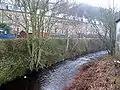 River Holme, Thongsbridge
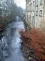 River Holme, Thongsbridge
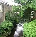 River Holme - Towngate
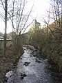 River Holme at Holmfirth
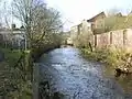 River Holme in Lockwood Huddersfield
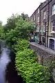 The River Holme in Holmfirth
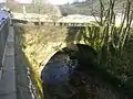 Old bridge over the River Holme, off Woodhead Road, Holmfirth
See also
References
- Huddersfield One
- "River Levels". Environment Agency River and Sea Levels. Retrieved 28 August 2011.
- "Floods". Holmfirth Floods. Retrieved 28 August 2011.
- Huddersfield One
- "River Valley Geology". Archived from the original on 3 September 2003. Retrieved 28 August 2011.