River Laneshaw
The River Laneshaw is a river in Northern England. It runs for 1.9 miles (3 km) from Laneshaw Reservoir to Laneshaw Bridge alongside the A6068 road[1] and has a catchment area of 5.1 square miles (13.2 km2).[2]

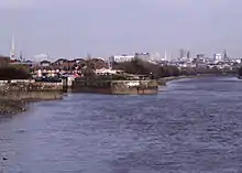
Laneshaw Brook on Emmott Moor
Rising as Laneshaw Brook on Combe Hill between the border of Lancashire and Yorkshire, the brook runs northwards, feeding first Laneshaw Reservoir then running westwards as the River Laneshaw.[3]
The River Laneshaw combines with Wycoller Beck at Covey Bridge to form Colne Water.[4]
References
- "103" (Map). Blackburn & Burnley (C2 ed.). 1:50,000. Landranger. Ordnance Survey. 2006. ISBN 978-0-319-22829-6.
- "Colne Water (Laneshaw)". Catchment Data Explorer. Environment Agency. Retrieved 16 October 2016.
- Hull, Edward; Dakyn, J R; Tiddeman, R H; Ward, J C; Gunn, W (1875). The geology of the Burnley Coalfield and of the country around Clitheroe, Blackburn, Preston, Chorley, Haslingden, and Todmorden. London: HMSO. p. 12. OCLC 315448672.
- Wilmore, A (2013). "6. Rivers". South Lancashire. Cambridge: Cambridge University Press. p. 24. ISBN 978-1-107-61616-5.
This article is issued from Wikipedia. The text is licensed under Creative Commons - Attribution - Sharealike. Additional terms may apply for the media files.