River Rouge, Michigan
River Rouge is a city in Wayne County in the U.S. state of Michigan.[5] The population was 7,903 at the 2010 census. The city is named after the River Rouge (from the French "rouge" meaning red), which flows along the city's northern border and into the Detroit River. The city includes the heavily industrialized Zug Island and also has its own school district, River Rouge School District.
River Rouge, Michigan
Rivière Rouge (French) | |
|---|---|
| City of River Rouge | |
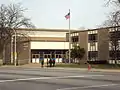
_3.jpg.webp) River Rouge Civic Center on W. Jefferson Avenue | |
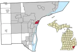 Location within Wayne County | |
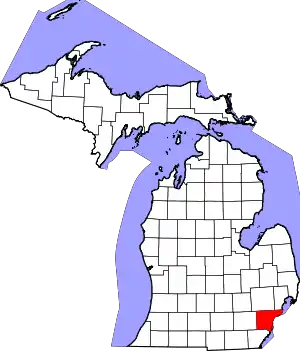
 River Rouge Location within the state of Michigan | |
| Coordinates: 42°16′17″N 83°08′05″W | |
| Country | United States |
| State | Michigan |
| County | Wayne |
| Settled | 1808 |
| Incorporated | 1899 (village) 1922 (city) |
| Government | |
| • Type | Mayor–council |
| • Mayor | Michael D. Bowdler |
| • Clerk | Patricia Johnson |
| Area | |
| • City | 3.25 sq mi (8.41 km2) |
| • Land | 2.65 sq mi (6.87 km2) |
| • Water | 0.59 sq mi (1.54 km2) |
| Elevation | 584 ft (178 m) |
| Population | |
| • City | 7,903 |
| • Estimate (2019)[3] | 7,419 |
| • Density | 2,795.40/sq mi (1,079.22/km2) |
| • Metro | 4,285,832 (Metro Detroit) |
| Time zone | UTC-5 (EST) |
| • Summer (DST) | UTC-4 (EDT) |
| ZIP code(s) | |
| Area code(s) | 313 |
| FIPS code | 26-68760[4] |
| GNIS feature ID | 635965[5] |
| Website | Official website |
History
The small settlement incorporated as a village in 1899 within Ecorse Township.[6] In 1922 as the city of Detroit expressed interest in annexing land in the township, the Village of River Rouge incorporated as a city on April 3 to avoid being annexed.[6] A month later Detroit completed annexation of land in the township immediately to the west of River Rouge.
One of the most important historical associations with River Rouge is its relationship to a Great Lakes freighter, the SS Edmund Fitzgerald, which sank in 1975 in a fierce storm in Lake Superior, with the loss of all 29 crew. The ship was constructed in 1958 at the Great Lakes Engineering Works in River Rouge and was the largest ship on the lakes at the time.
The city had its peak of population in 1950, when industry was the mainstay of the local economy. Restructuring of heavy industry and movement of jobs offshore have taken a toll of the city; the loss of jobs resulted in loss of population. In 2015 the population is less than half of what it was in 1950. Many workers who had the flexibility to seek jobs in other areas moved away. Outward migration has resulted in a shift in the racial demographics of the city.
Geography
According to the United States Census Bureau, the city has a total area of 3.24 square miles (8.39 km2), of which 2.65 square miles (6.86 km2) is land and 0.59 square miles (1.53 km2) is water.[7] Of the land area, 0.93 square miles (2.41 km2) consists of Zug Island.
Demographics
| Historical population | |||
|---|---|---|---|
| Census | Pop. | %± | |
| 1900 | 1,748 | — | |
| 1910 | 4,163 | 138.2% | |
| 1920 | 9,822 | 135.9% | |
| 1930 | 17,314 | 76.3% | |
| 1940 | 17,008 | −1.8% | |
| 1950 | 20,549 | 20.8% | |
| 1960 | 18,147 | −11.7% | |
| 1970 | 15,947 | −12.1% | |
| 1980 | 12,912 | −19.0% | |
| 1990 | 11,314 | −12.4% | |
| 2000 | 9,917 | −12.3% | |
| 2010 | 7,903 | −20.3% | |
| 2019 (est.) | 7,419 | [3] | −6.1% |
| U.S. Decennial Census[8] | |||
2010 census
As of the census[2] of 2010, there were 7,903 people, 2,897 households, and 1,885 families living in the city. The population density was 2,982.3 inhabitants per square mile (1,151.5/km2). There were 3,731 housing units at an average density of 1,407.9 per square mile (543.6/km2). The racial makeup of the city was 39.4% White, 50.5% African American, 0.6% Native American, 0.2% Asian, 0.1% Pacific Islander, 4.2% from other races, and 5.0% from two or more races. Hispanic or Latino of any race were 11.2% of the population.
There were 2,897 households, of which 37.7% had children under the age of 18 living with them, 25.1% were married couples living together, 32.3% had a female householder with no husband present, 7.6% had a male householder with no wife present, and 34.9% were non-families. 29.5% of all households were made up of individuals, and 10.2% had someone living alone who was 65 years of age or older. The average household size was 2.73 and the average family size was 3.37.
The median age in the city was 33 years. 29.2% of residents were under the age of 18; 10.6% were between the ages of 18 and 24; 24.4% were from 25 to 44; 24.7% were from 45 to 64; and 11.2% were 65 years of age or older. The gender makeup of the city was 47.0% male and 53.0% female.
2000 census
As of the census[4] of 2000, there were 9,917 people, 3,640 households, and 2,504 families living in the city. The population density was 3,713.9 per square mile (1,434.1/km2). There were 4,080 housing units at an average density of 1,528.0 per square mile (590.0/km2). The racial makeup of the city was 52.58% White, 42.01% African American, 0.78% Native American, 0.16% Asian, 0.04% Pacific Islander, 1.63% from other races, and 2.80% from two or more races. Hispanic or Latino of any race were 4.96% of the population.
There were 3,640 households, out of which 36.0% had children under the age of 18 living with them, 31.4% were married couples living together, 30.4% had a female householder with no husband present, and 31.2% were non-families. 26.3% of all households were made up of individuals, and 8.9% had someone living alone who was 65 years of age or older. The average household size was 2.72 and the average family size was 3.25.
In the city, the population was spread out, with 31.2% under the age of 18, 10.2% from 18 to 24, 29.2% from 25 to 44, 18.8% from 45 to 64, and 10.6% who were 65 years of age or older. The median age was 31 years. For every 100 females, there were 89.4 males. For every 100 females age 18 and over, there were 84.1 males.
The median income for a household in the city was $29,214, and the median income for a family was $33,875. Males had a median income of $35,613 versus $24,391 for females. The per capita income for the city was $13,728. About 19.1% of families and 22.0% of the population were below the poverty line, including 30.6% of those under age 18 and 10.5% of those age 65 or over.
Community resources
A number of community resources exist in River Rouge. These include the Senior Center, Teen Center, Beechwood Center, the Walter White Community Center, the River Rouge Historical Museum and the River Rouge Public Library.
In September 2015, River Rouge was selected by Gov Rick Snyder as one of 10 "Rising Tide" communities throughout the state. It is scheduled to benefit from the Michigan Department of Talent and Economic Development's ongoing efforts and resources. River Rouge is also seeing a major push into the redevelopment of the existing housing stock, with numerous families and investors attracted to the high demand for quality family housing there.
River Rouge welcomes major businesses; these include local and international presences in steel, lime, petroleum/lubricants/ethanol, recycling/resource recovery, precast concrete manufacturing, shipping and terminals, all located in River Rouge.
Education
River Rouge School District serves River Rouge. Schools include River Rouge STEM Academy, Ann Visger Elementary School, Clarence B. Sabbath Elementary/Middle School, and River Rouge High School.
Gallery
 Visger Elementary School
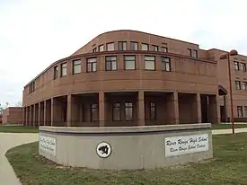 River Rouge High School
_2.jpg.webp) River Rouge Public library
River Rouge Public library_2.jpg.webp) Post office
Post office Jefferson Rouge River Bridge
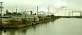 Industrial area along the riverfront of River Rouge
 Sabbath Middle School
Notes
- The unpopulated Zug Island uses the Detroit 48209 ZIP Code, while the rest of River Rouge uses the 48218 ZIP Code.
References
- "2019 U.S. Gazetteer Files". United States Census Bureau. Retrieved July 25, 2020.
- "U.S. Census website". United States Census Bureau. Retrieved 2012-11-25.
- "Population and Housing Unit Estimates". United States Census Bureau. May 24, 2020. Retrieved May 27, 2020.
- "U.S. Census website". United States Census Bureau. Retrieved 2008-01-31.
- U.S. Geological Survey Geographic Names Information System: River Rouge, Michigan
- "History of River Rouge". cityofriverrouge.com. Retrieved March 2, 2017.
- "US Gazetteer files 2010". United States Census Bureau. Archived from the original on 2012-01-25. Retrieved 2012-11-25.
- "Census of Population and Housing". Census.gov. Retrieved June 4, 2015.
External links
- City of River Rouge Official Website
- River Rouge Public Library Official Website
- River Rouge School District Official Website
Places adjacent to River Rouge, Michigan | ||||||||||
|---|---|---|---|---|---|---|---|---|---|---|
| ||||||||||
Downriver communities – Wayne County, Michigan | ||
|---|---|---|
| Cities | 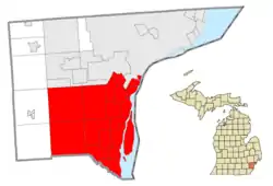 | |
| Charter townships | ||
| Civil township | ||
| Unincorporated communities | ||
| Footnotes | ‡This populated place also has portions in an adjacent county or counties | |
Municipalities and communities of Wayne County, Michigan, United States | ||
|---|---|---|
| Cities |
|  Map of Michigan highlighting Wayne County |
| Charter townships | ||
| Civil townships | ||
| Unincorporated communities | ||
| Ghost towns | ||
| Footnotes | ‡This populated place also has portions in an adjacent county or counties | |
| ||
| Topics |  | |
|---|---|---|
| Detroit | ||
| Municipalities over 80,000 | ||
| Municipalities 40,000 to 80,000 | ||
| Cultural enclaves | ||
| Satellite cities | ||
| Counties in MSA | ||
| Counties in CSA | ||
| Authority control |
|---|