Rocky Point, Kitsap County, Washington
Rocky Point is a census-designated place (CDP) in Kitsap County, Washington, United States.
Rocky Point, Washington | |
|---|---|
 Rocky Point  Rocky Point | |
| Coordinates: 47°35′10″N 122°40′05″W | |
| Country | United States |
| State | Washington |
| County | Kitsap |
| Area | |
| • Total | 0.76 sq mi (1.96 km2) |
| • Land | 0.75 sq mi (1.93 km2) |
| • Water | 0.008 sq mi (0.02 km2) |
| Elevation | 20 ft (6 m) |
| Population (2010) | |
| • Total | 1,564 |
| • Density | 2,096/sq mi (809.4/km2) |
| Time zone | Pacific |
| Area code(s) | 360 |
| FIPS code | 53-59390 |
| GNIS feature ID | 2585030 |
Demographics
In 2010, it had a population of 1,564 inhabitants,[1] 784 of whom were male, and 780 of whom were female.[2]
Geography
Rocky Point is located in central Kitsap County at coordinates 47°35′10″N 122°40′05″W. The CDP occupies a peninsula extending north from the city of Bremerton into the tidal Dyes Inlet, ending at Rocky Point. It is bordered to the east by Port Washington Narrows and Phinney Bay and to the west by Mud Bay, separating it from a parallel peninsula containing the Marine Drive neighborhood of Bremerton.
According to the U.S. Census Bureau, the Rocky Point CDP has a total area of 0.76 square miles (1.96 km2), of which 0.01 square miles (0.02 km2), or 1.26%, are water.
References
- "Geographic Identifiers: 2010 Census Summary File 1 (G001), Rocky Point CDP, Washington". American FactFinder. U.S. Census Bureau. Archived from the original on February 13, 2020. Retrieved July 3, 2019.
- "Rocky Point, Washington". Retrieved 19 August 2014.
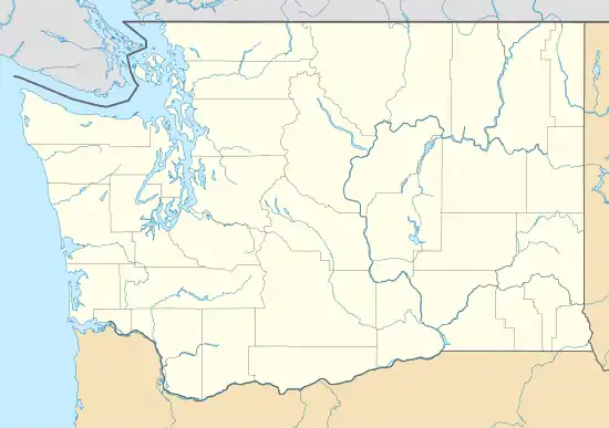
Municipalities and communities of Kitsap County, Washington, United States | ||
|---|---|---|
| Cities | 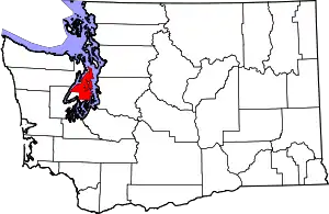 Map of Washington highlighting Kitsap County | |
| CDPs | ||
| Other unincorporated communities | ||
| Indian reservation | ||
| ||