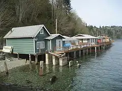
Kitsap County, Washington
Kitsap County is located in the U.S. state of Washington. As of the 2010 census, its population was 251,133.[1] Its county seat is Port Orchard,[2] and its largest city is Bremerton. The county was formed out of King County and Jefferson County on January 16, 1857, and is named for Chief Kitsap of the Suquamish Tribe. Originally named Slaughter County, it was soon renamed.[3]
Kitsap County | |
|---|---|
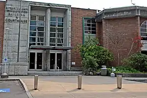 Kitsap County Courthouse | |
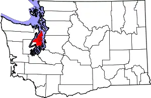 Location within the U.S. state of Washington | |
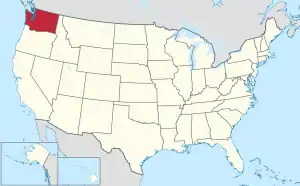 Washington's location within the U.S. | |
| Coordinates: 47.64°N 122.65°W | |
| Country | |
| State | |
| Founded | January 16, 1857 |
| Named for | Chief Kitsap |
| Seat | Port Orchard |
| Largest city | Bremerton |
| Area | |
| • Total | 566 sq mi (1,470 km2) |
| • Land | 395 sq mi (1,020 km2) |
| • Water | 171 sq mi (440 km2) 30%% |
| Population (2010) | |
| • Total | 251,133 |
| • Estimate (2019) | 271,473 |
| • Density | 644/sq mi (249/km2) |
| Time zone | UTC−8 (Pacific) |
| • Summer (DST) | UTC−7 (PDT) |
| Congressional district | 6th |
| Website | www |
Kitsap County comprises the Bremerton-Silverdale, WA Metropolitan Statistical Area, which is also included in the Seattle-Tacoma, WA Combined Statistical Area.
The United States Navy is the largest employer in the county, with installations at Puget Sound Naval Shipyard, Naval Undersea Warfare Center Keyport, and Naval Base Kitsap (which comprises former NSB Bangor, and NS Bremerton).
Kitsap County is connected to the eastern shore of Puget Sound by Washington State Ferries routes, including the Seattle-Bremerton Ferry, Southworth to West Seattle via Vashon Island, Bainbridge Island to Downtown Seattle, and from Kingston to Edmonds, Washington. Kitsap Transit provides passenger-only fast ferry service between Bremerton and Seattle and Kingston and Seattle.
History
The Kitsap Peninsula was originally acquired by the U.S. Government in three pieces by three treaties negotiated with the Native American tribes:
- The Treaty of Medicine Creek, signed 26 December 1854, ratified 3 March 1855
- The Treaty of Point Elliott, signed 22 January 1855, ratified 11 April 1859
- Point No Point Treaty, signed 26 January 1855, ratified 8 March 1859.[4]
Territorial Governor Isaac Stevens represented the United States in all three negotiations.
When the Washington Territory was organized in 1853, the Kitsap Peninsula was divided between King County to the east and Jefferson County to the west. Official public papers were required to be filed at the county seat, which meant Peninsula business people had to travel to either Seattle or Port Townsend to transact business. On the understanding that they would "bring home a new county," area mill operators George Meigs and William Renton supported the candidacies to the Territorial Legislature of two employees from their respective mills: Timothy Duane Hinckley from Meigs' and S.B. Wilson from Renton's.
Upon arrival in Olympia, the two men introduced bills to create a new county, to be named "Madison". Representative Abernathy from Wahkiakum County proposed an amendment to name it "Slaughter", in recognition of Lt. William Alloway Slaughter, who had been killed in 1855 in the Yakima War. The bill passed as amended. It was signed by Governor Isaac Stevens on January 16, 1857. The county seat would be located in Meigs's mill town at Port Madison.[5]
In Slaughter County's first election on July 13, 1857, voters were given the opportunity to rename the county. The options were "Mill", "Madison" or "Kitsap". Slaughter was not one of the options. Kitsap won by an overwhelming majority.[6]
Geography
According to the U.S. Census Bureau, the county has a total area of 566 square miles (1,470 km2), of which 395 square miles (1,020 km2) is land and 171 square miles (440 km2) (30%) is water.[7] It is the fourth-smallest county in Washington by land area and third-smallest by total area.
In addition to occupying most of the Kitsap Peninsula, Kitsap County includes both Bainbridge Island and Blake Island. According to Puget Sound Partnership, Kitsap county has over 250 miles (400 km) of saltwater shoreline.
The portion of the county north of Silverdale is often referred to as North Kitsap, and the portion south of Bremerton as South Kitsap.
Geographic features
Adjacent counties
- Island County - northeast
- Snohomish County - east
- King County - east/southeast
- Pierce County - south/southeast
- Mason County - southwest
- Jefferson County - northwest
Demographics
| Historical population | |||
|---|---|---|---|
| Census | Pop. | %± | |
| 1860 | 544 | — | |
| 1870 | 866 | 59.2% | |
| 1880 | 1,738 | 100.7% | |
| 1890 | 4,624 | 166.1% | |
| 1900 | 6,767 | 46.3% | |
| 1910 | 17,647 | 160.8% | |
| 1920 | 33,162 | 87.9% | |
| 1930 | 30,776 | −7.2% | |
| 1940 | 44,387 | 44.2% | |
| 1950 | 75,724 | 70.6% | |
| 1960 | 84,176 | 11.2% | |
| 1970 | 101,732 | 20.9% | |
| 1980 | 147,152 | 44.6% | |
| 1990 | 189,731 | 28.9% | |
| 2000 | 231,969 | 22.3% | |
| 2010 | 251,133 | 8.3% | |
| 2019 (est.) | 271,473 | [8] | 8.1% |
| U.S. Decennial Census[9] 1790–1960[10] 1900–1990[11] 1990–2000[12] 2010–2019[1] | |||
2010 census
As of the 2010 United States Census, there were 251,133 people, 97,220 households, and 65,820 families residing in the county.[13] The population density was 635.9 inhabitants per square mile (245.5/km2). There were 107,367 housing units at an average density of 271.9 per square mile (105.0/km2).[14] The racial makeup of the county was 82.6% white, 4.9% Asian, 2.6% black or African American, 1.6% American Indian, 0.9% Pacific islander, 1.6% from other races, and 5.8% from two or more races. Those of Hispanic or Latino origin made up 6.2% of the population.[13] In terms of ancestry, 21.3% were German, 14.4% were Irish, 13.8% were English, 7.1% were Norwegian, and 4.2% were American.[15]
Of the 97,220 households, 31.7% had children under the age of 18 living with them, 53.2% were married couples living together, 10.2% had a female householder with no husband present, 32.3% were non-families, and 25.2% of all households were made up of individuals. The average household size was 2.49 and the average family size was 2.97. The median age was 39.4 years.[13]
The median income for a household in the county was $59,549 and the median income for a family was $71,065. Males had a median income of $52,282 versus $38,499 for females. The per capita income for the county was $29,755. About 6.1% of families and 9.4% of the population were below the poverty line, including 11.8% of those under age 18 and 5.3% of those age 65 or over.[16]
Communities
Cities
- Bainbridge Island
- Bremerton
- Port Orchard (county seat)
- Poulsbo
Census-designated places
Other unincorporated communities
- Annapolis
- Bay Vista
- Breidablick
- Brownsville
- Camp Union
- Central Valley
- Clear Creek
- Crosby
- Eglon
- Fernwood
- Fragaria
- Gilberton
- Glenwood
- Harper
- Holly
- Horseshoe Lake
- Illahee
- Island Lake
- Kariotis
- Lofall
- Lone Rock
- Long Lake
- Olalla
- Olalla Valley
- Scandia
- South Colby
- South Park Village
- Virginia
- Waterman
- Wautauga Beach
- Wildcat Lake
- Wye Lake
Politics
Kitsap County is generally considered to be a relatively Democratic area. In the 2016 U.S. presidential election, Democrat Hillary Clinton received 49.05% of the vote to Republican Donald Trump's 38.07%.[17] There was a large improvement for the Democratic Party in 2020, with winning candidate Joe Biden getting 56.90% of the vote versus Trump's 38.80%.[18]
On mainland Kitsap County, politics are dominated by working-class Bremerton, which casts moderate margins for Democratic candidates. However, population shifts have resulted in Bremerton playing less of a role in politics, and unincorporated Kitsap County is a mix of battleground areas and staunchly Republican areas. Non-Bremerton parts of incorporated mainland Kitsap County vary, with Silverdale having become a Republican stronghold, Poulsbo marginally Democratic, and Port Orchard consistently electing Republican candidates over Democrats.
Democrats normally carry the Indian reservations of the area by wide margins; the area around Little Boston (part of the S'Klallam Indian Reservation) regularly gives Democratic candidates landslides of 10-to-1. The multicultural Port Madison Indian Reservation (across from Bainbridge Island) also gives Democrats victories of upwards of 3-to-1.
Democratic electoral control of Kitsap County is partly due to Bainbridge Island, which casts a significant number of votes and is almost 4-to-1 Democratic. Bainbridge Island's growth and Democratic trend offset the population losses of Bremerton, generally resulting in the county as a whole being stable but very close.
The Kitsap County Auditor Website has detailed election results from 1998 to the present. County area political trends can be tracked by analyzing the election precinct data.[19]
| Year | Republican | Democratic | Third parties |
|---|---|---|---|
| 2020 | 38.8% 61,563 | 56.9% 90,277 | 4.3% 6,832 |
| 2016 | 38.1% 49,018 | 49.1% 63,156 | 12.9% 16,596 |
| 2012 | 42.6% 52,846 | 54.2% 67,277 | 3.2% 3,978 |
| 2008 | 42.6% 53,297 | 54.9% 68,624 | 2.5% 3,090 |
| 2004 | 46.9% 55,608 | 51.2% 60,796 | 1.9% 2,266 |
| 2000 | 45.1% 46,427 | 48.9% 50,302 | 6.0% 6,138 |
| 1996 | 38.6% 35,304 | 48.3% 44,167 | 13.1% 12,016 |
| 1992 | 33.1% 29,340 | 38.9% 34,442 | 28.0% 24,786 |
| 1988 | 49.9% 34,743 | 48.5% 33,748 | 1.7% 1,158 |
| 1984 | 54.1% 36,101 | 44.5% 29,681 | 1.4% 931 |
| 1980 | 48.8% 29,420 | 34.7% 20,893 | 16.6% 9,983 |
| 1976 | 45.6% 23,124 | 50.6% 25,701 | 3.8% 1,925 |
| 1972 | 56.8% 25,831 | 37.4% 17,011 | 5.7% 2,604 |
| 1968 | 36.5% 14,520 | 55.9% 22,273 | 7.6% 3,022 |
| 1964 | 28.4% 10,702 | 71.3% 26,904 | 0.3% 108 |
| 1960 | 46.8% 17,459 | 52.7% 19,662 | 0.5% 181 |
| 1956 | 47.7% 17,986 | 52.1% 19,641 | 0.2% 58 |
| 1952 | 44.9% 16,876 | 54.6% 20,531 | 0.5% 189 |
| 1948 | 32.2% 9,869 | 63.7% 19,538 | 4.1% 1,271 |
| 1944 | 31.6% 11,224 | 67.7% 24,016 | 0.7% 251 |
| 1940 | 28.2% 5,525 | 70.7% 13,861 | 1.1% 210 |
| 1936 | 21.0% 3,440 | 75.9% 12,414 | 3.0% 493 |
| 1932 | 24.5% 3,465 | 70.6% 10,002 | 5.0% 706 |
| 1928 | 63.0% 6,544 | 35.3% 3,668 | 1.7% 180 |
| 1924 | 45.2% 3,954 | 5.6% 490 | 49.2% 4,306 |
| 1920 | 49.4% 4,989 | 13.4% 1,350 | 37.2% 3,759 |
| 1916 | 37.8% 2,638 | 49.9% 3,479 | 12.3% 857 |
| 1912 | 20.1% 1,224 | 15.9% 969 | 63.9% 3,889 |
| 1908 | 56.1% 1,819 | 26.2% 850 | 17.7% 572 |
| 1904 | 69.2% 1,736 | 12.8% 320 | 18.1% 453 |
| 1900 | 58.4% 880 | 32.5% 489 | 9.1% 137 |
| 1896 | 48.9% 728 | 48.9% 728 | 2.2% 33 |
| 1892 | 34.6% 438 | 29.2% 370 | 36.2% 458[lower-alpha 1] |
Government
Board of County Commissioners
- Robert Gelder (D) District #1, North Kitsap.
Gelder was appointed to replace Steve Bauer, who resigned in March 2011.
- Charlotte Garrido (D) - District #2, South Kitsap.
Garrido was re-elected in Nov. 2012, when she defeated Linda Simpson. Commissioner Garrido previously served on the county commission from 1997 to 2000 and again from 2009 to 2012.[21]
- Ed Wolfe (R) - District #3, Central Kitsap.
Wolfe became the first elected Republican county commissioner since Jan Angel was elected South Kitsap Commissioner in 2004. Wolfe replaced Linda Streissguth (D), who had been appointed in January 2014 to replace Josh Brown (D).[22] Prior to his election, he was a local attorney specializing in litigation and business law. Commissioner Wolfe served with the U.S. State Department during the Ronald Reagan and George H.W. Bush administrations as Deputy Assistant Secretary of State for Oceans and Fisheries Affairs with the rank of ambassador.
23rd Legislative District
Bainbridge Island, East Bremerton, Poulsbo and Silverdale
- Sen. Christine Rolfes (D) - Elected Nov 2012.
- Rep. Tarra Simmons (D) - First elected Nov. 2021.
- Rep. Drew Hansen (D) - Appointed Sept. 2011 to replace Christine Rolfes who had been appointed to the Senate. First elected in Nov. 2012.
26th Legislative District
Bremerton, Gig Harbor and Port Orchard
- Sen. Emily Randall (D)
- Rep. Jesse Young (R)
- Rep. Michelle Caldier (R)
35th Legislative District
Bremerton, Shelton and Mason County
- Sen. Tim Sheldon (D)* (Member of the Bi-Partisan Majority Coalition Caucus)
- Rep. Dan Griffey (R)
- Rep. Drew C. MacEwen (R)
Education
Post-secondary education
Transportation
Kitsap County is connected to the eastern shore of Puget Sound by several Washington State Ferries routes, including the Seattle-Bremerton Ferry, Southworth to West Seattle via Vashon Island, Bainbridge Island to Downtown Seattle, and from Kingston to Edmonds, Washington.
Kitsap Transit provides local transit service within Kitsap County and connects to other transit systems that continue onto the Olympic Peninsula. The agency launched its fast ferry services to Seattle in July 2017, beginning initially with a Bremerton route and later expanding to Kingston in 2018.[23][24] Fast ferry service to Southworth is expected to begin in 2020.
The county is connected to Jefferson County and the Olympic Peninsula to the west by the Hood Canal Bridge.
A 48-mile-long (77 km) government-owned rail line, the Bangor-Shelton-Bremerton Navy Railroad, runs through the county. It is a branch off the Puget Sound and Pacific Railroad, with its junction at Shelton. At the Bremerton Junction near Gorst a spur follows Highway 3 along the shore of the Sinclair Inlet terminating at the Puget Sound Naval Ship Yard, the other follows Highway 3 along the western shore of Dyes Inlet, servicing Bangor Naval Submarine Base. The Navy had originally intended to use armored trains to transport nuclear missiles to Bangor for the Trident submarines but protesters and a series of court decisions derailed the plan. Today the railroad is primarily used to transport scrap from PSNS.[25]
Notable people
- Tarn Adams, programmer and game designer, creator of Dwarf Fortress and other games
- Nathan Adrian, swimmer and Olympic gold medalist
- Ben Gibbard, musician
- Russell Johnson, actor, best known as The Professor on TV's Gilligan's Island.
- James Kelsey, sculptor
- Debbie Macomber, best-selling romance novelist
- Gregg Olsen, best-selling mystery/crime novelist
- Benji Olson, NFL player for Tennessee Titans
- Delilah Rene, radio personality, author and songwriter
- Bree Schaaf, 2010 Winter Olympics competitor in bobsled.
- Aaron Sele, former all-star MLB pitcher.
- Ben Shepherd, bass player of Seattle rock band Soundgarden
- Marvin Williams, NBA player for the Atlanta Hawks
- Andrew Wood, lead singer of Seattle rock band Mother Love Bone
- Scott Shipley, slalom canoeist
- Richard F. Gordon Jr., naval officer and aviator, test pilot, and NASA astronaut
In popular culture
Walking Tall with The Rock and Johnny Knoxville was based in Kitsap County, and the City of Port Orchard is the basis for the fictional community of Cedar Cove in the books by Debbie Macomber.
Notes
- The leading "other" candidate, Populist James B. Weaver, received 400 votes, whilst Prohibition Party nominee John Bidwell received 58 votes.
References
- "State & County QuickFacts". United States Census Bureau. Archived from the original on June 7, 2011. Retrieved January 7, 2014.
- "Find a County". National Association of Counties. Archived from the original on 2011-05-31. Retrieved 2011-06-07.
- "Milestones for Washington State History — Part 2: 1851 to 1900". HistoryLink.org. March 6, 2003.
- Clark, William G. (Summer 1985). "Fishing in a Sea of Court Orders: Puget Sound Salmon Management 10 Years After the Boldt Decision" (PDF). North American Journal of Fisheries Management. 5 (3B): 417–434. doi:10.1577/1548-8659(1985)5<417:FIASOC>2.0.CO;2. Archived from the original (PDF) on February 21, 2017. Retrieved 2017-06-28.
- Bowen et al. (1981), p. 11.
- Bowen et al. (1981), p. 12.
- "2010 Census Gazetteer Files". United States Census Bureau. August 22, 2012. Retrieved July 7, 2015.
- "Population and Housing Unit Estimates". Retrieved April 11, 2020.
- "U.S. Decennial Census". United States Census Bureau. Retrieved January 7, 2014.
- "Historical Census Browser". University of Virginia Library. Retrieved January 7, 2014.
- "Population of Counties by Decennial Census: 1900 to 1990". United States Census Bureau. Retrieved January 7, 2014.
- "Census 2000 PHC-T-4. Ranking Tables for Counties: 1990 and 2000" (PDF). United States Census Bureau. Retrieved January 7, 2014.
- "DP-1 Profile of General Population and Housing Characteristics: 2010 Demographic Profile Data". United States Census Bureau. Archived from the original on February 13, 2020. Retrieved March 6, 2016.
- "Population, Housing Units, Area, and Density: 2010 - County". United States Census Bureau. Archived from the original on February 13, 2020. Retrieved March 6, 2016.
- "DP02 SELECTED SOCIAL CHARACTERISTICS IN THE UNITED STATES – 2006-2010 American Community Survey 5-Year Estimates". United States Census Bureau. Archived from the original on February 13, 2020. Retrieved March 6, 2016.
- "DP03 SELECTED ECONOMIC CHARACTERISTICS – 2006-2010 American Community Survey 5-Year Estimates". United States Census Bureau. Archived from the original on February 13, 2020. Retrieved March 6, 2016.
- "General Election Official Final". Kitsap County Auditor. Archived from the original on April 2, 2016. Retrieved March 1, 2015.
- https://results.vote.wa.gov/results/20201103/kitsap/
- https://web.archive.org/web/20060318203842/http://www.kitsapgov.com/aud/elections/archive.htm
- Leip, David. "Dave Leip's Atlas of U.S. Presidential Elections". uselectionatlas.org. Retrieved April 6, 2018.
- Kitsap's 'New' Electeds Sworn In Amid Familiar Surroundings - Story Archived 2011-07-13 at the Wayback Machine
- Streissguth picked for vacant Kitsap County commissioner post - Story
- Friedrich, Ed (July 10, 2017). "First fast ferry sailed at sunrise". Kitsap Sun. Retrieved February 20, 2020.
- Gutman, David (November 3, 2018). "Kitsap Transit launching Kingston-to-Seattle fast ferry service after Thanksgiving". The Seattle Times. Retrieved February 20, 2020.
- Friedrich, Ed (24 September 2012). "Much Has Changed Since Bangor's Ammo Depot Days". Kitsap Sun. Bremerton, Wash.
Bibliography
- Bowen, Evelyn T.; Kvelstad, Rangvald; Parfitt, Elnora; Perry, Fredi; Stott, Virginia (1977). Kitsap County: A History: A Story of Kitsap County and its Pioneers (Second Edition, 1981 ed.). Seattle: Dinner & Klein.
External links
| Wikimedia Commons has media related to Kitsap County, Washington. |
- Kitsap County official website
- Kitsap County USGenWeb
- Kitsap Peninsula Visitor and Convention Bureau
- Kitsap Economic Development Alliance
- Kitsap Historical Society and Museum Archived 2014-08-19 at the Wayback Machine
- Kitsap County, Washington at Curlie
Places adjacent to Kitsap County, Washington | ||||||||||
|---|---|---|---|---|---|---|---|---|---|---|
| ||||||||||
Municipalities and communities of Kitsap County, Washington, United States | ||
|---|---|---|
| Cities | Map of Washington highlighting Kitsap County | |
| CDPs | ||
| Other unincorporated communities | ||
| Indian reservation | ||
| ||
| Authority control |
|---|