Southworth, Washington
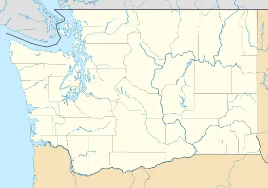
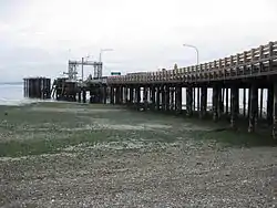
Southworth is an unincorporated community and census-designated place (CDP) on Puget Sound in Kitsap County, Washington, United States.[1] It is best known for being the west end of the Fauntleroy-Vashon Island-Southworth Washington State Ferries run. Landmarks include Southworth Grocery, a US Post Office, ferry terminal, clay cliffs and a private beach on the point. Next to the ferry is a popular place to launch kayaks for trips to nearby Blake Island. The population of the Southworth CDP was 2,185 at the 2010 census.[2]
Southworth, Washington | |
|---|---|
 Southworth Location in Washington and the United States  Southworth Southworth (the United States) | |
| Coordinates: 47°30′44″N 122°30′02″W | |
| Country | United States |
| State | Washington |
| County | Kitsap |
| Area | |
| • Total | 3.39 sq mi (8.77 km2) |
| • Land | 3.37 sq mi (8.74 km2) |
| • Water | 0.008 sq mi (0.02 km2) |
| Elevation | 49 ft (15 m) |
| Population (2010) | |
| • Total | 2,185 |
| • Density | 647/sq mi (250.0/km2) |
| Time zone | UTC-8 (Pacific (PST)) |
| • Summer (DST) | UTC-7 (PDT) |
| ZIP code | 98386 |
| FIPS code | 53-66220 |
| GNIS feature ID | 1512679[1] |
Geography
Southworth is in southeastern Kitsap County on the shore of Puget Sound, with the CDP limits extending southwest from Point Southworth 0.5 miles (0.80 km) along Colvos Passage and northwest from Point Southworth 2.5 miles (4.0 km) to Yukon Harbor. The CDP includes the communities of Southworth, Harper, and South Colby. Washington State Route 160 is the southern edge of the CDP and leads west 7 miles (11 km) to State Route 16 in the southern outskirts of Port Orchard.
Point Southworth was named by Charles Wilkes, during the Wilkes Expedition of 1838–1842, in honor of Edward Southworth, one of the expedition's quartermasters.[3]
According to the U.S. Census Bureau, the Southworth CDP has a total area of 3.39 square miles (8.77 km2), of which 0.01 square miles (0.02 km2), or 0.28%, are water.[2]
References
- "Southworth". Geographic Names Information System. United States Geological Survey.
- "Geographic Identifiers: 2010 Census Summary File 1 (G001), Southworth CDP, Washington". American FactFinder. U.S. Census Bureau. Archived from the original on February 13, 2020. Retrieved July 5, 2019.
- Phillips, James W. (1971). Washington State Place Names. University of Washington Press. pp. 134. ISBN 0-295-95158-3.
External links
 Southworth (Washington) travel guide from Wikivoyage
- Kitsap Peninsula Visitor Information - Southworth
Municipalities and communities of Kitsap County, Washington, United States | ||
|---|---|---|
| Cities | 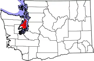 Map of Washington highlighting Kitsap County | |
| CDPs | ||
| Other unincorporated communities | ||
| Indian reservation | ||
| ||