Rupt de Mad
The Rupt de Mad (French: le Rupt de Mad) is a 54.6-kilometre (33.9 mi) long river in the Meuse and Meurthe-et-Moselle départements, northeastern France.[1] Its source is several small streams which rise at Geville, 17 kilometres (11 mi) northwest of Toul. It flows generally northeast. It is a left tributary of the Moselle into which it flows at Arnaville, 15 kilometres (9 mi) southwest of Metz.
| Rupt de Mad | |
|---|---|
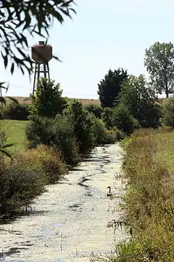 The Rupt de Mad at Lahayville | |
| Location | |
| Country | France |
| Physical characteristics | |
| Source | |
| • location | Geville |
| • coordinates | 48°47′48″N 05°42′33″E |
| • elevation | 240 m (790 ft) |
| Mouth | |
• location | Moselle |
• coordinates | 49°00′47″N 06°02′38″E |
• elevation | 170 m (560 ft) |
| Length | 54.6 km (33.9 mi) |
| Basin size | 385 km2 (149 sq mi) |
| Discharge | |
| • average | 3.65 m3/s (129 cu ft/s) |
| Basin features | |
| Progression | Moselle→ Rhine→ North Sea |
Départements and communes along its course
This list is ordered from source to mouth:
- Meuse: Geville, Broussey-Raulecourt, Bouconville-sur-Madt, Rambucourt, Xivray-et-Marvoisin, Richecourt, Lahayville
- Meurthe-et-Moselle: Saint-Baussant, Essey-et-Maizerais, Pannes, Euvezin, Bouillonville, Thiaucourt-Regniéville, Jaulny, Rembercourt-sur-Mad, Waville, Villecey-sur-Mad, Onville, Vandelainville, Bayonville-sur-Mad, Arnaville
Notes
- This article is based on the equivalent article from the French Wikipedia, consulted on 21 April 2009.
External links
| Wikimedia Commons has media related to Rupt de Mad. |
Tributaries of the river Moselle | ||
|---|---|---|
| From the left | ||
| From the right | ||
This article is issued from Wikipedia. The text is licensed under Creative Commons - Attribution - Sharealike. Additional terms may apply for the media files.