Ruthernbridge
Ruthernbridge (Cornish: Ponsrudhyn)[1] is a village in the parish of Withiel in Cornwall, England, UK.[2]
| Ruthernbridge | |
|---|---|
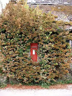 The postbox at Ruthernbridge | |
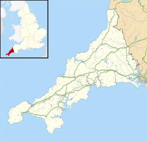 Ruthernbridge Location within Cornwall | |
| OS grid reference | SX 01293 66832 |
| Unitary authority | |
| Ceremonial county | |
| Region | |
| Country | England |
| Sovereign state | United Kingdom |
| Post town | BODMIN |
| Postcode district | PL30 |
| Dialling code | 01208 |
| Police | Devon and Cornwall |
| Fire | Cornwall |
| Ambulance | South Western |
| UK Parliament | |
The early 15th-century bridge with two pointed arches carries the road over the River Ruthern.[3]
When the Bodmin and Wadebridge Railway (B&W) was built in 1834 it included a short branch of about 1.25 miles (2.01 km) from Grogley Junction to Ruthernbridge. Although not a requirement, the B&W placed stone markers every quarter of a mile, and a marker stone at each terminus showing the distance to the company's headquarters in Wadebridge, that at Ruthernbridge showing a distance of 4 miles 1 furlong 5 chains 10 yards.[4][5] The main use of the line was to carry sand to local farms for use as a soil improver while ores of Lead, Iron and Copper from Mulberry Mine and Iron from Blackhay Mine were taken out.[6][7] Although there was never an official passenger service on the branch and no platform or other facilities were provided, passengers were carried in the tool wagon.[5] The original terminus had two sidings, one of which ran over wooden sand drops, and in 1914 a loop long enough to accommodate 8 wagons was installed 6 chains (120 m) up the line towards Grogley, the line being shortened to this location in 1926.[8] The line ran along a lane for almost the whole length falling at a gentle incline of 1 in 158, this requiring any wagons left at Ruthernbridge to be chained to the rails to prevent them running away.[4] In later years the only engines to work the branch were Beattie well tanks, which would work chimney-first to Ruthernbridge and then propel their train back to the junction as there were no run-round facilities as Grogley.[4] The last train to Ruthernbridge ran on 29 November 1933 and the line officially closed on 30 December that year, less than 1 year short of its centenary.[8]
References
- Place-names in the Standard Written Form (SWF) : List of place-names agreed by the MAGA Signage Panel. Cornish Language Partnership.
- Ordnance Survey: Landranger map sheet 200 Newquay & Bodmin (Map). Ordnance Survey. ISBN 978-0-319-22938-5.
- Pevsner, N. (1970) Cornwall; 2nd ed., revised by Enid Radcliffe. Harmondsworth: Penguin; p. 241
- Fairclough, Tony; Wills, Alan (1979). Bodmin and Wadebridge 1834-1978. Truro: D Bradford Barton. pp. 40–41. ISBN 0 85153 343 4.
- Fairclough, Tony (1970). The Story of Cornwall's Railways. Truro: Tor Mark Press. pp. 12–14.
- Ingrey, Jack (1989). The Camel Footpath : From Wadebridge to Bodmin and Wenfordbridge. Cornish Walkabout Books. Padstow: Lodenek Press. p. 30. ISBN 0 946143 14 X Check
|isbn=value: checksum (help). - "Blackhay Mine, Withiel". mindat.org. 2020. Retrieved 13 December 2020.
- Mitchell, Vic; Smith, Keith (1996). Branch lines around Bodmin. Midhurst: Middleton Press. pp. 28–29. ISBN 1 873793 83 9.
Cornwall Portal | |
| Unitary authorities | |
| Major settlements |
|
| Rivers | |
| Topics | |
