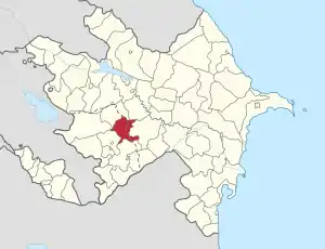
Sırxavənd
Sırxavənd (Syrkhavend; Armenian: Նոր Ղազանչի, romanized: Nor Ghazanchi) is a village de jure in Agdam District of Azerbaijan, de facto in Martakert Province of the self-proclaimed Republic of Artsakh. The village had an Azerbaijani majority prior to their expulsion during the First Nagorno-Karabakh War.[1] The village had 177 inhabitants in 2005.[2]
Sırxavənd
Նոր Ղազանչի • Nor Ghazanchi | |
|---|---|
 Sırxavənd 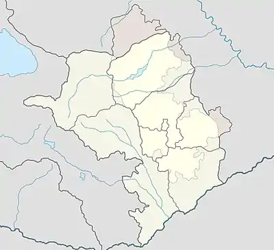 Sırxavənd | |
| Coordinates: 40°03′54″N 46°41′06″E | |
| Country | |
| District | Agdam (de jure) |
| Province | Martakert (de facto) |
| Population (2015) | |
| • Total | 143 |
| Time zone | UTC+4 (AZT) |
Geography
The village of Nor Ghazanchi was founded on the left bank of the Xaçın River in the mountainous regions of Murovdağ. Its total area is 2181 hectares of which 487 hectares are of agricultural significance and 1582 hectares consists of forest lands. The village is located on the Ağdərə-Xankəndi mountain road, which was built in the early 1960s. Nor Ghazanchi is 30 km away from Ağdam and Mardakert and 40 km away from Stepanakert.
History
Before the collapse of the USSR
The current village was founded in the 17th century, but the ancient landscape shows that it was a settlement since the 12th century. A church, Gevorg Church was built in the 19th century but was later destroyed. There are numerous khachkars and ancient gravestones in the surroundings of Tunis Beekeeper, Beacarac sacred places, the Red Kala, the Aristamz bar, the Jalalants bath and other places. 167 people took part in the WW II, 65 were killed, in memory of which the monument is erected The collective was formed in 1931 and was electrified in 1963.[3]
Until the collapse of the USSR, it was part of the Nagorno-Karabakh Autonomous Oblast (NKAO), established in 1923. In April 1991, in connection with the conflict in Nagorno-Karabakh, the Sırxavənd territorial executive committee was established by the decision of the then government of Azerbaijan. The goal was to create a management centre for 12 Azerbaijani villages in Ağdərə (today Martakert) with Sırxavənd as its administrative centre, homing the territorial police department, the agricultural department, the education department, a logistics supply base, an automotive base, two road repair office and more. Various enterprises were created and started operating. In December 1991, the village self-defence battalion was created officially, appointing Bəhmən Məmmədov head of the battalion.[4]
During the Nagorno-Karabakh-war
The village was occupied by Armenian Armed Forces on March 12, 1992, together with other villages of Azerbaijan in the Mardakert District – Bəşirlər, Qaraşlar, Baş Güneypəyə, Orta Güney, Xatınbəyli and the surrounding territory. Since its capture until the ceasefire, there have been various attempts by Azerbaijan to recapture the territory, in one of these attempts, on November 2, 1992, the "National Hero of Azerbaijan" Anvar Talish oglu Arazov was killed.[5]
Population
Azerbaijani population
In 1908, the village's population consisted of 430 people, with all of them being Azerbaijanis.[6] This number rose to 514 by 1921.[7] According to Armenian sources, at the beginning of the 1990s, there were 325 residents and 35 houses in the village, in 1970, 455 residents and 89 houses, in 1987, 260 inhabitants and 75 houses.[3]
According to Azerbaijani sources, there were around 2,000 people living in the village during the late Soviet period, which would have made it the largest Azerbaijani village in the Mardakert District of the Nagorno-Karabakh Autonomous Oblast.[8] According to Azerbaijani claims, Azerbaijani-majority villages in the NKAO were disadvantaged regarding socio-economic and cultural development, which led to migration from the region with many relocating to the relatively densely populated areas in the Barda District outside of Nagorno-Karabakh.
Armenian population
The current population of the Nor Ghazanchi community is 143 people. There are 42 businesses. The population is mainly engaged in agriculture, cattle-breeding, and farming. In 2005 an estimated 177 people lived there.[2]
References
- "Карта 33. Зона конфликта в Нагорном Карабахе (1988–1994...)". iriston.com.
- Population of the Nagorno-Karabakh Republic (2005)
- Մելքումյան, Ս. (1990). Լեռնային Ղարաբաղ. Yerevan. p. 178.
- "SIRXAVƏND". My Aghdara – My Azerbaijan (in Azerbaijani). 2010-05-01. Retrieved 2019-03-14.
- "Azərbaycan :: Baş səhifə". www.azerbaijans.com. Retrieved 2019-03-14.
- Кавказский календарь на 1910 г., ч. 1, с. 365
- "Д Ж Р А Б Е Р Д С К И Й Р А Й О Н". karabagh.am (in Russian).
- "ƏSİR YURDLARDAN BİRİ. SIRXAVƏNDİN İŞĞALINDAN 17 İL KEÇİR (AĞDƏRƏ)" (in Azerbaijani).