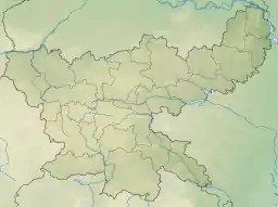
Sadni Falls
Sadni Falls (also called Sadnighagh Falls) is a waterfall located about 3 kilometres (1.9 mi) from Rajadera village in Gumla district in the Indian state of Jharkhand.[2]
| Sadni Falls | |
|---|---|
 Sadni Falls | |
| Location | Rajadera, Gumla district, Jharkhand, India |
| Coordinates | 23°17′00″N 84°14′00″E[1] |
| Type | Snake |
| Elevation | 934 metres (3,064 ft) |
| Total height | 60 metres (200 ft) |
| Watercourse | Sankh River |
The Falls
The 60 metres (200 ft) falls on the Sankh River is a scarp fall. It is referred to as a snake type falls and is a popular picnic spot.[3][4] Its surroundings are spectacular with hillocks, forests and streams.[5]
History
Once upon a time, active diamond mines existed at Sadni Falls. These mines yielded many large and fine stones in the sixteenth and the seventeenth centuries.[6]
Transport
See also
- List of waterfalls in India
- List of waterfalls in India by height
References
- "Rajadera, India Page". Falling Rain Genomics. Retrieved 20 April 2010.
- "Rajadera". india9. Retrieved 20 April 2010.
- "Jharkhand". Jharkhand Govt. Retrieved 20 April 2010.
- Bharatdwaj, K. (2006). Physical Geography: Hydrosphere By K. Bharatdwaj. ISBN 9788183561679. Retrieved 20 April 2010.
- "Sadani Falls". india9. Retrieved 20 April 2010.
- "History of Diamond mining in Jharkhand and Chhattisgarh". Environment and Geology. Retrieved 20 April 2010.
- Guru, Travel (20 March 2014). "Sadni Waterfalls". Beautiful Indian Tourist Spots. Retrieved 13 May 2020.
This article is issued from Wikipedia. The text is licensed under Creative Commons - Attribution - Sharealike. Additional terms may apply for the media files.
