Saint-Andéol-de-Berg
Saint-Andéol-de-Berg is a commune in the Ardèche department in the Auvergne-Rhône-Alpes region in southern France.
Saint-Andéol-de-Berg | |
|---|---|
.JPG.webp) Sheep grazing outside the village in 1997 | |
Location of Saint-Andéol-de-Berg 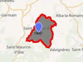
| |
 Saint-Andéol-de-Berg  Saint-Andéol-de-Berg | |
| Coordinates: 44°31′41″N 4°31′41″E | |
| Country | France |
| Region | Auvergne-Rhône-Alpes |
| Department | Ardèche |
| Arrondissement | Largentière |
| Canton | Berg-Helvie |
| Intercommunality | Berg et Coiron |
| Government | |
| • Mayor (2008–2014) | Régis Ozil |
| Area 1 | 15.57 km2 (6.01 sq mi) |
| Population (2017-01-01)[1] | 123 |
| • Density | 7.9/km2 (20/sq mi) |
| Time zone | UTC+01:00 (CET) |
| • Summer (DST) | UTC+02:00 (CEST) |
| INSEE/Postal code | 07208 /07170 |
| Elevation | 262–524 m (860–1,719 ft) (avg. 375 m or 1,230 ft) |
| 1 French Land Register data, which excludes lakes, ponds, glaciers > 1 km2 (0.386 sq mi or 247 acres) and river estuaries. | |
Population
|
|
See also
References
- "Populations légales 2017". INSEE. Retrieved 6 January 2020.
External links
| Wikimedia Commons has media related to Saint-Andéol-de-Berg. |
This article is issued from Wikipedia. The text is licensed under Creative Commons - Attribution - Sharealike. Additional terms may apply for the media files.