Saint-André, New Brunswick
Saint-André (2016 pop.: 772[2]) is an incorporated rural community in Saint-André Parish, Madawaska County, New Brunswick, Canada.[3]
Saint-André | |
|---|---|
 Flag | |
| Motto(s): "Fructus ex floribus" | |
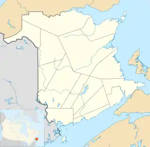
 Saint-André Location of Saint-André, New Brunswick | |
| Coordinates: 47.1°N 67.76°W | |
| Country | |
| Province | |
| County | Madawaska |
| Parish | Saint-André |
| Founded | 1904 |
| Incorporated | 1967 |
| Electoral Districts Federal | Tobique—Mactaquac |
| Provincial | Grand Falls-Drummond-Saint-André |
| Government | |
| • Type | Community Council |
| • Mayor | Marcel Levesque |
| • Councillors | List of Members
|
| Area | |
| • Total | 8.04 km2 (3.10 sq mi) |
| Population (2016)[2] | |
| • Total | 772 |
| • Density | 96.0/km2 (249/sq mi) |
| • Change 2011-16 | |
| • Census Ranking | 3,303 of 5,008 |
| Time zone | UTC-4 (AST) |
| • Summer (DST) | UTC-3 (ADT) |
| Area code(s) | 506 |
| Dwellings | 341 |
| Median Income* | $57,472 CDN |
| Website | Saint-André, NB |
| |
Situated in a potato farming area, Saint-André was founded in 1904.
Demographics
History
Notable people
See also
References
- Government of New Brunswick website: Saint-André Archived 2011-06-11 at the Wayback Machine
- "Census Profile, 2016 Census Saint-André, Rural community". 2016 Census. Statistics Canada. Retrieved August 11, 2019.
- "New Brunswick Regulation 2006-34 under the Municipalities Act (O.C. 2006-185)". Government of New Brunswick. Retrieved 19 July 2020.
- Statistics Canada: 1996, 2001, 2006 census
- Statistics Canada Population and dwelling counts, for Canada, provinces and territories, and census subdivisions (municipalities), 2011 and 2006 censuses
This article is issued from Wikipedia. The text is licensed under Creative Commons - Attribution - Sharealike. Additional terms may apply for the media files.