Saint-André Parish, New Brunswick
Saint-André is a civil parish in Madawaska County, New Brunswick, Canada.[2]
Saint-André
St. André | |
|---|---|
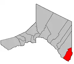 Location within Madawaska County, New Brunswick. | |
| Coordinates: 47.14361°N 67.755°W | |
| Country | |
| Province | |
| County | Madawaska |
| Erected | 1907 |
| Area | |
| • Land | 128.18 km2 (49.49 sq mi) |
| Population (2016)[1] | |
| • Total | 1,129 |
| • Density | 8.8/km2 (23/sq mi) |
| • Pop 2011-2016 | |
| • Dwellings | 448 |
| Time zone | UTC-4 (AST) |
| • Summer (DST) | UTC-3 (ADT) |
For governance purposes it is divided between the town of Grand Falls and the incorporated rural community of Saint-André,[3] both of which are members of the Northwest Regional Service Commission (NWRSC).[4]
Origin of name
The parish takes its name from the Roman Catholic ecclesiastical parish.[5]
History
Saint-André was erected from Saint-Léonard Parish in 1907.[5]
Delineation
Saint-André Parish is defined in the Territorial Division Act[2] as being bounded:
- All that part of the former Parish of Saint-Léonard in the County of Madawaska, lying southeasterly of the following described lines, namely: Beginning on the eastern bank or shore of the Saint John River, at the most western angle of lot No. 147, granted to Peter C. Martin, above Powers Creek, thence northeasterly along the northwest line of said lot to the most northern angle thereof, thence southeasterly along the northeastern line of said lot and its southeastern prolongation to the southwest angle of lot No. 1, granted to R. Poitras in the second tier, thence northerly along the western line of said lot to the most northern angle thereof, thence southeasterly along the northeastern line of said lot to the most southern angle of lot number two hundred and eleven granted to O. Bellefleur, junior, in Block R., thence northeasterly along the southeastern line of said lot and its northeastern prolongation to the most eastern angle of lot No. 314 in Block R. aforesaid, thence northwesterly along the northeastern line of said lot to the most western angle of lot No. 12 in the first tract, Saint-Amand,[lower-alpha 1] thence northeasterly along the northwestern line of said lot and its northeastern prolongation to the southern line of lot No. 3, on the southern side of Coombes Road [Settlement], thence easterly along the southern base line of lots fronting on the southern side of Coombes Road to the southeastern angle of lot No. 13 granted to Juliene John, thence northerly along the eastern line of said lot to the northeast angle thereof, thence easterly along the southern line of lot No. 15 granted to Alexander Michaud, to the southeast angle thereof, thence north along the eastern line of said lot to the northeast angle of the same, and thence easterly along the eastern prolongation of the northern line of last mentioned lot to the line dividing the Counties of Madawaska and Victoria.
Communities
Parish population total does not include incorporated municipalities (in bold):
|
|
Bodies of water
Bodies of water at least partly in the parish
- Saint John River
Demographics
Population
|
LanguageMother tongue (2016)[1]
|
See also
Notes
- Actually Cyr Settlement; the confusion is caused by the community of Saint-Amand within the Settlement.
References
- "Census Profile, 2016 Census Saint-André, Parish [Census subdivision], New Brunswick". Statistics Canada. Retrieved August 29, 2019.
- "Chapter T-3 Territorial Division Act". Government of New Brunswick. Retrieved 13 November 2020.
- "New Brunswick Regulation 2006-34 under the Municipalities Act (O.C. 2006-185)". Government of New Brunswick. Retrieved 19 July 2020.
- "Communities in each of the 12 Regional Service Commissions (RSC) / Les communautés dans chacune des 12 Commissions de services régionaux (CSR)" (PDF), Government of New Brunswick, July 2017, retrieved 2 February 2021
- "6 Edward 7 c. 22 An Act to amend an Act intituled 'An Act to revise and codify an Act to provide for the division of the Province into Counties, Towns and Parishes,' so far as relates to the County of Madawaska.". Acts of the Legislative Assembly of New Brunswick. Passed in the Month of March. 1906. Fredericton: Government of New Brunswick. 1906. pp. 62–66.
- Statistics Canada: 1996, 2001, 2006 census
- 2011 Statistics Canada Census Profile: Saint-André Parish, New Brunswick
Places adjacent to Saint-André Parish, New Brunswick | |
|---|---|
| Subdivisions | |
|---|---|
| Cities | |
| Counties | |
| |
This article is issued from Wikipedia. The text is licensed under Creative Commons - Attribution - Sharealike. Additional terms may apply for the media files.