Sainte-Martine, Quebec
Sainte-Martine is a municipality in Beauharnois-Salaberry Regional County Municipality in the Montérégie region of Quebec, Canada. The population as of the Canada 2016 Census was 5,461. The municipality is made up of a large northern section and a small unattached southern area that was known as the municipality of Saint-Paul-de-Châteauguay until its merger with Sainte-Martine on September 9, 1999.
Sainte-Martine | |
|---|---|
 | |
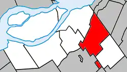
 Location within Beauharnois-Salaberry RCM | |
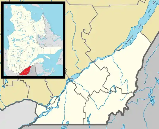
 Sainte-Martine Location in southern Quebec | |
| Coordinates: 45.25°N 73.8°W[1] | |
| Country | |
| Province | |
| Region | Montérégie |
| RCM | Beauharnois-Salaberry |
| Constituted | September 9, 1999 |
| Government | |
| • Mayor | Maude Laberge |
| • Federal riding | Châteauguay—Lacolle |
| • Prov. riding | Huntingdon |
| Area | |
| • Total | 64.70 km2 (24.98 sq mi) |
| • Land | 63.59 km2 (24.55 sq mi) |
| Population (2016)[4] | |
| • Total | 5,461 |
| • Density | 86.4/km2 (224/sq mi) |
| • Pop 2011-2016 | |
| • Dwellings | 2,368 |
| Time zone | UTC−5 (EST) |
| • Summer (DST) | UTC−4 (EDT) |
| Postal code(s) | J0S 1V0 |
| Area code(s) | 450 and 579 |
| Highways | |
| Website | www |
Geography
Communities
The following locations reside within the municipality's boundaries:[1]
- Laberge (45°17′07″N 73°48′25″W) – a hamlet located along Quebec Route 205 in the north part of the municipality.
- La Ferme (45°19′15″N 73°50′20″W) – a residential area located along Quebec Route 138.
- Le Domaine-de-la-Pêche-au-Saumon (45°15′15″N 73°47′55″W) – a residential area located along Quebec Route 138.
- Le Méandre (45°14′55″N 73°47′55″W) – a residential area located along Quebec Route 138.
Demographics
Population
| |||||||||||||||||||||||||||||
| Year | Pop. | ±% |
|---|---|---|
| 1991+ | 3,593 | — |
| 1996+ | 3,678 | +2.4% |
| 2001 | 3,740 | +1.7% |
| 2006 | 4,237 | +13.3% |
| 2011 | 4,966 | +17.2% |
| +) Pre-merger combined population totals for Sainte-Martine (municipality) and Saint-Paul-de-Châteauguay (municipality). | ||
Language
| Canada Census Mother Tongue - Sainte-Martine, Quebec[8] (+) Pre-merger combined population totals for Sainte-Martine (municipality) and Saint-Paul-de-Châteauguay (municipality). | ||||||||||||||||||
|---|---|---|---|---|---|---|---|---|---|---|---|---|---|---|---|---|---|---|
| Census | Total | French |
English |
French & English |
Other | |||||||||||||
| Year | Responses | Count | Trend | Pop % | Count | Trend | Pop % | Count | Trend | Pop % | Count | Trend | Pop % | |||||
2011 |
4,950 |
4,680 | 94.54% | 175 | 3.54% | 40 | 0.81% | 55 | 1.11% | |||||||||
2006 |
4,205 |
4,050 | 96.31% | 85 | 2.02% | 10 | 0.24% | 60 | 1.43% | |||||||||
2001 |
3,715 |
3,555 | 95.69% | 135 | 3.63% | 25 | 0.67% | 0 | 0.00% | |||||||||
1996 |
3,645+ |
3,495 | n/a | 95.88% | 110 | n/a | 3.02% | 40 | n/a | 1.10% | 0 | n/a | 0.00% | |||||

Chateauguay River with Parish of Sainte Martine Church in distance.
Transportation
The Exo du Haut-Saint-Laurent sector provides commuter and local bus services.
See also
References
- Reference number 261892 of the Commission de toponymie du Québec (in French)
- Ministère des Affaires municipales, des Régions et de l'Occupation du territoire: Sainte-Martine
- Riding history for Beauharnois—Salaberry, Quebec from the Library of Parliament
- 2011 Statistics Canada Census Profile: Sainte-Martine, Quebec
- "2011 Community Profiles". 2011 Canadian Census. Statistics Canada. July 5, 2013. Retrieved 2014-02-15.
- "2006 Community Profiles". 2006 Canadian Census. Statistics Canada. March 30, 2011. Retrieved 2014-02-15.
- "2001 Community Profiles". 2001 Canadian Census. Statistics Canada. February 17, 2012.
- Statistics Canada: 1996, 2001, 2006, 2011 census
External links
| Wikimedia Commons has media related to Sainte-Martine. |
This article is issued from Wikipedia. The text is licensed under Creative Commons - Attribution - Sharealike. Additional terms may apply for the media files.