Sekigahara, Gifu
Sekigahara (関ケ原町, Sekigahara-chō) is a town located in Fuwa District, Gifu Prefecture, Japan. As of 1 December 2018, the town had an estimated population of 7,109 and a population density of 140 persons per km2, in 2,725 households.[2] The total area of the town was 49.28 square kilometres (19.03 sq mi).
Sekigahara
関ケ原町 | |
|---|---|
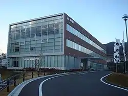 Sekigahara Town Hall | |
 Flag  Seal | |
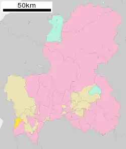 Location of Sekigahara in Gifu Prefecture | |
 Sekigahara | |
| Coordinates: 35°21′55.8″N 136°28′01″E | |
| Country | Japan |
| Region | Chūbu |
| Prefecture | Gifu |
| District | Fuwa |
| Government | |
| • Mayor | Kentarō Azai |
| Area | |
| • Total | 49.28 km2 (19.03 sq mi) |
| Population (December 1, 2018) | |
| • Total | 7,109 |
| • Density | 140/km2 (370/sq mi) |
| Time zone | UTC+9 (Japan Standard Time) |
| City symbols | |
| - Tree | Japanese Cedar[1] |
| - Flower | Ume[1] |
| - Bird | Rock ptarmigan |
| Phone number | 0585-22-2111 |
| Address | Sekigahara 894-58, Sekigahara-chō, Fuwa-gun, Gifu-ken 503-1592 |
| Website | Official website |

Geography
Sekigahara is located in a mountainous valley in far southwestern Gifu Prefecture, which forms a natural bottleneck connecting the Kansai region with the Tōkai region of Japan. The routes of the ancient Nakasendō highway and the modern Meishin Expressway, as well as the Tōkaidō Shinkansen and Tōkaidō Main Line all pass through this area. The town has a climate characterized by hot and humid summers, and mild winters (Köppen climate classification Cfa). The average annual temperature in Sekigahara is 14.4 °C. The average annual rainfall is 1908 mm with September as the wettest month. The temperatures are highest on average in August, at around 26.9 °C, and lowest in January, at around 3.2 °C.[3] The mountainous areas of the town are noted for heavy snow in winter.
| Climate data for Sekigahara | |||||||||||||
|---|---|---|---|---|---|---|---|---|---|---|---|---|---|
| Month | Jan | Feb | Mar | Apr | May | Jun | Jul | Aug | Sep | Oct | Nov | Dec | Year |
| Average high °C (°F) | 6.7 (44.1) |
7.6 (45.7) |
11.5 (52.7) |
17.9 (64.2) |
22.4 (72.3) |
25.9 (78.6) |
29.5 (85.1) |
31.4 (88.5) |
27.2 (81.0) |
21.5 (70.7) |
15.6 (60.1) |
9.8 (49.6) |
18.9 (66.1) |
| Average low °C (°F) | −0.3 (31.5) |
−0.2 (31.6) |
2.4 (36.3) |
7.6 (45.7) |
12.6 (54.7) |
17.4 (63.3) |
21.7 (71.1) |
22.8 (73.0) |
18.9 (66.0) |
12.4 (54.3) |
6.6 (43.9) |
2.0 (35.6) |
10.3 (50.6) |
| Average precipitation mm (inches) | 140.0 (5.51) |
117.8 (4.64) |
147.7 (5.81) |
164.2 (6.46) |
203.2 (8.00) |
272.6 (10.73) |
287.1 (11.30) |
184.5 (7.26) |
250.9 (9.88) |
137.3 (5.41) |
103.5 (4.07) |
116.3 (4.58) |
2,125.1 (83.65) |
| Average snowfall cm (inches) | 62 (24) |
45 (18) |
10 (3.9) |
0 (0) |
0 (0) |
0 (0) |
0 (0) |
0 (0) |
0 (0) |
1 (0.4) |
0 (0) |
28 (11) |
146 (57.3) |
| Average precipitation days (≥ 1.0 mm) | 15.7 | 13.7 | 13.7 | 11.1 | 11.5 | 12.9 | 13.7 | 10.4 | 11.5 | 9.7 | 10.5 | 15.0 | 149.4 |
| Mean monthly sunshine hours | 114.8 | 127.2 | 159.9 | 181.7 | 175.9 | 142.5 | 153.1 | 176.8 | 137.5 | 150.7 | 138.7 | 122.7 | 1,781.5 |
| Source: Japan Meteorological Agency | |||||||||||||
Neighbouring municipalities
- Gifu Prefecture
- Shiga Prefecture
Demographics
Per Japanese census data,[4] the population of Sekigahara has declined over the past 40 years.
| Census Year | Population |
|---|---|
| 1970 | 10,788 |
| 1980 | 10,483 |
| 1990 | 9,544 |
| 2000 | 9,110 |
| 2010 | 8,096 |
History
The area around Sekigahara was part of traditional Mino Province. In 1600, the Battle of Sekigahara took place here. During the Edo period it was tenryō territory directly under the Tokugawa shogunate, administered by a hatamoto. During the post-Meiji restoration cadastral reforms, the area was organised into Fuwa District, Gifu Prefecture. The village of Sekigahara was formed on July 1, 1889 with the establishment of the modern municipalities system, and was raised to town status on April 1, 1928. In 1954, Sekigahara annexed the village of Imasu, as well as part of the neighboring town of Tarui. A proposed merger with the neighboring city of Ōgaki was rejected in 2004.
Education
Sekigahara has one public elementary school and one public middle school operated by the town government, and one private combined elementary/middle school. The town does not have a high school.
Transportation
Railway
Sister city relations
 - Gettysburg, Pennsylvania, USA, from 2016 [5]
.svg.png.webp) - Waterloo, Belgium, from 2017
- Waterloo, Belgium, from 2017
Local attractions
- site of the Battle of Sekigahara
Notes
- 町のプロフィール>町章と町民憲章. Sekigahara official website (in Japanese). Retrieved August 14, 2011.
- Sekigahara Town official statistics (in Japanese)
- climate data
- Sekigahara population statistics
- "Sister Cities Share Bond". Gettysburg Times. 5 September 2016. Retrieved 2016-05-08.
External links
| Wikimedia Commons has media related to Sekigahara, Gifu. |
| Wikivoyage has a travel guide for Sekigahara. |
- Sekigahara Town (in Japanese)
- Gifu Prefectural homepage
| Authority control |
|---|
| Core city | ||
|---|---|---|
| Cities | ||
| Districts | ||