Tarui, Gifu
Tarui (垂井町, Tarui-chō) is a town located in Fuwa District, Gifu Prefecture, Japan. As of 1 December 2018, the town had an estimated population of 27,439 and a population density of 480 persons per km2, in 10,525 households.[2] The total area of the town was 57.09 square kilometres (22.04 sq mi).
Tarui
垂井町 | |
|---|---|
 Clockwise from top: Shigekado Takenaka's Jinya, Nangu Taisha, Tairyo Shrine, Site of Morichika Chosokabe's Jinya, Mineral Spring in Tarui, Picture of Tarui Traditional Inn in Edo Period | |
 Flag  Seal | |
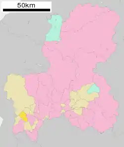 Location of Tarui in Gifu Prefecture | |
 Tarui | |
| Coordinates: 35°22′12.9″N 136°32′37.4″E | |
| Country | Japan |
| Region | Chūbu |
| Prefecture | Gifu |
| District | Fuwa |
| Government | |
| • Mayor | Mitsuya Nakagawa |
| Area | |
| • Total | 57.09 km2 (22.04 sq mi) |
| Population (December 1, 2018) | |
| • Total | 27,439 |
| • Density | 480/km2 (1,200/sq mi) |
| Time zone | UTC+9 (Japan Standard Time) |
| City symbols | |
| - Tree | Japanese Zelkova[1] |
| - Flower | Camellia[1] |
| Phone number | 0584-22-1151 |
| Address | 1532-1 Tarui-chō, Fuwa-gun, Gifu-ken 503-2193 |
| Website | Official website |

Geography
Tarui is located in far southwestern Gifu Prefecture, at the western end of the Nōbi Plain of Japan. The town has a climate characterized by characterized by hot and humid summers, and mild winters (Köppen climate classification Cfa). The average annual temperature in Tarui is 15.0 °C. The average annual rainfall is 1904 mm with September as the wettest month. The temperatures are highest on average in August, at around 27.5 °C, and lowest in January, at around 3.7 °C.[3]
Neighbouring municipalities
- Gifu Prefecture
- Ōgaki
- Ikeda
- Ibigawa
- Sekigahara
- Yōrō
Demographics
Per Japanese census data,[4] the population of Tarui has increased slightly over the past 40 years.
| Census Year | Population |
|---|---|
| 1970 | 23,240 |
| 1980 | 26,404 |
| 1990 | 28,605 |
| 2000 | 28,935 |
| 2010 | 28,505 |
History
The area around Tarui was part of traditional Mino Province. Numerous Jōmon period and Kofun period remains have been found in the area, which was the site of the Nara period provincial capital and Provincial temple. During the Edo period, Tarui-juku prospered as a post station on the Nakasendō highway connecting Edo with Kyoto. The town of Tarui was formed on July 1, 1889 with the establishment of the modern municipalities system. The 1891 Mino–Owari earthquake caused considerable damage to the area. Tarui annexed the neighboring villages of Iwate, Fuchu, Miyashiro, Osa and Aihara in 1954. The 1959 Isewan Typhoon caused severe damage to the town.
Education
Tarui has seven public elementary schools and two public middle schools operated by the town government, and one public high school operated by the Gifu Prefectural Board of Education.
Sister city relations
.svg.png.webp) - Calgary, Alberta, Canada, from July 1996
- Calgary, Alberta, Canada, from July 1996
Local attractions
- Nangū Taisha, the ichinomiya of Mino Province
- Tarui Ichirizuka. a National Historic Site
- Mino Provincial Capital Site, A National Historic Site
- The Beauty of Tarui, a video portraying the major sites of Tarui
References
- まちのプロフィール > まちの概要. Tarui official website (in Japanese). Retrieved 12 August 2011.
- Tarui town official statistics (in Japanese)
- Tarui climate data
- Tarui population statistics
External links
| Wikimedia Commons has media related to Tarui, Gifu. |
- Official website (in Japanese)
| Authority control |
|---|
| Core city | ||
|---|---|---|
| Cities | ||
| Districts | ||