Seventeen Seventy, Queensland
Seventeen Seventy, also written as 1770 and also known as the Town of 1770, is a coastal town and locality in the Gladstone Region, Queensland, Australia.[2][3] In the 2016 census the locality of Seventeen Seventy had a population of 69 people.[1]
| Seventeen Seventy Queensland | |||||||||||||||
|---|---|---|---|---|---|---|---|---|---|---|---|---|---|---|---|
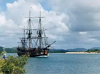
.jpg.webp) View out to the bay from Seventeen Seventy, November 2009 | |||||||||||||||
 Seventeen Seventy | |||||||||||||||
| Coordinates | 24.1633°S 151.8852°E | ||||||||||||||
| Population | 69 (2016 census locality)[1] | ||||||||||||||
| • Density | 2.518/km2 (6.52/sq mi) | ||||||||||||||
| Postcode(s) | 4677 | ||||||||||||||
| Area | 27.4 km2 (10.6 sq mi) | ||||||||||||||
| Time zone | AEST (UTC+10:00) | ||||||||||||||
| LGA(s) | Gladstone Region | ||||||||||||||
| State electorate(s) | Burnett | ||||||||||||||
| Federal Division(s) | Hinkler | ||||||||||||||
| |||||||||||||||
| |||||||||||||||
The town is built on the site of the second landing in Australia by James Cook and the crew of HM Bark Endeavour in May 1770 (and their first landing in what is now the state of Queensland).
Official name
Although the town is referred to locally as 1770 using numerals, the official name of the town is in words Seventeen Seventy,[2][3] as it is a principle of Queensland's place naming that numbers are spelled out.[4]
Geography
The town is situated on a peninsula, with the Coral Sea and Bustard Bay on three sides.
Seventeen Seventy can be reached by a sealed road from Bundaberg, 120 kilometres (75 mi) to the south, going through Agnes Water (immediately to the south). The town sustains a small permanent population; a significant holiday population makes it to the area to take advantage of fishing, Great Barrier Reef trips and other water activities.
The northern tip of the peninsula is mostly with the protected area of Joseph Banks (Round Hill Head) Conservation Park (24.1600°S 151.8883°E).[5][6]
Seventeen Seventy has the following headlands:
- Monument Point (24.1597°S 151.8828°E)[7][8]
- Round Hill Head (24.1503°S 151.8864°E)[7][9]
Monument Point is named because of the monument erected there to commemorate the landing by James Cook on 23 May 1770.[8]
Offshore from Seventeen Seventy is:
- Bustard Bay (24.1061°S 151.8189°E)[10][11]
- the Fairfax Islands group (23.8582°S 152.3735°E)[12][13]
- the Hoskyn Islands group (23.8046°S 152.2948°E)[12][14]
- the Bunker Group of islands (23.8486°S 152.3482°E)[12][15]
- Capricorn Channel (22.9649°S 152.4734°E)[16][17]
- Curtis Channel (24.0020°S 152.0851°E)[16][18]
History
The town is built on the site of the second landing in Australia by James Cook and the crew of HM Bark Endeavour in May 1770 (and their first landing in what is now the state of Queensland). Originally known as Round Hill – after the creek it sits on – the name was changed on 24 June 1936 after the town allotments were surveyed in 1935 to recognise the historical importance of the town.[2][19]
At the 2011 census the town of Seventeen Seventy had a population of 76 people.[20]
In the 2016 census the locality of Seventeen Seventy had a population of 69 people.[1]
Tourism
The village is a tourist destination on Queensland's Discovery Coast. The village itself contains holiday accommodation, restaurants, general store, hotel, picnic areas with free barbecues and a small marina where daily trips depart for Lady Musgrave Island on the Great Barrier Reef, and several trips a week to Bustard Head Light Station.
The area's wildlife and vegetation have been preserved as far as possible, and this, together with the area's natural environment, and an outer surf and inner still water beach, is a tourist attraction. There are also day cruises and flights to the outer Great Barrier Reef, to nearby Lady Musgrave Island and Pancake Creek, and the nearby Bustard Head lighthouse.
The local Tourism & Commerce organisation responsible for promoting the region is Discovery Coast Tourism and Commerce.[21]
Heritage listings

Seventeen Seventy has a number of heritage-listed sites, including:
- Round Hill Creek and Round Hill Head: Cook's Landing Place[22]
Amenities
There is a boat ramp with pontoon on Captain Cook Drive at Round Hill Creek (24.1713°S 151.8831°E). It is managed by the Gladstone Regional Council.[23]
There is a heliport on Captain Cook Drive (24.1826°S 151.8826°E).[24] It is adjacent to the Agnes Water/1770 SES Facility (24.1837°S 151.8829°E).[25]
Events
The community of Seventeen Seventy hold the re-enactment of this historic landing each year as part of the 1770 Festival held in May.[26]
Attractions
There are two lookouts on the northern tip of the peninsula:
- Joseph Banks Lower Lookout (24.1513°S 151.8866°E).[27]
- Joseph Banks Top Lookout (24.1490°S 151.8858°E).[27]
See also
References
- Australian Bureau of Statistics (27 June 2017). "Seventeen Seventy (SSC)". 2016 Census QuickStats. Retrieved 20 October 2018.

- "Seventeen Seventy – town in Gladstone Region (entry 44530)". Queensland Place Names. Queensland Government. Retrieved 24 December 2020.
- "Seventeen Seventy – locality in Gladstone Region (entry 47286)". Queensland Place Names. Queensland Government. Retrieved 24 December 2020.
- "How places are named". Queensland Government. Archived from the original on 12 October 2016. Retrieved 28 May 2016.
- "Queensland Globe". State of Queensland. Retrieved 23 December 2020.
- "Joseph Banks (Round Hill Head) Conservation Park – conservation park in Gladstone Region (entry 39506)". Queensland Place Names. Queensland Government. Retrieved 24 December 2020.
- "Mountain peaks and capes - Queensland". Queensland Open Data. Queensland Government. 12 November 2020. Archived from the original on 25 November 2020. Retrieved 25 November 2020.
- "Monument Point – mountain in Gladstone Region (entry 22564)". Queensland Place Names. Queensland Government. Retrieved 25 November 2020.
- "Round Hill Head – mountain in Gladstone Region (entry 29166)". Queensland Place Names. Queensland Government. Retrieved 25 November 2020.
- "Bays - Queensland". Queensland Open Data. Queensland Government. 12 November 2020. Archived from the original on 25 November 2020. Retrieved 25 November 2020.
- "Bustard Bay – bay in Gladstone Region (entry 5491)". Queensland Place Names. Queensland Government. Retrieved 24 December 2020.
- "Island groups - Queensland". Queensland Open Data. Queensland Government. 12 November 2020. Archived from the original on 25 November 2020. Retrieved 25 November 2020.
- "Fairfax Islands – island (entry 12119)". Queensland Place Names. Queensland Government. Retrieved 25 November 2020.
- "Hoskyn Islands – island group in the Gladstone Region (entry 16332)". Queensland Place Names. Queensland Government. Retrieved 24 December 2020.
- "Bunker Group – island group in Gladstone Region (entry 5289)". Queensland Place Names. Queensland Government. Retrieved 24 December 2020.
- "Mountain ranges beaches and sea passages - Queensland". Queensland Open Data. Queensland Government. 12 November 2020. Archived from the original on 25 November 2020. Retrieved 25 November 2020.
- "Capricorn Channel – channel in the Livingstone Shire (entry 38870)". Queensland Place Names. Queensland Government. Retrieved 24 December 2020.
- "Curtis Channel – channel in the Gladstone Region (entry 9099)". Queensland Place Names. Queensland Government. Retrieved 24 December 2020.
- "Earthly Paradise of Miriam Vale". The Queenslander. Queensland, Australia. 12 November 1936. p. 42. Archived from the original on 24 December 2020. Retrieved 14 August 2018 – via National Library of Australia.
- Australian Bureau of Statistics (31 October 2012). "Seventeen Seventy (L) (Urban Centre/Locality)". 2011 Census QuickStats. Retrieved 11 May 2014.
- "Agnes Water & Town of 1770 - Visitor Information". Visit Agnes 1770. Archived from the original on 28 November 2020. Retrieved 18 October 2017.
- "Cook's Landing Place, Town of Seventeen Seventy (entry 601614)". Queensland Heritage Register. Queensland Heritage Council. Retrieved 8 July 2013.
- "Recreational Boating Facilities Queensland". Queensland Open Data. Queensland Government. 12 November 2020. Archived from the original on 22 November 2020. Retrieved 22 November 2020.
- "Heliports and landing grounds - Queensland". Queensland Open Data. Queensland Government. 22 October 2020. Archived from the original on 16 November 2020. Retrieved 3 November 2020.
- "Emergency services facilities - Queensland". Queensland Open Data. Queensland Government. 18 November 2020. Archived from the original on 24 November 2020. Retrieved 24 November 2020.
- The 1770 Festival Archived 3 May 2013 at the Wayback Machine. Lets Connect. Retrieved 12 May 2014.
- "Tourist points - Queensland". Queensland Open Data. Queensland Government. 18 November 2020. Archived from the original on 24 November 2020. Retrieved 24 November 2020.
External links
![]() Media related to Seventeen Seventy, Queensland at Wikimedia Commons
Media related to Seventeen Seventy, Queensland at Wikimedia Commons
| Authority control |
|---|