Shindler, South Dakota
Shindler is an unincorporated community and census-designated place (CDP) in Lincoln County, South Dakota, United States. According to the 2010 census, the population was 584.[2]
Shindler, South Dakota | |
|---|---|
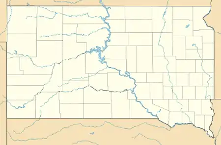 Shindler Location in South Dakota  Shindler Location in the United States | |
| Coordinates: 43°28′30″N 96°38′55″W | |
| Country | United States |
| State | South Dakota |
| County | Lincoln |
| Area | |
| • Total | 1.50 sq mi (3.89 km2) |
| • Land | 1.50 sq mi (3.89 km2) |
| • Water | 0.0 sq mi (0.0 km2) |
| Elevation | 1,403 ft (428 m) |
| Population | |
| • Total | 584 |
| • Density | 389/sq mi (150.1/km2) |
| Time zone | UTC-6 (Central (CST)) |
| • Summer (DST) | UTC-5 (CDT) |
| ZIP code | 57106 |
| FIPS code | 46-58590 |
| GNIS feature ID | 1261065 |
Geography
Shindler is located in the northeastern corner of Lincoln County at 43°28′30″N 96°38′55″W (43.474976, -96.648658).[3] It is approximately 8 miles (13 km) southeast of the center of Sioux Falls along South Dakota Highway 11. It is 15 miles (24 km) north of Canton, the Lincoln county seat, and 3 miles (5 km) west of the Big Sioux River, which forms the Iowa state line.
According to the U.S. Census Bureau, the Shindler CDP has an area of 1.5 square miles (3.9 km2), all land.[1] Spring Creek flows eastward through the southern part of the CDP, leading to the Big Sioux River.
History
The community has the name of Charles Shindler, a settler.[4]
References
- "2019 U.S. Gazetteer Files". United States Census Bureau. Retrieved January 4, 2021.
- "Total Population: 2010 Census DEC Summary File 1 (P1), Shindler CDP, South Dakota". data.census.gov. U.S. Census Bureau. Retrieved January 4, 2021.
- U.S. Geological Survey Geographic Names Information System: Shindler, South, Dakota. Retrieved on 2008-02-19. (Elev. 1404 ft / 428 m)
- Federal Writers' Project (1940). South Dakota place-names, v.1-3. University of South Dakota. p. 60.
Municipalities and communities of Lincoln County, South Dakota, United States | ||
|---|---|---|
| Cities | 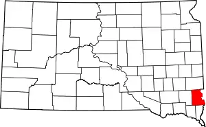 | |
| Towns | ||
| Townships |
| |
| CDP | ||
| Footnotes | ‡This populated place also has portions in an adjacent county or counties | |
| ||
