Sialan
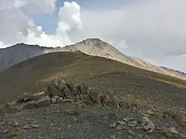
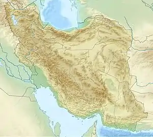
Sialan is a mountain peak in Alborz range in Iran. This mountain peak is located at altitude of 4,250 metres (13,940 ft) and overlooks to the valley of Duhezar and Daryasar plain in Tonekabon county from the north and overlooks to the Alamut valley and Heniz in Qazvin County from the south.
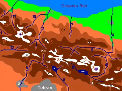
| Map of central Alborz | Peaks: | 1 Alam-Kuh |
|---|---|---|
 −25 to 500 m (−82 to 1,640 ft) 500 to 1,500 m (1,600 to 4,900 ft) 1,500 to 2,500 m (4,900 to 8,200 ft) 2,500 to 3,500 m (8,200 to 11,500 ft) 3,500 to 4,500 m (11,500 to 14,800 ft) 4,500 to 5,671 m (14,764 to 18,606 ft) |
2 Azad Kuh | 3 Damavand |
| 4 Do Berar | 5 Do Khaharan | |
| 6 Ghal'eh Gardan | 7 Gorg | |
| 8 Kholeno | 9 Mehr Chal | |
| 10 Mishineh Marg | 11 Naz | |
| 12 Shah Alborz | 13 Sialan | |
| 14 Tochal | 15 Varavašt | |
| Rivers: | 0 | |
| 1 Alamut | 2 Chalus | |
| 3 Do Hezar | 4 Haraz | |
| 5 Jajrood | 6 Karaj | |
| 7 Kojoor | 8 Lar | |
| 9 Noor | 10 Sardab | |
| 11 Seh Hazar | 12 Shahrood | |
| Cities: | 1 Amol | |
| 2 Chalus | 3 Karaj | |
| Other: | D Dizin | |
| E Emamzadeh Hashem | K Kandovan Tunnel | |
| * Latyan Dam | ** Lar Dam |
| Sialan | |
|---|---|
 | |
| Highest point | |
| Elevation | 4,250 m (13,940 ft) |
| Coordinates | 36°30′42.6″N 50°41′55.2″E |
| Geography | |
 Sialan | |
| Parent range | Alborz |
Climbing
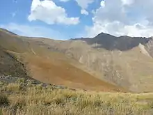
The level of difficulty is "walk-up" and the nearest center is Haniz village. There is a hut at 3270 m for climbers from the Southern valley.
Mount Sialan: +36° 30' 42.6", +50° 41' 55.2", 4185 m and Sialan shelter: +36° 30' 21.10", +50° 40' 9.10", 3271 m
References
This article is issued from Wikipedia. The text is licensed under Creative Commons - Attribution - Sharealike. Additional terms may apply for the media files.
